Black Hills, SD Expedition No. 171 – Little Crow Peak & Spearfish Peak (5-7-16)

The patio was damp, but that was all.  It must have sprinkled overnight.  Plenty of clouds were still around.  Normally, even a little rain would help clear the air.  Not this time.  It was hazy.  Very, very hazy.  Otherwise it was a beautiful day in early May.  SPHP hoped the haze would burn off before too long.  Lupe didn’t care whether it did or not.  She was charged up and ready to roll!

A couple miles before reaching the starting place for her peakbagging efforts, Lupe and SPHP made a quick stop to see Bridal Veil Falls in Spearfish Canyon.  Later in the season Bridal Veil Falls often slows to a trickle, but the falls were beautiful this morning.

Bridal Veil Falls in Spearfish Canyon.

Bridal Veil Falls was looking great!  The falls were probably near maximum springtime flow, barring a thunderstorm.  Only 6 days ago on Black Hills, SD Expedition No. 170, Lupe had found several inches of snow up on Kirk Hill (5,345 ft.) and Tetro Rock (5,562 ft.).  The weather had really warmed up since then, especially the last 3 days which were near 80°F.  Lupe loves the snow, but she wasn’t likely to find any remaining today.  Bridal Veil Falls wasn’t going to get any more of a boost from melting snow, either.

After admiring the falls, Lupe and SPHP continued S on Hwy 14A going up Spearfish Canyon.  SPHP was looking for USFS Road No. 186.2A, but doubted it would be marked as such.  A little less than 2 miles from Bridal Veil Falls, there was a road to the E with a street sign that said Cleopatra.  Right away, SPHP knew this was it!  The little parking area close to Spearfish Creek was full, but SPHP found another place to park nearby (10:50 AM, 61°F).

SPHP knew this place.  Lupe was at the confluence of Spearfish and Squaw Creeks.  (“Maurice” on the Peakbagger.com topo map.)  A trail goes up Squaw Creek perhaps a mile from here to the Devil’s Bathtub, a pool of water fed by a small waterfall.  A hiking trail to the Devil’s Bathtub is popular with local residents, but is not marked and not well known to tourists.

Lupe wasn’t going to the Devil’s Bathtub today, however.  Instead she was heading for Little Crow Peak (5,885 ft.), a nearby peak along the E rim of Spearfish Canyon.  At least, that was the plan.  SPHP had to find USFS Road No. 186.2 first.  The Peakbagger.com topo map showed No. 186.2 winding E up out of Spearfish Canyon from somewhere above Squaw Creek.

Lupe and SPHP crossed the bridge below the confluence of Spearfish and Squaw Creeks. Lupe then started out on the low road leading to the Devil’s Bathtub trail.  After just a few hundred feet, the trail left the road to cross Squaw Creek for the first time.  Lupe didn’t cross the creek.  If USFS Road No. 186.2 was still in existence, it would be somewhere higher up on this side of the canyon.

SPHP scanned the forest above to the E.  It did look like there might be some terrain a short distance higher up that could be level enough for a road.  Lupe was just past the last private cabin near Squaw Creek.  Time to find out if USFS Road No. 186.2 was actually still up there somewhere or not, and if so, what kind of condition it was in.  Lupe and SPHP started climbing up the steep forested slope.

Lupe didn’t have to climb far at all!  She popped out of the forest onto a very nice little road.  The road was rocky and narrow.  Heading SE, it climbed steadily up the side of the canyon.  There was no marker, but that wasn’t surprising.  This almost had to be USFS Road No. 186.2.  Lupe and SPHP started following it up.

Lupe on USFS Road No. 186.2 on her way to Little Crow Peak.

No. 186.2 wound around some, but generally worked its way E for more than a mile.  It was a rather steep climb the entire way.  Lupe came to several grassy side roads, but she always stayed on the main road.  The rocky road went relentlessly up and up.  Lupe followed at SPHP’s heels much of the time.  Lupe found the road a bit dull.

The map showed a power line crossing the road, but Lupe didn’t come to one.  After Lupe had gone more than 0.75 mile, SPHP looked back down to the W.  A swath of the forest had been cut in a straight line leading to the road.  The old power line must have been here at one time.  By now, Lupe was high enough to see a high forested hill off to the NW.  That had to be Little Crow Peak (5,885 ft.)!

Lupe and SPHP stayed on No. 186.2 until it finally quit gaining elevation.  As soon as the road leveled out, Lupe left it heading N into the forest.  As Lupe reached the top of a broad forested ridge, she came to another road.  The road was faint, but its existence was good news.  It was going WNW toward Little Crow Peak.

The faint road didn’t go all the way up Little Crow Peak, but it did bring Lupe to a point just E of the final rise.  The climb through the forest was pretty easy.  As Lupe got higher up on the mountain, she encountered quite a bit of deadfall timber, but by then Lupe didn’t have much farther to go.

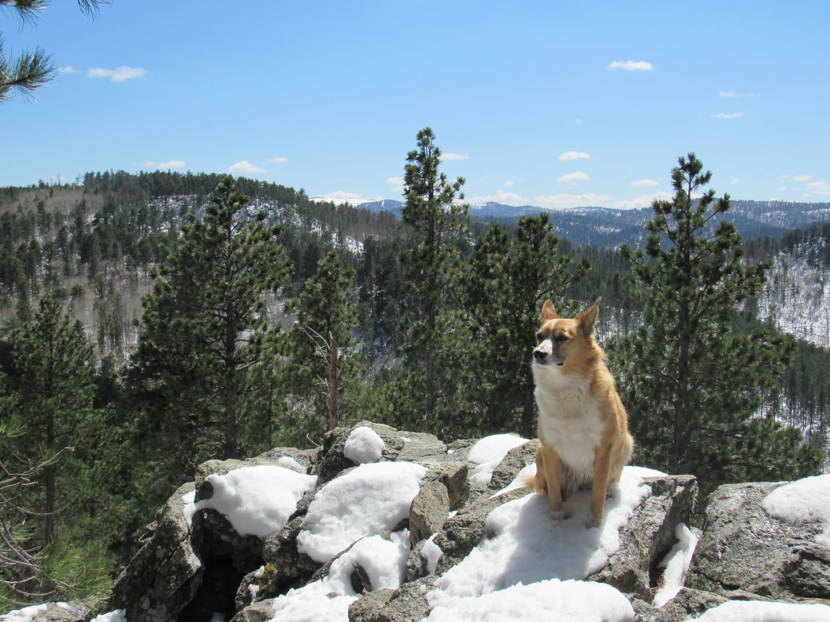
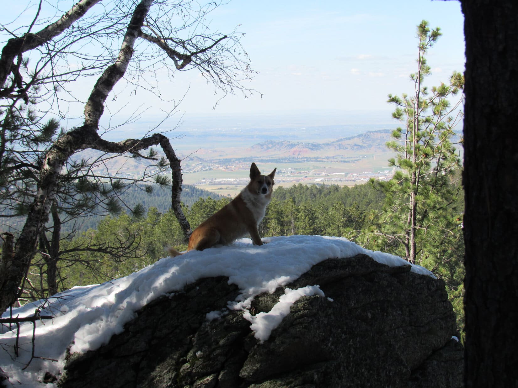
Fairly large rock outcroppings started appearing about the time the terrain began leveling out.  Lupe was getting close to the summit of Little Crow Peak.  Suddenly, SPHP spotted a cairn up on some high rocks a short distance ahead.  Lupe was almost there!

Lupe up on a rock outcropping on Little Crow Peak featuring a cairn. The true summit was still another 150 feet farther W. Photo looks S.

Lupe scrambled up onto the rocks next to the cairn.  Initially, SPHP thought this might well be the summit of Little Crow Peak.  Peering to the W through the forest, though, it looked like there might well be a higher point not too much farther away.

The true summit proved to be roughly 150 feet W of the cairn.  Lupe climbed up a larger rock formation there to claim her Little Crow Peak peakbagging success!

Lupe at the true summit of Little Crow Peak. Photo looks W.
Another look at Lupe on the summit. This photo looks N.
A Carolina Dog surveys the situation from her vantage point at the E end of the summit rock formation. Photo looks W.

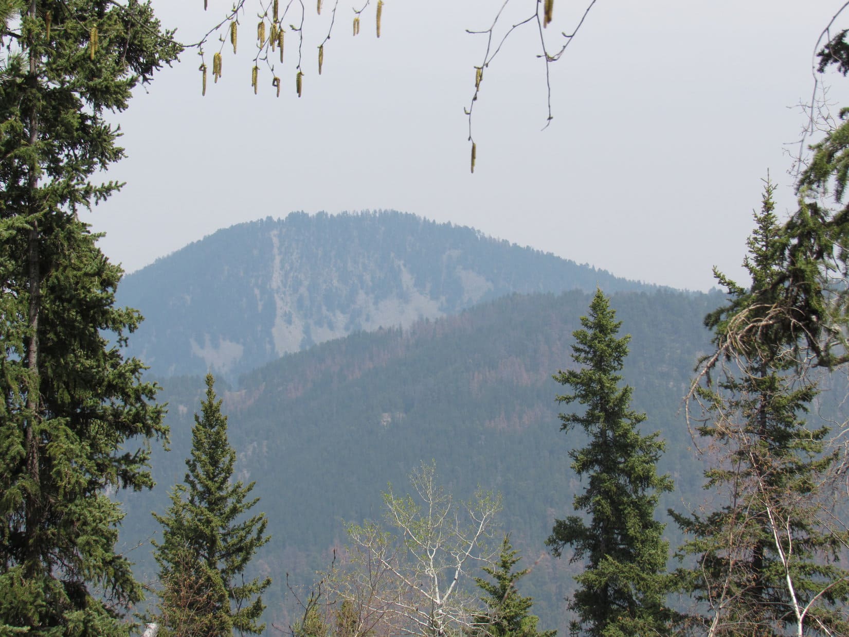
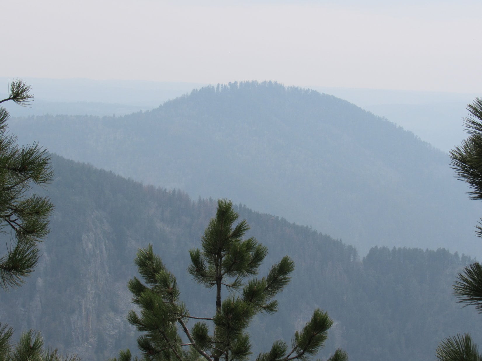
Forest hid the views in almost every direction.  It hardly mattered.  The entire sky remained very hazy.  If the air had been clear, there was quite a nice view toward Terry Peak (7,064 ft.) to the SSE.  As it was, the camera could barely detect Terry Peak in the haze, although it was visible to the naked eye.  Lupe and SPHP took a rest break up on Little Crow Peak before continuing on.

When it was time to leave, Lupe went back E down the mountain, a little S of the way she had come up.  This route avoided some of the deadfall timber, and brought Lupe to more interesting rock formations.  It proved to be a somewhat easier way back to the faint road.

These plants with little yellow flowers were common on Little Crow Peak.
Forest blocked the views in most directions from Little Crow Peak. Lupe did find this one hazy glimpse of Spearfish Peak (5,800 ft.) on her way down the mountain. Spearfish Peak was Lupe's next peakbagging goal. Photo looks NE.
Forest blocked the views in most directions from Little Crow Peak. Lupe did find this one hazy glimpse of Spearfish Peak (5,800 ft.) on her way down the mountain. Spearfish Peak was Lupe’s next peakbagging goal. Photo looks NE.  Taken with the telephoto lens.
Near rock formations Lupe passed by on her way down the E side of Little Crow Peak. Photo looks S.

Lupe and SPHP followed the faint road ESE all the way until it reached USFS Road No. 186.2 some distance E of where Lupe had left it to climb Little Crow Peak.  At least SPHP thought Lupe was back at No. 186.2, but she really wasn’t.

Lupe’s next peakbagging goal was Spearfish Peak (5,800 ft.).  The original plan was to follow No. 186.2 E and then SE from Little Crow Peak.  The Peakbagger.com topo map showed that No. 186.2 would reach an intersection with another road that wound its way several miles N along the top of a long ridge.  That road would bring Lupe to a point close to Spearfish Peak where she should be able to climb it easily enough from the SE.

As Lupe and SPHP headed ENE along No. 186.2, it didn’t take too long for SPHP to realize something was wrong.  The road should have gone almost due E just S of a slightly higher ridge to the N, but it didn’t.  Lupe passed several side roads, but they didn’t look as well traveled as the road Lupe was on.  They didn’t seem right either, and SPHP was reluctant to take them.

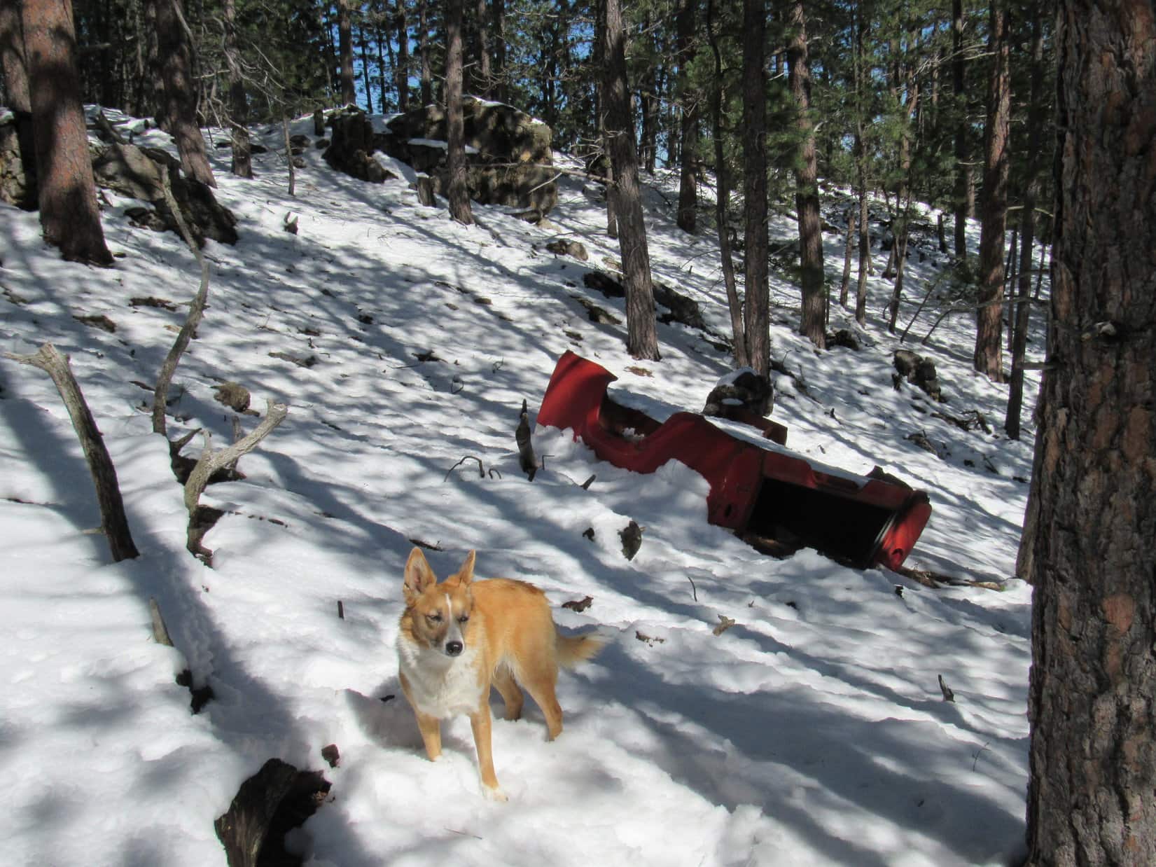
Lupe reached an intersection with a grassy road that continued NE.  An ancient small bus was rusting away next to this side road.  The main road turned E and started climbing again.  SPHP pondered for only a moment.  Lupe took the main road E.

The ancient decaying bus about 0.67 mile ESE of Little Crow Peak. Lupe thought this was a stupendous Lupe Treasure, but SPHP was too weak to cart it back to the G6 to secure her prize. This photo was taken later in the day on Lupe's return from Spearfish Peak. Photo looks NW.
The ancient decaying bus about 0.67 mile ESE of Little Crow Peak. Lupe thought this was a stupendous Lupe Treasure, but SPHP was too weak to cart it back to the G6 to secure her prize. This photo was taken later in the day on Lupe’s return from Spearfish Peak. Photo looks NW.

The main road Lupe was following E led up onto some high ground.  SPHP soon realized Lupe was on the ridge N of USFS Road No. 186.2.  She was traveling the section line between Sections 10 & 15.  There was supposed to be a power line here, according to the map, but none was present.  The road was level at times, and at other times went up and down steep ravines.

As Lupe reached the E end of the high ground along the ridge, she came to a misspelled sign for the Carbonate Camp Cemetery.  Lupe found 5 old gravesites here.  Each grave was marked with a ring of small stones.  There were no headstones, only a wooden board sticking up at the head of each grave.  The boards were so old and weathered, any information that might have been on them about the deceased had long ago worn away.

This misspelled Carbonate Camp Cemetery sign was near 5 graves. Online research later revealed that these graves would all have dated back to the late 1800's.
This misspelled Carbonate Camp Cemetery sign was near 5 graves. Online research later revealed that these graves would all have dated back to the late 1800’s.
Lupe sits on the best preserved gravesite at the Carbonate Camp Cemetery. Originally there were at least 11 graves, but Lupe & SPHP only saw evidence of 5. Carbonate Camp was a mining camp back in the 1880's.
Lupe sits on the best preserved gravesite at the Carbonate Camp Cemetery. Originally there were at least 11 graves, but Lupe & SPHP only saw evidence of 5. Carbonate Camp was a mining camp back in the 1880’s.  Photo looks E.

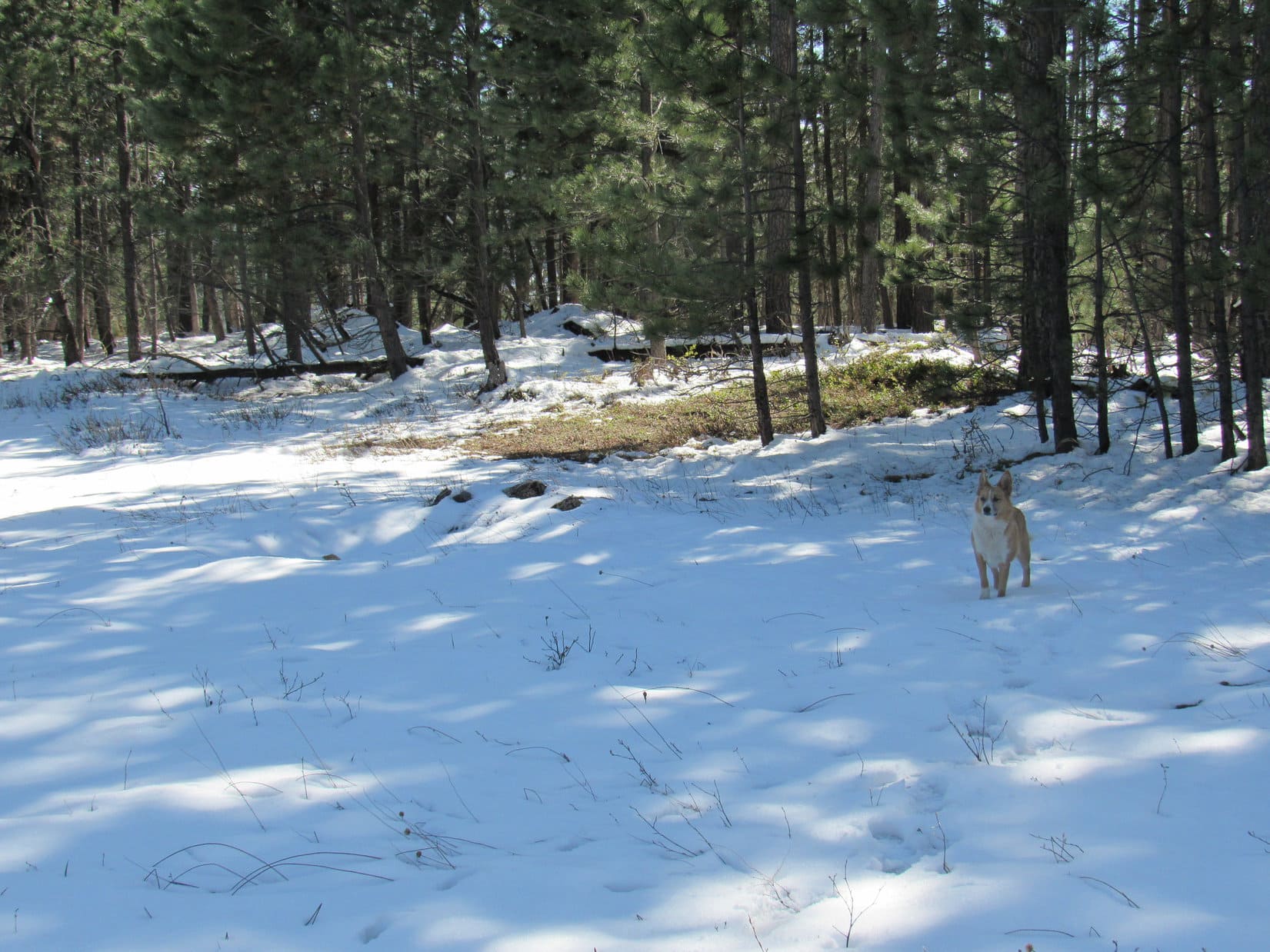
E of Carbonate Camp Cemetery, the road soon wound steeply down into the upper reaches of Rubicon Gulch.  Continuing E, the road went up and down over several steep hills.  Lupe was delighted and SPHP was amazed, when she found several patches of snow still melting on the road.

Lupe found several patches of snow on the road in the upper reaches of Rubicon Gulch. This one was the largest of all. Photo looks E.

At the final low point on the E side of Rubicon Gulch, a small stream flowed out to the NW from a culvert under the road.  This stream eventually goes over Bridal Veil Falls, but it was much smaller up here.  On the S side of the road was a slough, which SPHP naturally dubbed Rubicon Slough.  The surface of Rubicon Slough was almost entirely thickly covered with gray-green duckweed.  The water’s surface was scarcely visible.

At Rubicon Slough. Photo looks SSW.

A little SE of Rubicon Slough was a metal building, and a fence with a No Trespassing sign.  The land to the S was likely part of the Richmond Hill mining operations.  It was now clear that if Lupe had actually returned to No. 186.2 after leaving Little Crow Peak, it would have taken her into that private property.  It was a good thing Lupe came the way she did.  This route was a shortcut, too!  Lupe had saved more than a mile coming via Carbonate Camp Cemetery and Rubicon Slough.

From Rubicon Slough, a very rocky road went NE up a ridge.  Lupe and SPHP followed it.  Near a power line at the top of the ridge, another road came in from the SSE.  This was the road that would wind N following the long ridge to Spearfish Peak.  It intersected the road from Rubicon Slough just S of a small private cabin.

Near the little cabin on the ridge NNE of Rubicon Slough. Photo looks E.

A couple of Private Property signs near the little cabin had been spray painted over with black paint for some reason.  Lupe continued N on the road, which SPHP now believed was USFS Road No. 220, although Lupe and SPHP never saw any marker for it.  The road went past some other private property.  At a fork in the road, Lupe stayed to the NW.  She passed by some land for sale.

From the land for sale, the road went downhill and passed beneath the power line again.  Spearfish Peak was now visible to the N.  Lupe had come clear around the upper end of Rubicon Gulch, and was finally getting closer.

Spearfish Peak is in view to the N. The power line really helped SPHP stay oriented so Lupe was able to remain on the correct road instead of wandering off on one of the possible side roads on the way to Spearfish Peak, which often was not in view until Lupe got close.
Spearfish Peak is in view to the N. The power line really helped SPHP stay oriented so Lupe was able to remain on the correct road instead of wandering off on one of the possible side roads on the way to Spearfish Peak, which often was not in view.

USFS Road No. 220 wound around to the W of the power line, but generally headed N toward Spearfish Peak.  The road stayed up on the ridge.  Sometimes Lupe could see Little Crow Peak to the SW.  Eventually Spearfish Peak came into view.  It wasn’t much farther N now!

Beautiful new light green aspen leaves were sprouting.

USFS Road No. 220 eventually crossed under to the E side of the power line again, but Lupe did not.  Instead, she followed a road going N beneath the power line for a little way.  When a side road turned NW toward Spearfish Peak, Lupe took that one.  It soon ended at the edge of the forest.  A faint single track trail went up the SE ridge of Spearfish Peak.  Lupe was able to follow it all the way to the top.

Lupe on the highest rock on Spearfish Peak. Photo looks WNW.
Lupe's paw next to the survey benchmark on Spearfish Peak.
Lupe’s paw next to the survey benchmark on Spearfish Peak.

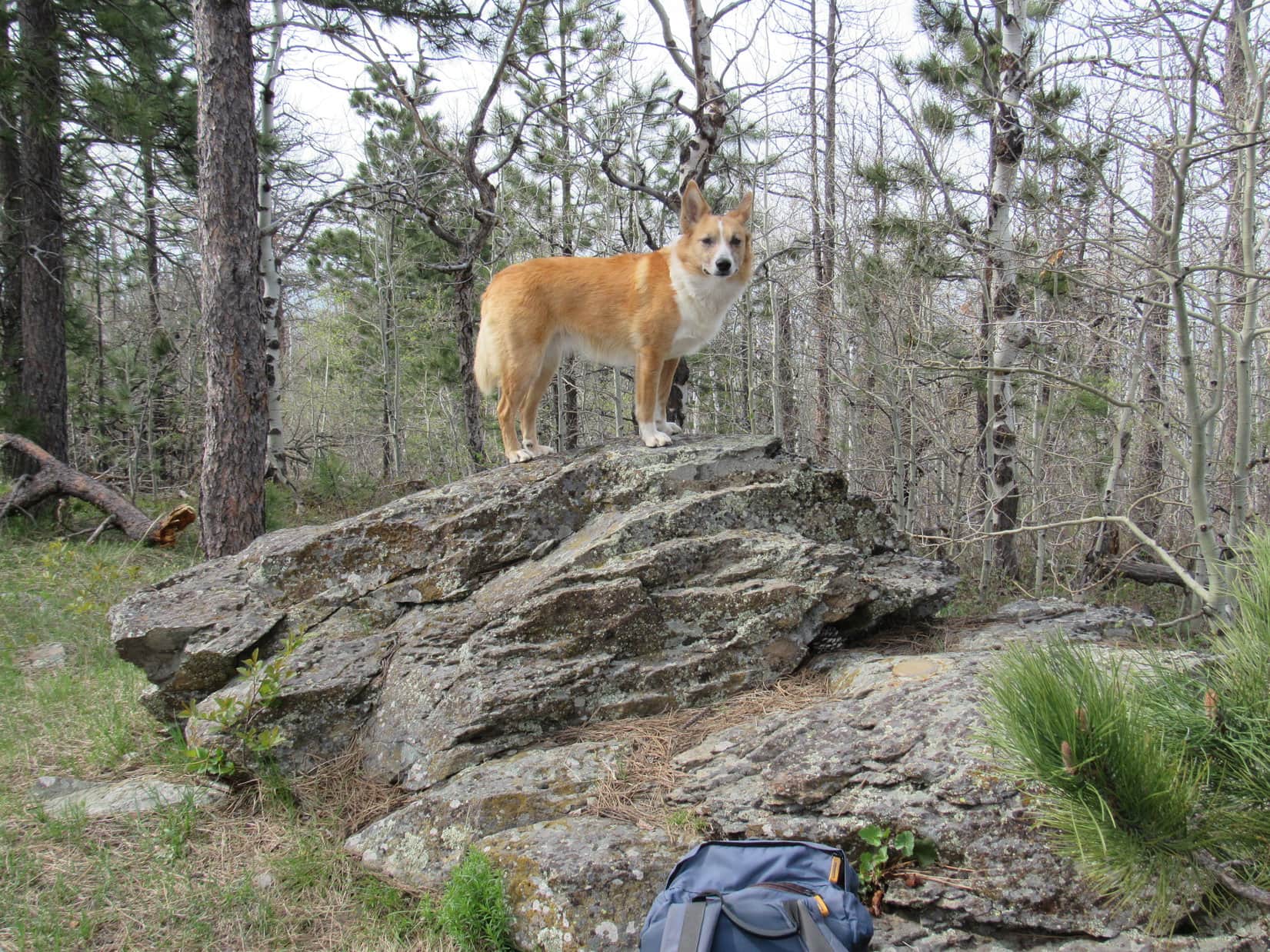
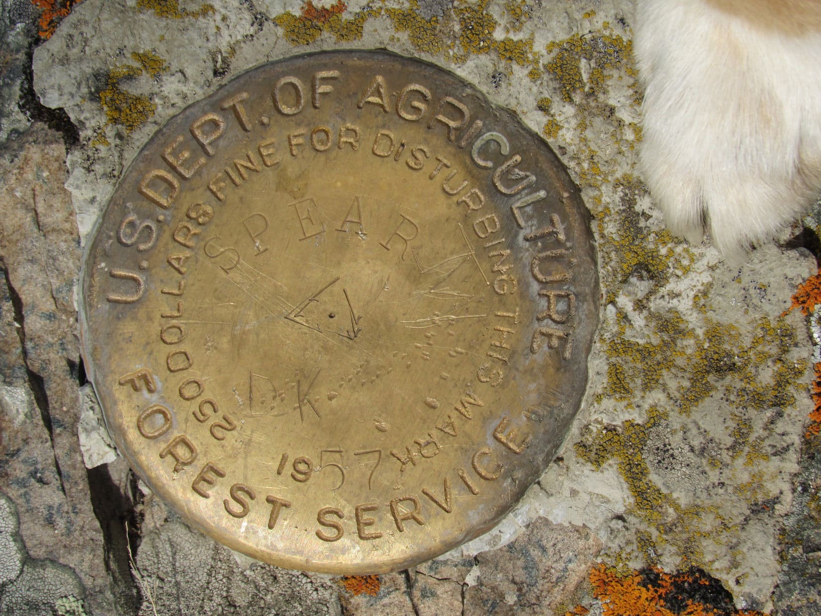
The rock formation at the top of Spearfish Peak was only a few feet high.  Lupe immediately claimed her second peakbagging success of the day!  Lupe found a survey benchmark right next to the highest rock.

Like Little Crow Peak, Spearfish Peak was heavily forested.  Once again, the only open views were to the S.  Unfortunately, the haze hadn’t dissipated at all yet.

A very hazy view of Bald Mountain (6,617 ft.) and Terry Peak (7,064 ft.) from Spearfish Peak. Photo looks S.
A very hazy view of Bald Mountain (6,617 ft.) (L) and Terry Peak (7,064 ft.) (R) from Spearfish Peak. Photo looks S using the telephoto lens.
Little Crow Peak from Spearfish Peak. Photo looks SW.
Little Crow Peak from Spearfish Peak using the telephoto lens. Photo looks SW.

It seemed like it had taken a long time to get to Spearfish Peak from Little Crow Peak.  Lupe and SPHP were both ready for another break.  SPHP ate the last apple.  Lupe had Taste of the Wild.  Water was the only other available provision.  Lupe curled up to rest at SPHP’s feet.

Apparently, this haze was going to hang around all day.  Strange, and a little frustrating.  Approaching Spearfish Peak, there had been some big views evident off to the NE, but it had been impossible to actually see much.  It was too bad, but there was nothing to be done about it.

When the rest break was over, Lupe posed for a few more summit photos.  Then it was time to go.

Back on the summit rock. Photo looks E.

Sitting next to the survey benchmark.

On the way down again, the faint trail up the SE ridge was so faint that SPHP lost it entirely.  It turned out Lupe was coming down well to the N of the trail.  Lupe finally reached it again, not too far from the road.

The same type of flower common on Little Crow Peak was flourishing on Spearfish Peak, too.

Once Lupe was back on the road, all she had to do was retrace her earlier route back to Little Crow Peak.  The return trip seemed to go considerably faster.  SPHP didn’t have to keep stopping to check the maps anymore.

Lupe and SPHP were taking another break in the forest near the start of the faint road to Little Crow Peak when an ATV roared up the main road from the W.  Surprisingly, the ATV stopped at the intersection.  The driver spotted Lupe and SPHP right away and waved.  SPHP waved back.  Lupe growled.  Within a minute, another ATV roared up and stopped.  The two drivers got on their cell phones.

The first driver got off his ATV and came to talk to SPHP.  Did SPHP know where the road to the Cleopatra Mine was?  Not really, although the Cleopatra Mine was somewhere up Squaw Creek beyond the Devil’s Bathtub.  The ATV’s weren’t that close to it here.  The Cleopatra Mine was on a hillside, but a lot lower down than this.

SPHP mentioned how hazy it was.  The ATV driver said the haze was smoke from the huge wildfire going on up near Ft. McMurray in Canada.  SPHP was surprised, but it made some sense.  That would explain why the haze hadn’t dissipated all day long.  On the other hand, Ft. McMurray was an extremely long way N, way up in northern Alberta.

The ATV’s roared off.  Lupe smiled.  It was evening now.  American Dingoes like this time of day.  There was still time to go back up Little Crow Peak one more time.  So, Lupe did.  The cool evening air energized her.  She raced through the forest sniffing.  She found a few squirrels to bark at.  She heard wild turkeys gobble in the woods.  She climbed Little Crow Peak again.

Lupe returns to the summit of Little Crow Peak. Photo looks W.

Lupe and SPHP lingered on Little Crow Peak.  It was cooler out now, and getting a little chilly.  Finally, SPHP was ready.  Lupe headed back down the mountain.  SPHP had been collecting Lupe Treasures since leaving Spearfish Peak.  SPHP resumed collecting along No. 186.2 on the way back to the G6.  Lupe stayed on the alert for squirrels.

The way down seemed very long, steep, and rocky.  No wonder it had been tough going up in the morning!  Lupe stayed on No. 186.2 all the way down.  At the bottom, SPHP wanted to see where No. 186.2 joined Cleopatra Road.  It came out between private cabins just N (downstream) of the bridge over Spearfish Creek.

It had been a pretty long day.  The light was fading.  Someday Lupe would have to return to go see the Devil’s Bathtub.  It was way too late to do that now.  Time to go home (8:37 PM, 52°F).

For miles, Lupe rode in the G6 with her head out the window.  She was hoping to see a deer, but there weren’t any down in Spearfish Canyon.  Finally, Lupe gave up.  She pulled her head back inside, curled up on the seat, and heaved a great sigh before falling asleep.  At least there would be Alpo at home!

Crow Peak (5,787 ft.) in the evening as seen through the haze and branches of trees on Little Crow Peak. Photo looks NW.

Lupe Treasures collected: 4 glass bottles, 4 plastic bottles, 30 aluminum cans.

Links:

Next Black Hills Expedition                 Prior Black Hills Expedition

Black Hills, SD Expedition No. 258 – Spearfish Peak & Little Crow Peak (11-19-20)

Want more Lupe adventures?  Choose from Lupe’s Black Hills Expeditions Adventure Index or Master Adventure Index.  Or subscribe free to new Lupe adventures.

Black Hills, SD Expedition No. 170 – Kirk Hill, Tetro Rock & Custer Peak (5-1-16)

April in the Black Hills ended with 5 straight days when Lupe never saw the sun.  Sometimes it rained, sometimes it snowed, sometimes it didn’t do anything except blow.  The one thing that didn’t change was the unrelenting gloom.  Lupe stared out the window for hours.  She dozed when the boredom got to be too much to bear.

The clouds were breaking up and the sun was shining, though, on the first morning of May.  Was Lupe ready for a Black Hills expedition?  Was she ever!  Impatiently she urged SPHP to action.  Let’s go this very second!  That didn’t happen, but as soon as the usual preparations were complete, the Carolina Dog got her wish.

Within moments of when SPHP parked the G6 near the intersection of USFS Roads No. 180 and No. 541.1, Lupe was even happier!  After spending all of her April expeditions in cactus country in the southern or SW Black Hills, she was now much farther N.  Lupe instantly seemed to realize there was no danger of encountering any of the hated cactus here.  She ran with abandon through the fields and pine forests.  This was more like it, as far as the American Dingo was concerned!

Lupe near the start of USFS Road No. 541.1. She was very happy to be up in the hills again, and even happier to be out of cactus country! Photo looks S.

Lupe’s first peakbagging goal, Kirk Hill (5,345 ft.), was only a little more than a mile SSE of the G6.  Lupe and SPHP started out following USFS Road No. 541.1, which gained elevation steadily as it headed SE up a small valley.  A tiny stream soon appeared just W of the road, but Lupe was more interested in the delightful patches of cool, wet snow in the forest.

On USFS Road No. 541.1. Photo looks SE.

After following No. 541.1 uphill for a mile, Lupe arrived at a flat stretch of road at a pass just E of Kirk Hill.  Lupe had already gained hundreds of feet of elevation.  Here the forest had several inches of heavy wet snow, not just scattered patches.  That didn’t bother Lupe in the slightest.  She left the road heading W up the mountain.

Lupe left USFS Road No. 541.1 here to climb Kirk Hill from the E. Photo looks W at her way up.

Lupe didn’t have to go very far through the snowy forest before she found another road.  That made things real easy.  Lupe and SPHP followed this new road N.  As SPHP hoped, it soon curved W and took Lupe all the way to the summit near the SW end of Kirk Hill.

Lupe arrives at the summit of Kirk Hill. The summit area was broad, flat and mostly forested. Photo looks W.

The very highest rocks were in a sunny little meadow, but the much larger summit area was broad, nearly flat and mostly forested.  Some of the forest had been thinned, but although Lupe and SPHP wandered around the mountaintop quite a bit, it was hard to find any really good viewpoints.  The very best view was of Custer Peak (6,804 ft.) to the SW, which looked quite snowy and rather dramatic.

The best view Lupe could find from Kirk Hill was this look at Custer Peak (6,804 ft.). Photo looks SW. Taken with the telephoto lens.
Lupe sniffing around on Kirk Hill. Photo looks NW.

After exploring much of the W end of Kirk Hill, Lupe returned briefly to the highest rocks at the summit one more time.  Then she and SPHP started back E on the road.

After exploring the W end of the mountain, Lupe returns to the summit for the last time. Photo looks NE.

Toward the middle of the mountain, Lupe and SPHP left the road to scout out the S rim.  It was thinly forested, snowy, and sunny.  The forest still interfered with the views to a significant degree, but it didn’t matter.  The area to the S was pretty, but not dramatic.  Lupe and SPHP returned to the road.

Just to find out if this road was marked in any way, Lupe and SPHP stayed on it all the way until it reached No. 541.1 again.  There was a marker at the intersection.  The road to the top of Kirk Hill was No. 541.1G.  If Lupe and SPHP had stayed on No. 541.1 just a little longer on the way up, Lupe would have reached this junction within a few minutes.

Lupe and SPHP returned to the G6 on No. 541.1, this time following it downhill to the NW (12:04 PM, 50°F).  Before leaving the area, Lupe went to get a drink out of the tiny stream nearby.  The little stream has no name on the maps, but is a seasonal tributary of Park Creek.

Looking down USFS Road No. 541.1 on the way back to the G6. Photo looks N.
Lupe got a drink out of this little seasonal tributary of Park Creek before leaving the Kirk Hill area. It was nice to be in a place where there was a stream of any size after spending all her April expeditions in parched cactus country!

Lupe’s journey to Kirk Hill had been a success, but her next peakbagging mission was quite some distance away.  She was going to climb Tetro Rock (5,562 ft.) located 6 miles SSE of Spearfish, SD.  Lupe took a rest break while SPHP drove.

Tetro Rock was only 1.5 miles SSE as the crow flies from where SPHP parked the G6 at the intersection of Maitland Road and USFS Road No. 195.2A (12:53 PM, 52°F).  Before heading out to Tetro Rock, however, Lupe and SPHP went to take a quick look at False Bottom Creek.

False Bottom Creek was flowing along quite nicely due to runoff from melting snow. False Bottom Creek tends to dry up to a large extent in late summer.

With snow melting up in the nearby hills, False Bottom Creek was looking good.  What wasn’t looking so good were some Lupe Treasures scattered around both banks.  SPHP collected some of them before Lupe left for Tetro Rock following USFS Road No. 195.2A.

No. 195.2A started off heading NNE away from Tetro Rock.  It gained a little elevation heading out of the Black Hills National Forest and then leveled out as it turned E, passing by a couple of large homes up in the forest S of the road.  The road soon jogged to the S a bit, turned E again, and then went SE back into the National Forest.

The original plan had been to follow No. 195.2A as it wound around crazily for well over a mile.  At a point about 2 miles NNE of Tetro Rock, the Peakbagger.com topo map showed some kind of faint road leaving No. 195.2A a little to the W of Tetro Creek.  This road snaked S up a ridge about halfway to Tetro Rock.  Lupe would then have to bushwhack the rest of the way trying to follow the high ground to the summit.

The original plan might have worked just fine, but shortly after No. 195.2A entered Section 6, an unmarked side road appeared on the SE side of 195.2A.  It was just the sort of private, secluded little road that Lupe and SPHP love.  A hump of dirt near its start looked likely to discourage any low-clearance vehicles.  Lupe and SPHP went up onto the hump to get a better look at where this side road was going.

Lupe up on the hump of dirt near the start of the side road off USFS Road No. 195.2A. Photo looks SSW.

Past the hump of dirt, the little side road turned W gaining elevation gradually.  The grassy road looked inviting.  SPHP checked the topo map again.  This road wasn’t shown, but if it were to turn S, it might actually be a shortcut to Tetro Rock.  The terrain seemed to favor the notion that it would at least turn and head SW for a little while.

Well, so much for the original plan!  Lupe and SPHP abandoned No. 195.2A to follow the side road.  It went W for a little way, but as anticipated, gradually bent around to the S.  SPHP became quite enthused with the way things were working out.  The side road was staying on the E side of a drainage near the E side of Section 1.  Although it wasn’t in view yet, Lupe and SPHP were heading almost directly toward Tetro Rock.

Lupe and SPHP made great progress for a little while on the grassy road.  That is, until it ended.  Suddenly, that was it.  No more road.  It really wasn’t surprising, but still a little disappointing that it hadn’t gone further.  Lupe was still at least a mile N of Tetro Rock.  The snow covered slopes of the mountain ahead looked fairly steep.

The choice was either to bushwhack on up the mountain and try to follow the high ground to Tetro Rock, or double back to No. 195.2A and go back to the original plan.  SPHP checked the topo map again.  It looked like Lupe ought to be able to continue following the high ground easily enough, if the way didn’t get too steep.  Yeah, Lupe could do this!

The first part of the climb up the snowy slope was filled with a tangle of the branches of small trees and large, slender bushes.  It didn’t take very long to get up above the worst of it.  The rest of the climb was steep, but not steep enough to prevent Lupe from continuing onward.  Lupe had fun exploring, while SPHP plodded slowly upward.  Lupe reached a rock outcropping at the top of this first big climb.

Lupe on the rocks at the top of the first steep climb up from where the grassy road dead-ended.

SPHP paused for a breather and another map check.  The worst was over.  It looked like the way S from here had to be less steep.  Lupe should be able to stay toward the W side of a ridgeline and just keep climbing.  There would be a couple of minor high points along the way, but it ought to be possible to find and climb Tetro Rock.

So Lupe and SPHP continued on S through the trackless forest.  As Lupe gained elevation, there was even more snow in the woods.  Happily, as the topo map showed, the way forward wasn’t as steep as what Lupe had just come through.  After climbing for a while longer, Lupe and SPHP took a break near another rock outcropping.  SPHP ate an apple.  Lupe had some Taste of the Wild.

Off to the WNW, the top of Spearfish Peak (5,800 ft.) could be seen between the trees.  Across the valley to the W was a ridge at least as high as where Lupe was.  SPHP checked the topo map again.  Yes, it looked like Lupe was on the right track, but Tetro Rock was still 0.75 mile farther S.

Lupe at the break area near more rocks. Another high ridge can be seen between the trees. It helped confirm Lupe's position on the topo map, but Lupe didn't have to go over there. Photo looks W.
Lupe at the break area near more rocks. Another high ridge can be seen between the trees. It helped confirm Lupe’s position on the topo map, but Lupe didn’t have to go over there. Photo looks W.

Suddenly, Lupe growled.  Her hackles raised up.  She stood at attention looking W at the nearby rocks.  Lupe growled several low threatening growls over the span of a few minutes.  She detected something out there.  SPHP stared W wondering what was approaching.  SPHP detected nothing unusual.

Whatever it was never appeared.  Lupe relaxed.  So did SPHP.  SPHP wondered what Lupe had sensed.  Maybe it was better not knowing.

What was out there? Only Lupe knew.

It was time to get going again.  A little farther S, Lupe should come to the first, and highest, of a couple of minor high points near the SW corner of Section 6.  Maybe Lupe would be able to see Tetro Rock from there?

Lupe and SPHP continued a gradual climb to the SE through the snowy woods.  Sure enough, Lupe came to a high point.  There were a number of nice rock formations here, but the biggest one with the best view was toward the SW end of the high ground.

Lupe on the rock formation at the SW end of the high point N of Tetro Rock. Photo looks SW.

Ahead to the S was a higher forested hill where Tetro Rock was supposed to be.  SPHP shouldn’t have been disappointed, but this first view of Tetro Rock was a bit of a letdown.  Of course, the topo map showed that Tetro Rock was not steep when viewed from the N.  The SW slope is much steeper and probably far craggier and more impressive, but the SW slope wasn’t in view from this angle.

Tetro Rock, the high forested hill on the L, as seen from the minor high point. SPHP wasn't too impressed from this angle. Photo looks SW.
Tetro Rock, the high forested hill on the L, as seen from the minor high point. SPHP wasn’t too impressed from this angle. Photo looks SW.
Lupe among the interesting rock formations at the SW end of the highest minor high point N of Tetro Rock. Photo looks NW.
This chipmunk was curious about Lupe and SPHP. Lupe was interested in it, too! The chipmunk wisely hung out at the very edge of the rock formations where Lupe couldn't get close, as much as she would have liked to.
This chipmunk was curious about Lupe and SPHP. Lupe was interested in it, too! The chipmunk wisely hung out at the very edge of the rock formations where Lupe couldn’t get close, as much as she would have liked to.

Tetro Rock was still 0.5 mile away.  Lupe and SPHP left the minor highpoint continuing S.  Now Lupe was losing elevation.  She soon came to another lower high point.  It featured less impressive rock formations and no views.  The forest was too dense.

S of the second high point, Lupe entered a small meadow created by heavy logging.  Slash was on the ground everywhere, along with numerous big long tree trunks that had been cut into 2.5 foot long pieces left to rot on the ground.  Lupe and SPHP had come to lots of similar areas where loggers had been busy along the way, but none as big as this one.  It was slow going picking a route through all the debris.

At the bottom of the saddle between the last minor high point and the start of the climb to Tetro Rock, Lupe found a logging road.  It was pretty snowy, but it helped speed things up considerably.  The road took Lupe S to a point 0.25 mile E of the summit of Tetro Rock.  At the high ground there, another logging road branched off to the W.  SPHP suspected it would take Lupe right to the top of Tetro Rock.

The logging road going W was blocked in quite a few places by dead trees, but it did go to the summit area on Tetro Rock.  The road ended in a snowy clearing surrounded by forest.  Gah!  No views at all.  With a name like Tetro Rock, SPHP had been expecting, or at least hoping for something more exotic.  Well, viewed from the SW it probably was, as the topo map indicated.  Coming from the N or E, it was just another high spot in the forest.

Lupe at the edge of the snowy clearing on Tetro Rock where the logging road ended. Photo looks WSW.

The snowy clearing was nearly level.  There was no obvious high point or summit.  It looked like there might be higher ground off to the N, and maybe some places scattered in the nearby forest that were a little higher than the snowy clearing.  Nothing looked like it was more than a few feet higher, though.  Lupe was basically at the top of the mountain.

Before going to check out the possible rise to the N, Lupe and SPHP headed SW to see what the steep SW face of Tetro Rock looked like from above.  From the edge of the level ground, the mountain sloped off increasingly steeply.  There were too many trees to see the views from the high ground, although it looked like it might be possible to see something from some of the rock formations below.

Someone had dumped this red pickup truck bed over the SW edge of the flat summit area on Tetro Rock. The pickup bed wasn't very far down the slope. It would have made a stupendous Lupe Treasure, but SPHP wasn't up to the task.
Someone had dumped this red pickup truck bed over the SW edge of the flat summit area on Tetro Rock. The pickup bed wasn’t very far down the slope. It would have made a stupendous Lupe Treasure, but SPHP wasn’t up to the task.

A little cautiously, Lupe and SPHP went over the SW edge of Tetro Rock.  The slope wasn’t bad, but looked like it was going to get steeper.  In fact, this looked like the kind of place that might easily end in some dramatic cliffs.  Not too far below, there were rock formations that looked like the tops of cliffs.

Lupe and SPHP went down to check out the view from the most promising one nearby.  Lupe was treated to a beautiful view of Terry Peak (7,064 ft.) to the SSW.

Terry Peak (7,064 ft.) (Center) from the top of cliffs on the SW slope of Tetro Rock. The ski runs on Terry Peak were plainly visible. Photo looks SSW.
Terry Peak using the telephoto lens.

Lupe and SPHP were satisfied.  At least Tetro Rock had yielded a lovely view of Terry Peak.  Lupe and SPHP climbed back up to the rim of the flat ground.  It was time to go check out the possible higher ground N of the snowy clearing.  Lupe passed through the snowy clearing again on the way.

It wasn’t too far to the high ground to the N.  It took longer than it should have to get there.  The loggers had been busy here, too.  There were lots of big tree trunks cut into sections on the ground.  Slash was everywhere.  As Lupe drew near the highest rocks, it was possible to see a long way off to the NE.  Unfortunately, there were still enough standing trees to mar the view for the camera.

A collection of fairly big rocks among all the debris of the logged trees seemed to be the highest point on Tetro Rock.  This was probably the true summit.  It did seem a little higher than the snowy clearing had been, though SPHP wouldn’t swear to it.  Several rocks looked about equally high.  SPHP encouraged Lupe to get up on the most impressive looking of these rocks for her Tetro Rock summit photo.

Lupe on the rock SPHP designated the true summit of Tetro Rock. Photo looks NE.

It didn’t look like there was any higher ground farther N, but it did look like there were some bigger rock formations not too far away in that direction.  Lupe and SPHP went over to check them out.  The true summit definitely wasn’t over here, but the rock formations were certainly more impressive than those at the actual summit.

Up on rock formations near the NW end of Tetro Rock. Photo looks N.

By now Lupe and SPHP were near the NW end of Tetro Rock.  Lupe’s explorations of the summit area were complete.  The sensible thing to have done would have been to just go back S to the snowy clearing and take the logging roads back to the saddle S of the minor high points N of Tetro Rock.

However, it seemed more enticing to explore a shortcut by simply heading NE down the mountain.  This route might not be any faster than taking the logging roads, but it went through still unexplored territory.  The topo map indicated it should work.  So off Lupe and SPHP went, heading NE down off Tetro Rock.  At first it was kind of steep, and Lupe passed by more big rocks.

Lupe on rocks encountering coming down the N slope of Tetro Rock. The area E of Spearfish, SD can be seen in the distance. Photo looks N.

The shortcut worked!  It was slow going over the snowy rough ground, and Lupe eventually had to turn more to the E to maintain elevation, but Lupe found the same logging road again a little S of the two minor high points.

From here, the trek back was easy.  Lupe and SPHP just followed their tracks in the snow.  SPHP was happy that Lupe had made it to Tetro Rock.  Lupe enjoyed exploring the woods.  Once Lupe reached the dead-end of the grassy side road again, the rest of the way back to the G6 was just a pleasant late afternoon road hike.  Lupe and SPHP spent a little time collecting more Lupe Treasures at False Bottom Creek before leaving the area (5:56 PM, 55°F).

What now?  Lupe already had a successful peakbagging day behind her.  She could have gone straight home.  The American Dingo didn’t seem at all tired, though.  SPHP still had some energy reserves left, too.  There were still a couple of hours of daylight left.

Custer Peak (6,804 ft.) had looked snowy and impressive from Kirk Hill earlier in the day.  Why not go there?  It was an easy road hike.  Lupe could reach the top before sunset.  The dominant peak of the N central Black Hills would provide impressive views in every direction.  Lupe had been there before, but it sounded like a good way to end the day.

About 0.5 mile SE of Custer Peak, SPHP parked the G6 at an intersection along USFS Road No. 216 (6:41 PM, 42°F).  It was chillier up here.  There was a N breeze blowing.  Lupe and SPHP started the familiar road hike to the top.

Custer Peak from the road to the top. Photo looks ENE using the telephoto lens.

A lot of snow must have melted during the day.  There wasn’t nearly as much around as SPHP expected.  It was an easy trek, but the N breeze felt quite cool as Lupe and SPHP neared the summit.  The road up the mountain ends a little short of the summit.  From there, a trail goes up to the lookout tower.  Lupe was already beyond the end of the road and on the trail’s switchbacks, when SPHP was very surprised to see a vehicle driving up the road.

Lupe on the trail just below the top of Custer Peak. The sun was getting close to the horizon.
Lupe on the rock wall around the lookout tower. This was Lupe's 5th ascent of Custer Peak! Photo looks E.
Lupe on the rock wall around the lookout tower. This was Lupe’s 5th ascent of Custer Peak! Photo looks E.

Lupe reached the lookout tower to complete her 5th ascent of Custer Peak.  The sun wouldn’t set for another 15 minutes or so.  SPHP expected people from the vehicle that had driven up the mountain would be coming up to see the sunset, but no one came.  Lupe and SPHP wandered around the lookout tower and the surrounding area while waiting for sunset.

The E side of Custer Peak was still snowy, but the afternoon sun had melted nearly all the snow on the W side. These trees near the lookout tower still had snow and ice clinging to their NE branches.
Looking SW.
Looking SW.
Lupe waits for the sun to set on Black Hills, SD Expedition No. 170 at the top of Custer Peak.

The sky was almost completely clear.  There were no clouds in the W to make the sunset glorious.  Lupe and SPHP watched a golden-orange fireball sink below the horizon.  Except for the trek back to the G6, Lupe’s Black Hills, SD Expedition No. 170 was over.

On the way down the switchbacks, suddenly there were two dogs!  Two people appeared right behind them.  Lupe sniffed with Ansel and Fern.  SPHP chatted briefly in the cool breeze with Aaron Ploog and his girlfriend, Kelsey.  It was already near freezing out, but Aaron, Kelsey and 3 dogs (there was a husky still in the car) were going to car camp on Custer Peak!  They were on their way up to the top, so Aaron could decide what to shoot.

Ansel (L) and Fern (R).

Aaron said he was with Awake At Night and lived in Spearfish.  Later on at home, SPHP looked up Awake At Night Photography on the internet.  Aaron is a Noctographer, taking photos after dark and selling them.  Pretty cool stuff!

Lupe seldom meets anyone on most of her adventures.  Every now and then, though, Lupe meets some very interesting people (and dogs) out on adventures of their own!  (8:54 PM, 33°F)

The sun sets on Black Hills, SD Expedition No. 170.

Lupe Treasures collected: 6 glass bottles, 3 plastic bottles, 8 aluminum cans.

Links:

Next Black Hills Expedition                     Prior Black Hills Expedition

Want more Lupe adventures?  Choose from Lupe’s Black Hills Expeditions Adventure Index or Master Adventure Index.  Or subscribe free to new Lupe adventures.

Black Hills, SD Expedition No. 169 – Boulder Hill (4-22-16 & 4-23-16)

Joe and cousin Dusty were in town!  That meant another Black Hills Expedition was in the cards for Lupe.  Joe was in the mood for a nice, easy trail hike where the dogs could romp around in the forest.  SPHP suggested taking the loop N of Boulder Hill on Flume Trail No. 50.  The loop was only a few miles long, and much of it was nearly level.  Joe thought that sounded fine.

A short time later, Joe was parking the G6 at the Boulder Hill trailhead (4-22-16, 2:00 PM, upper 70’s °F).  Lupe, Dusty, Joe and SPHP all piled out.  Although there were maps posted at the trailhead, only the W part of the Flume Trail loop was shown.  SPHP didn’t think it mattered.  Lupe and SPHP had explored the entire Flume Trail, including the loop, back in 2012.  The loop was a piece of cake!

SPHP led everyone SE on Flume Trail No. 50, going almost 0.5 mile up a long steady rise to a saddle area between Boulder Hill (5,331 ft.) to the SW and Storm Hill (5,192 ft.) to the NE.  Boulder Hill had been visible from the trailhead, and SPHP had mentioned to Joe that a spur of Flume Trail No. 50 went up to the top.  Although Joe hadn’t initially seemed too interested in Boulder Hill, when the junction with the spur trail was reached just over the saddle, Joe asked about it again.

When SPHP said the spur trail to the top was only 0.25 to 0.375 mile long, and the route up involved only minor exposure/scrambling, Joe wanted to try it.  Dusty and Lupe were both game, too, of course!

It had been nearly 4 years since Lupe was last here on Black Hills, SD Expedition No. 19 on 5-13-12.  SPHP’s memory was less than perfect.  The spur trail was more like 0.5 mile long, and SPHP lost it for a while taking a short cut.  Nevertheless, the trail was soon found again near the end of a spur road to Boulder Hill off USFS Road No. 358.  From here, the scramble up the rocky path to the summit began.

The path started at the SW end of the mountain.  It wasn’t long, although it was longer than SPHP remembered.  The little bit of scrambling and exposure involved were easily navigated.  Only partway up, Joe was already becoming impressed with the views.

Joe and Dusty partway up Boulder Hill. Photo looks SW.

The only problem encountered on the way to the summit was a considerable amount of broken glass on the trail, evidence of the existence of a local band of Neanderthals.  Fortunately, Lupe and Dusty made it past all the broken glass without incident.

The path approached the summit from the W between two high points roughly equal in elevation.  Dusty, Lupe, Joe and SPHP went to check out the S summit area first.  The S area is mostly level, open and pretty much solid rock.  It features concrete blocks and a concrete step that must have once been part of a previously existing lookout structure.

Success! Joe, Dusty & Lupe arrive at the summit of Boulder Hill. Photo looks SSW at Silver Mountain (5,405 ft.)
Success! Joe, Dusty & Lupe on the old concrete steps at the summit of Boulder Hill. Photo looks SSW at Silver Mountain (5,405 ft.).
Joe & Lupe. Silver Peak is seen beyond Joe. Harney Peak (7,242 ft.) is in the distance on the R. Photo looks SW.
Joe & Lupe. Silver Mountain is seen beyond Joe. Harney Peak (7,242 ft.) is in the distance on the R. Photo looks SW.
Dusty toward the slanting N end of the S summit area. Photo looks NNW.
Lupe near the N end of the S summit area. Part of the N summit area is visible over by the trees. Photo looks NW.
Lupe near the N end of the S summit area. Part of the N summit area is visible in the trees. Photo looks NW.

After looking around the S summit, everyone went over to the N summit area to check it out, too.  The N summit area was more wooded, uneven and natural looking.  There was another lower high point a little farther N, but no one went over to it.  The views were fine from on high.

Lupe on the N summit area. Photo looks NNW.
Lupe on the N summit. Photo looks NNW.
The Boulder Hill survey benchmark was on one of the high rocks of the N summit area.

When Joe and SPHP were done looking at the views, it was time to head down.  There was still plenty of time remaining to go around the loop back at Flume Trail No. 50.

Lupe perches high up on a rock of the S summit area close to where the trail heads down.
Joe and Dusty shortly after starting down. This photo looks W from close to the top of the mountain.
Dusty goes down the path on the W side of Boulder Hill. Photo looks S.

Once down off the rocky path to the summit, Lupe, Dusty, Joe and SPHP followed the Flume Trail spur back to the main trail.  From the junction, SPHP led everyone E on the main trail, which lost elevation steadily.  The trail soon appeared to follow an old road.

The road went past a strange, decaying structure a little way off to the SE in the forest.  This proved to be an odd water collection device.  A “V” shaped metal roof sloped down to a water trough in the middle.  A sign said it was supposed to help provide a source of water for wildlife.  Well, maybe for short wildlife.  The roof over the trough was only 1.5 feet high.  The whole thing was fenced in, neglected and falling apart.  Very strange.

Lupe, Dusty, Joe and SPHP returned to the road/trail.  Before long it came to a dead end.  There was no sign of the Flume Trail continuing beyond the end of the road.  Hmm.  Mysterious.  It was time to backtrack.  The spur trail to Boulder Hill was in view again by the time Joe found where SPHP had missed a turn earlier.  Finally back on the correct route, everyone headed E again.

Flume Trail No. 50 lost elevation steadily.  SPHP kept expecting it to level out and curve around to the N.  It didn’t.  Finally, part of the old man-made rock foundation that supported the flume back in the early 1880’s came into view on the N side of the valley.  The trail didn’t go toward it.  Instead it continued E on the S side of the valley.

This just didn’t seem right.  Lupe and SPHP left the trail to go over to the man-made rock foundation, hoping to find the loop trail.  Joe and Dusty stayed on the main trail, exploring it a little farther E.  Lupe and SPHP found no sign of the loop trail, but Joe and Dusty almost immediately came to a map posted along the main trail.  The map explained everything.

SPHP had led Lupe, Dusty and Joe completely astray.  This was Flume Trail No. 50 alright, but this part of the trail was going to the trail’s E end at Coon Hollow near Rockerville.  The loop trail actually turned N way back at the E edge of the Boulder Hill trailhead where the G6 was parked!

Well, that was that!  There was nothing to do, but return to the G6.  Lupe, Dusty, Joe and SPHP turned around and were back by 5:15 PM.  Sure enough, there was the start of the Flume Trail loop, just a few paces E of the trailhead parking lot.  From the very start, there had been no reason to head toward Boulder Hill.

Except, of course, that everyone enjoyed Boulder Hill.  Joe liked it so much, he proposed coming back the next day to hike the Flume Trail loop and climb Boulder Hill again!

So that’s what happened.  The next afternoon, Lupe, Dusty, Joe and SPHP returned to the Boulder Hill trailhead (low 80’s °F).  Perhaps to prevent another fiasco to the E, Joe suggested taking the trail W toward the Baker Park area to hike the loop clockwise.

Going W worked just fine.  It was a bit warm out, but everyone except Lupe enjoyed the pleasant, easy stroll around the Flume Trail No. 50 loop.  Lupe would have liked it, too, but the sound of distant target practice gunfire concerned her.  She was in no danger despite her worries.  Dusty paid no attention to the gunfire at all.

Dusty takes a break along the Flume Trail No. 50 loop.

Dusty on the Flume Trail No. 50 loop, 4-23-16After completing the loop, everyone hopped back in the G6.  Joe still wanted to climb Boulder Hill again.  The rest of the gang was in favor, too.  By repositioning the G6 0.75 mile farther S up at the high point on USFS Road No. 358, the hiking distance up Boulder Hill was considerably reduced.

Lupe, Dusty, Joe and SPHP followed a rough spur road off No. 358 up to the path at the start of the scramble to the top.

Lupe WSW of Boulder Hill. Photo taken from close to the spur road off USFS Road No. 358 that ends near the path to the top.

This time, SPHP was better prepared with a couple of plastic grocery bags for collecting broken glass and other Lupe Treasures.  Joe helped with the cleanup efforts.  There was quite a lot of broken glass not only on the trail, but up on top, too.  The cleanup job wasn’t perfect by any means, but at least there weren’t any large, sharp pieces of glass on the trail by the time Joe and SPHP finished.

Dusty on one of the rock ledges that are part of the path to the top.
Joe & Dusty return to the summit of Boulder Hill for a 2nd day in a row!
Joe & Dusty up on the S summit area. Photo looks SE.
Lupe and Joe on the S summit area. Four-lane Hwy 16 (Center) is seen in the distance. Part of Storm Hill (5,192 ft.) is on the L. Photo looks ENE.
Lupe and Joe on the S summit. Four-lane Hwy 16 (Center) is seen in the distance. Part of Storm Hill (5,192 ft.) is on the L. Photo looks ENE.

After a good time picking up broken glass and admiring the views from both the N and S summit areas, it was time to head down again.  On the way back, SPHP intended to gather up Lupe Treasures discarded in the ashes of a big campfire ringed by stones.  The campfire was in the middle of the turn-around loop at the end of the spur road.

Apparently, it hadn’t been long since the Neanderthals’ last celebration.  The campfire ashes were still quite warm!  Lupe Treasures were scattered all over the place, way more than fit in two little plastic grocery sacks.  Joe and SPHP picked up what could be carried, but far more had to be left behind.

Joe, Dusty, Lupe and SPHP returned to the G6, and headed to grandma’s house.  Lupe’s Expedition No. 169 to Boulder Hill twice in two days had been a success!  Joe and Dusty proclaimed Boulder Hill one of their favorite short hikes in the Black Hills.  Best of all, Lupe had left the mountain in a little better shape than she found it.

Joe, Dusty & Lupe on Boulder Hill, 4-23-16

Lupe Treasures collected: 5 plastic bottles, 6 glass bottles, 10 aluminum cans, lots of broken glass and other assorted trash.

Links:

Next Black Hills Expedition                 Prior Black Hills Expedition

Want more Lupe adventures?  Choose from Lupe’s Black Hills Expeditions Adventure Index or Master Adventure Index.  Or subscribe free to new Lupe adventures.