Black Hills, SD Expedition No. 149 – Centennial Trail No. 89: Fort Meade to Bear Butte Lake (12-19-15)

Lupe was injured on Black Hills, SD Expedition No. 148 back on 12-5-15, probably due to becoming impaled on a sharp broken branch on one of the hundreds of dead trees she jumped over.  By 12-18-15, she had recovered to the point where she had her stitches taken out.  Although the wound itself is healing nicely, she still has some swelling.  The swelling doesn’t seem to bother her at all, though, and after 2 weeks of mostly resting, Lupe was pretty dang bored.

The weather the day after Lupe’s stitches came out was forecast to get way up to 50°F, before turning significantly colder.  This one warm day was clearly Lupe’s opportunity to resume her adventures, but where should she go?

SPHP wanted to be extra careful to avoid any chance of re-injury before Lupe is completely healed.  The problem was, the vast majority of the Black Hills is heavily timbered with Ponderosa pines, which have suffered enormous damage from pine-bark beetles over the past 5 – 10 years.  It’s hard to go very far anywhere in the Black Hills without encountering significant amounts of deadfall timber.

SPHP’s solution was to take Lupe to South Dakota’s Centennial Trail No. 89.  Centennial Trail No. 89 is a 111 mile long trail developed to celebrate 100 years of South Dakota statehood.  (South Dakota joined the union back in 1889, hence the trail No. 89.)  Centennial Trail No. 89 starts at Bear Butte (4,422 ft.) in the N, and goes through the eastern Black Hills down to Wind Cave National Park at its S end.

Although nearly all of Centennial Trail No. 89 is up in the Black Hills, a 4.5 mile section from the Ft. Meade trailhead to the Bear Butte Lake trailhead is out on the prairie NE of Sturgis, SD.  There wouldn’t be any danger of Lupe becoming impaled on broken tree branches.  That made this section of the trail ideal for Lupe, while she finishes healing up.

Lupe was ecstatic, barking and jumping for joy, when she realized she was finally going to get to go on an adventure again!  At 9:59 AM, SPHP parked the G6 near Ft. Meade.  It was a balmy 41°F out, with some snow on the ground, when Lupe crossed over to the N side of Hwy 34 to begin her day’s trek on Centennial Trail No. 89.

Lupe hits snowy Centennial Trail No. 89 just N of Hwy 34 & Ft. Meade. Woods along Bear Butte Creek are already close at paw ahead. Bear Butte Creek used to be an important campsite for the plains Indians.

Sign along Hwy 34 at Ft. Meade, 12-19-15
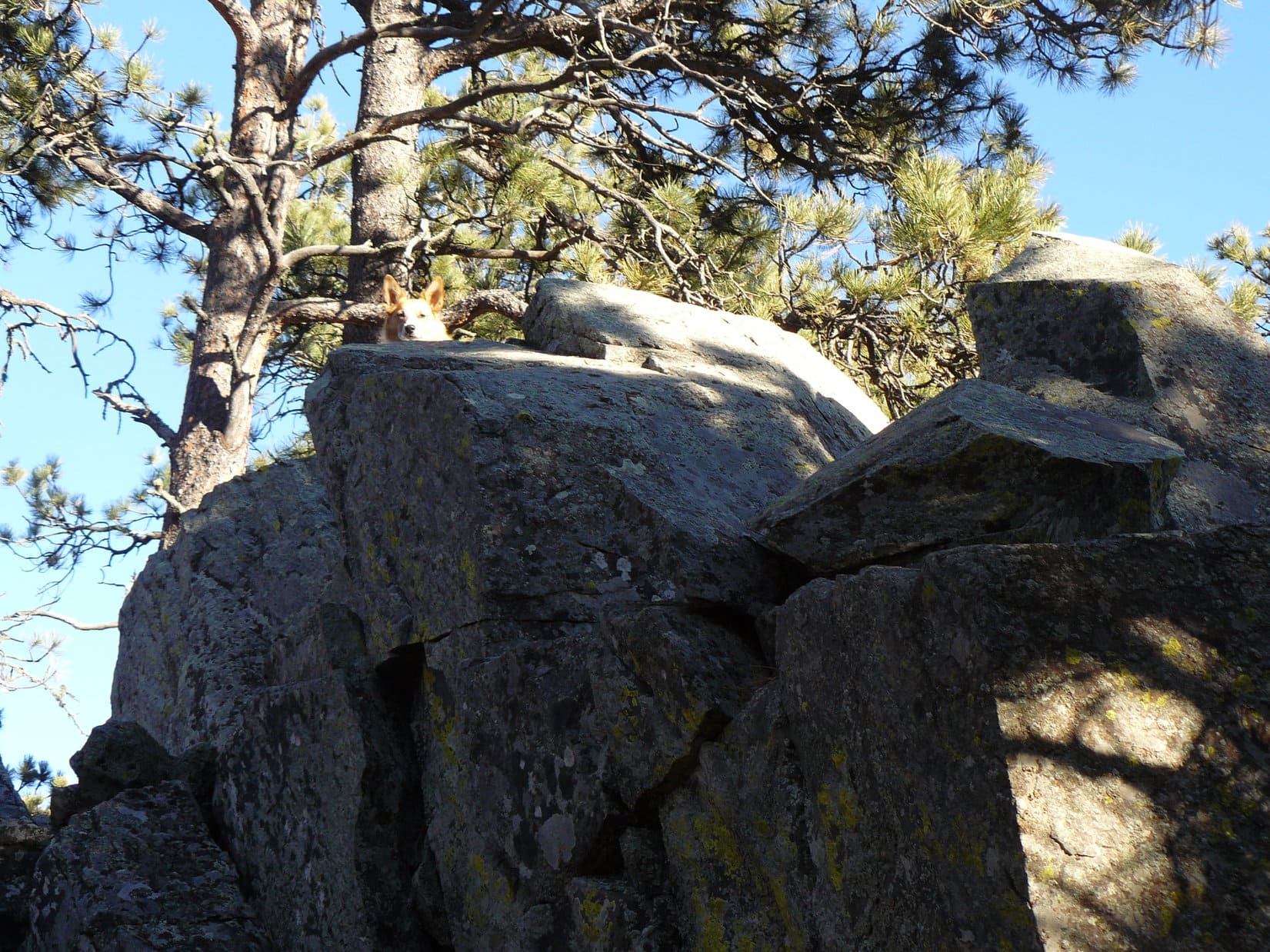
Lupe enjoyed sniffing around in the trees near Bear Butte Creek.  This was the only forested area she would come to all day.  She quickly reached the footbridge over Bear Butte Creek, and didn’t have much farther to go through the woods to reach the prairie.

Lupe on the footbridge over Bear Butte Creek.
Looking downstream (E).
A happy American Dingo lifts her head just high enough to be seen above the middle railing.

After crossing Bear Butte Creek, the woods ended just N of the creek.  There are two large ridges on the way to Bear Butte Lake.  The first one was now in sight dead ahead to the N.  Lupe could already see the top of Bear Butte sticking up over the ridge.

Just N of Bear Butte Creek. The first big ridge is seen up ahead.

Lupe gained only about 175 feet in elevation going from Bear Butte Creek up to the high points on the top of the first big ridge.  She was soon there.  Once up on this first ridge, Centennial Trail No. 89 turns ENE and runs along the top of the ridge for more than a mile.  Bear Butte is visible off to the NE the entire way.

Lupe up on the S edge of the 1st big ridge. Photo looks W along the ridge toward the Black Hills.
Looking E along the S edge of the 1st big ridge.
There's Bear Butte to the NE! The first big ridge is broad and flat. The Centennial Trail follows a dirt road along the top of the ridge. A few livestock watering tanks are scattered along the way, but Lupe didn't see any cows up here this day. Clearly she's not going to get impaled on any deadfall timber up here!
There’s Bear Butte to the NE! The first big ridge is broad and flat. The Centennial Trail follows a dirt road along the top of the ridge. A few livestock watering tanks are scattered along the way, but Lupe didn’t see any cows up here this day. Clearly she’s not going to get impaled again on any deadfall timber up here!

Lupe followed Centennial Trail No. 89 ENE along the first big ridge, getting closer to Bear Butte.  Lupe kind of missed the forests of the Black Hills, and looking for squirrels.  It was a little dull on the snowy prairie, but at least she wasn’t going to get impaled on anything.  Sometimes she tromped along right behind SPHP.  Sometimes she trotted along off the trail sniffing the cold ground.

There had been plenty of tracks in the snow in the short distance between Hwy 34 and Bear Butte Creek.  However, by the time Lupe was up on the first big ridge, there were no tracks in the snow at all.  No other American Dingoes or humans had been up here since the snow fell four days earlier.  Lupe and SPHP saw absolutely no one on the trail all day long.  The sound of traffic on Hwy 34 was mildly annoying, but Lupe and SPHP were alone.

Before starting down off the first big ridge, SPHP took a few pictures to show Lupe’s progress toward Bear Butte, and the expanse of prairie Centennial Trail No. 89 would cross to get to the second big ridge.

Lupe near the point where Centennial Trail No. 89 leaves the first big ridge. Bear Butte looms in the distance, still a few miles away.
Oh, there’s Bear Butte now!
Bear Butte from Centennial Trail No. 89. Bear Butte Lake is barely visible over the top of the second big ridge ahead. Photo looks NE.

Centennial Trail No. 89 goes down off the first big ridge at a small gap in the ridgeline.  Although part of the ridge continues on to the E, the trail doesn’t go there.  Instead, the trail drops down into the gap, and then turns NNE to cross more than a mile of lower ground on the way to the second big ridge.

Near the base of the first ridge, there is a patch of bushes and small scattered trees where birds take shelter.  Lupe enjoyed sniffing around in the bushes for a few minutes.

On the way down the gap from the first big ridge is this small patch of bushes and scattered trees. Lupe enjoyed sniffing around here. A few birds flew away at the Dingo's approach.
On the way down the gap from the first big ridge is this small patch of bushes and scattered trees. Lupe enjoyed sniffing around here. A few birds flew away at the American Dingo’s approach.

The entire area between the ridges is open grassland.  There was nothing remarkable along the way, except the solitude, which was somewhat marred by the sound of traffic on Hwys 34 & 79.  At least the traffic couldn’t be heard quite as clearly along in here.

Although the beauty of the prairie isn’t as dramatic as that of the mountains; the solitude, big sky and long unbroken views are all enjoyable, too.  Peaceful, if somewhat bleak scenes stretched off in every direction on this snowy December day.  Lupe and SPHP trudged along, and eventually reached the top of the second big ridge.

Lupe near the top of the second ridge. Photo looks SSW back along Centennial Trail No. 89 toward the first big ridge.
The second big ridge isn't as distinct a rise as the first one was. The second ridge is narrow, and the Centennial Trail No. 89 just crosses it without following it. Here Lupe is on the high point of the second big ridge where the trail crosses it. Photo looks NE toward Bear Butte. Lupe is definitely much closer to Bear Butte Lake now, which can be seen more clearly ahead.
The second big ridge isn’t as distinct a rise as the first one was. The second ridge is narrow, and the Centennial Trail No. 89 just crosses it without following it. Here Lupe is on the high point of the second big ridge where the trail crosses it. Photo looks NE toward Bear Butte. Lupe is definitely much closer to Bear Butte Lake now, which can be seen more clearly ahead.

The Bear Butte Lake trailhead for Centennial Trail No. 89 is a short distance off Hwy 79 near the SE end of the lake.  Lupe and SPHP went around the S side of Bear Butte Lake to the trailhead.  The trailhead features a big gravel parking lot, a few old picnic tables, and a small grove of trees.

SPHP stopped at one of the picnic tables, and had some banana bread and an apple.  Lupe wasn’t really hungry yet, she just had a little Taste of the Wild.  She didn’t even want any water, since she’d been eating snow along the way.  She sniffed around the parking lot, but didn’t find anything of interest.  When SPHP offered her some banana bread, she took it and stashed it in a safe place, just in case she needs it later.  Carolina Dogs like to plan sensibly for the future!

The N wind had blown snow across Bear Butte Lake to form drifts. Here Lupe is among the snow drifts near a little bay on the S side of the lake. Photo looks N.
Lupe on a small ridge S of Bear Butte Lake. Photo looks NE toward Bear Butte. Lupe still hasn't reached the Bear Butte Lake TH yet, but she is getting close.
Lupe on a small ridge S of Bear Butte Lake. Photo looks NE toward Bear Butte. Lupe still hasn’t reached the Bear Butte Lake TH yet, but she is getting close.
Bear Butte from close to the Bear Butte Lake TH of Centennial Trail No. 89. Photo looks NE.

After the brief rest break at the Bear Butte Lake trailhead, Lupe and SPHP decided to circumnavigate Bear Butte Lake.  Lupe went a short distance E to Hwy 79, which she followed N to Bear Butte Lake Road.  Bear Butte Lake Road is a major gravel road, and had some traffic on it.  Lupe followed it W along the N shore of Bear Butte Lake to a campground.

Looking SW across Bear Butte Lake toward the Black Hills from the N shore just off Bear Butte Lake Road.

Lupe and SPHP left Bear Butte Lake Road, and went through the campground to a little road along the NW side of the lake.  There Lupe saw a rare sight!  A bald eagle was sitting high up in a tree some distance away near the W end of the lake.  SPHP managed to get a picture of it with the telephoto lens before it flew away.

Looking ESE across Bear Butte Lake from the campground on the N side of the lake.
Looking back toward the campground and Bear Butte from the little road on the NW side of Bear Butte Lake.
Bald eagle in a tree near the W shore of Bear Butte Lake.

A little way W of Bear Butte Lake, Lupe and SPHP returned to Centennial Trail No. 89 again.  Lupe had been clear around Bear Butte Lake.  Now it was time to head back to the G6.  On the return trip, Lupe and SPHP got to enjoy Centennial Trail No. 89 heading in the opposite direction, going SW toward the Ft. Meade trailhead.

W of Bear Butte Lake, Lupe rejoined Centennial Trail No. 89 here. The second big ridge now lies ahead. Photo looks W.
View of the ranchlands W of the 2nd big ridge. Photo looks W.
Looking SE at the 2nd big ridge from Centennial Trail No. 89. The part of the 2nd big ridge shown here is well S of where the trail crosses the ridge.
Lupe between the two big ridges. Photo looks SSW toward the first ridge.
A final look back at Bear Butte to the NE. Lupe is once again up on the first big ridge here.
Looking NW from the first big ridge.
Along the S edge of the first big ridge. Photo looks W.
Looking S toward Ft. Meade from the first big ridge. The trees along Bear Butte Creek are lined up ahead.
Looking W along Bear Butte Creek from the Centennial Trail No. 89 footbridge.

Despite a rather leisurely pace taken on Expedition No. 149, Lupe was back at the G6 by 3:01 PM (37°F).  With winter solstice just 2 days away, the sun was already quite low in the sky, but it was still up.  Lupe paid a visit to Ft. Meade, which was a cavalry outpost during the late 1800’s.

Sign at the old Ft. Meade parade grounds.
Lupe at Ft. Meade.
Lupe at Ft. Meade.

Fort Meade was established during the winter of 1878-1879.  Here, the 7th Cavalry was re-formed after it’s disastrous defeat under General George A. Custer at the Battle of the Little Bighorn (Custer’s Last Stand) in Montana, in June 1876.

Comanche, a 7th Cavalry horse, and sole surviving member of the cavalry found on the Little Bighorn battlefield, was retired at Ft. Meade with military honors.  Ft. Meade survived as a military installation until 1944, when it became the site of the current Veteran’s Administration Hospital.

After visiting Ft. Meade, Lupe and SPHP drove over to Bear Butte.  At a pullout along Hwy 79, Lupe and SPHP stopped to take a look at Bear Butte from the NW.

Bear Butte from the NW along Hwy 79.
A closer look with help from the telephoto lens.
Lupe NW of Bear Butte. South Dakota’s 111 mile long Centennial Trail No. 89, which ends in Wind Cave National Park in the Black Hills, starts at the top of Bear Butte.

Lupe didn’t get to bark at any squirrels on Black Hills, SD Expedition No. 149, but she did get to spend the day outdoors wandering the prairie with SPHP.  Most importantly, she didn’t get hurt again, and continues to get better.  Lupe is back in action.  She will return again soon with more American Dingo adventures in the Black Hills and beyond!

Links:

Next Black Hills Adventure                Prior Black Hills Adventure

Next Trail Section South:

Black Hills, SD Expedition No. 241 – Centennial Trail No. 89: Alkali Creek to Fort Meade (12-10-18)

Centennial Trail No. 89 Map & Brochure

Want more Lupe adventures?  Choose from Lupe’s Black Hills Expeditions Adventure Index or Master Adventure Index.  Or subscribe free to new Lupe adventures.

Black Hills, SD Expedition No. 148 – Smith Mountain, Flag Mountain & Campaign Hill (12-5-15)

The Black Hills experienced a cold snap over Thanksgiving and the following long weekend.  Several nights there was light snow.  At the very end of November, there was about 4″ of additional new snow overnight at Lupe’s house.  Then it started to warm up.  SPHP decided to wait for a few days to let some of the snow melt before Lupe’s next expedition.

Finally, on December 5th, Lupe and SPHP headed out for adventure again.  Lupe was excited.  She could hardly wait.  At 9:29 AM, SPHP parked the G6 at the Newton Lake trailhead.  It was 37 °F and overcast.  Lupe leaped over SPHP to get out of the G6 at the first possible moment.  She was expecting great things!

SPHP had 4 peakbagging goals in mind for Lupe.  The first was Smith Mountain (5,897 ft.), which was very close at hand.  Soon Lupe and SPHP were heading up the fairly steep NE slope.  It was very slow going.  There was still some snow on the ground, which made it a bit slippery.  The real problem, though, was the terrible condition of the forest.  There were lots of dead trees, killed by the pine bark beetles, that had fallen over.

For SPHP, it was a struggle getting over, under or around all the deadfall timber.  At one point, SPHP lifted Lupe over a dangerous barbed wire fence that was partially collapsed by the dead trees.  Lupe only needed to gain a little over 600 feet of elevation to get up on the ridge, but it was taking SPHP a long time to get up there.  Finally, the ground began to level out a bit, and there was somewhat less deadfall around.

View from the upper NE slopes of Smith Mountain looking SE towards Harney Peak. There is less deadfall timber here than lower down.

Once Lupe and SPHP were up on the ridge, the going was a bit easier.  The deadfall wasn’t quite as bad, and the ground wasn’t so steep.  Lupe and SPHP reached the ridgeline near the N end of Smith Mountain.  There was a series of rock outcroppings spaced out along the ridge as Lupe headed S toward the summit.

Lupe on one of the rock outcroppings near the N end of Smith Mountain. It took so long for SPHP to get up here, by now the formerly overcast skies were almost clear. It was going to be a beautiful day!
Lupe on one of the rock outcroppings near the N end of Smith Mountain. It took so long for SPHP to get up here, by now the formerly overcast skies were almost clear. It was going to be a beautiful day!  Photo looks W or SW.
Here Lupe is shown at another rock outcropping farther S on Smith Mountain. At first, SPHP thought this might be the true summit, but it wasn't.
Here Lupe is shown at another rock outcropping farther S on Smith Mountain. At first, SPHP thought this might be the true summit, but it wasn’t.
Lupe up on the false summit of Smith Mountain.
Lupe up on the false summit of Smith Mountain.  Despite the pine bark beetle carnage, there were still too many trees standing to permit any really decent distant views.

The Smith Mountain ridge runs N/S for about a mile.  The ridge was all forested, and provided only occasional glimpses of distant hills.  It was pretty easy going along the ridge, since it was plenty wide.  Although it went up and down some, it was overall pretty level.  Lupe found the true summit of Smith Mountain at a big rock outcropping a bit S of the mid-point along the ridge.

Lupe reaches the true summit of Smith Mountain.
Although the highest rock on Smith Mountain was too steep for Lupe to reach the tippy top, she got pretty close. Close enough for Dingo work!
SPHP reached up to touch the top of the closest high rock. It was still a foot or two below the very highest point. Lupe and SPHP are both claiming success, though.

With her Smith Mountain peakbagging goal accomplished, Lupe continued S along the Smith Mountain ridge.  It was easier going along in here, since there wasn’t nearly so much deadfall.  This part of the forest seemed to have been thinned by loggers some years ago.  Whatever the reason, the forest was in better condition.  SPHP was a bit surprised to find some big rock outcroppings near the S end of the mountain, but is pretty certain they weren’t quite as high as the rocks farther N.

Lupe’s 3 remaining peakbagging goals were all mountains along a line S of Smith Mountain.  Her next goal was Flag Mountain (5,896 ft.).  To get to Flag Mountain, Lupe went down the S end of Smith Mountain, and crossed Patterson Creek.  Patterson Creek isn’t very large, and didn’t have much flow at this time of year.  Lupe and SPHP had no problem crossing it.  S of Patterson Creek, Lupe started climbing the N slope of Flag Mountain.

Lupe on her way to Flag Mountain, seen to the S in the background. Lupe is developing a habit of taking picture time very seriously, kind of like they did back in the late 1800's. Here she strikes her very best stiff and serious historic 1870 Carolina Dog pose. She often starts smiling again as soon as SPHP turns off the camera. It's a bit frustrating sometimes!
Lupe on her way to Flag Mountain, seen to the S in the background. Lupe is developing a habit of taking picture time very seriously, kind of like they did back in the late 1800’s. Here she strikes her very best stiff and serious historic 1870 Carolina Dog pose. She often starts smiling again as soon as SPHP turns off the camera. It’s a bit frustrating sometimes!

The last part of the climb up Flag Mountain was the steepest.  There was snow again on the N slope, but only a couple of inches.  The situation on Flag Mountain was the reverse of what it had been on Smith Mountain.  Most of the deadfall timber was up on the highest slopes.  The first part of the climb went fast, but the last part was slow.

Despite the deadfall, Lupe and SPHP reached the top of Flag Mountain.  Lupe had accomplished her 2nd peakbagging goal of the day.  It was time for a break.  Lupe had some water and a bit of Taste of the Wild.  She licked herself for a few minutes, and laid down to rest, but SPHP didn’t think a thing of it.

The top of Flag Mountain is pretty flat.  Unlike Smith Mountain, Flag Mountain is not a long ridge.  There is no chance of mistaking the summit.  Toward the E is a spacious open grassy area.  The actual highest point is over at some slightly higher rocks toward the W.

There are trees around the summit, some of them dead, which effectively block the views from Flag Mountain in most directions.  However, there were really nice open views to the SE toward Harney Peak (7,242 ft.) from the grassy area.  There was also a pretty good view to the NW, from the highest rocks at the W end of the summit area.

Lupe reaches the grassy area at the E end of the top of Flag Mountain. Photo looks SE toward Harney Peak.
Lupe reaches the grassy area at the E end of the top of Flag Mountain. Photo looks SE toward Harney Peak, the highest point on the horizon.
Harney Peak from Flag Mountain. The E part of the top of Campaign Hill, Lupe's 3rd peakbagging goal of the day is seen in the foreground on the R.
Harney Peak from Flag Mountain. The E part of the top of Campaign Hill, Lupe’s 3rd peakbagging goal of the day, is seen in the foreground on the R.
Lupe on the highest rocks on Flag Mountain. Photo looks NW.

Lupe had now completed 2 of her 4 peakbagging goals of the day.  Her next goal wasn’t very far away.  Just to the S of Flag Mountain is Campaign Hill (5,800 ft.).  Campaign Hill isn’t quite as high as Flag Mountain, so it didn’t look like a very impressive goal.  Due to the trees, it was hard to get a very good look at it, except from the very SE edge of the summit on Flag Mountain.

Since the sun stays pretty low this time of year, even at mid-day it always feels like sunset isn’t very far off.  Lupe and SPHP enjoyed a little time up on Flag Mountain, but didn’t linger up there too long before Lupe began descending the SW slope.  She only had to lose a few hundred feet of elevation to get down to the saddle between Flag Mountain and Campaign Hill.

Down at the saddle, there was a USFS road junction.  USFS Road No. 727 passes through the gap between the two mountains.  No. 727.1F branches off to head N on the W side of Flag Mountain.   Lupe crossed No. 727, and started climbing directly up the N slope of Campaign Hill.  It was fairly steep, especially near the top.  Again there was some snow, but SPHP was glad that this time there wasn’t much of the pesky deadfall timber.  Lupe was soon up on the highest rocks at the E end of Campaign Hill.

Lupe reaches the highest rocks at the E end of Campaign Hill. This was not the true summit.

Lupe on Campaign Hill, 12-5-15There were too many trees near the rocks at the E end of the Campaign Hill ridge to really see much.  It proved not to be the true summit anyway.  Lupe headed W along the ridge, which soon turned SW, and came to a big rock that was clearly higher.  Beyond it was a grouping of rocks that were even higher yet.  This was the true summit of Campaign Hill.

SPHP had to lift Lupe up to get her up on top of the true summit.  The entire Campaign Hill ridge, which wasn’t terribly long, was all pretty heavily forested.  There weren’t really hardly any views.  There was a glimpse of Harney Peak, though, from where Lupe was up on top.

Lupe on the very top of Campaign Hill. There was just a glimpse of Harney Peak to the SSE through the trees.
An American Dingo is just visible peering out from the rocks on top of Campaign Hill.
Lupe was very good about staying up on top of Campaign Hill for photos while SPHP scrambled around on the rocks below for position.

Usually Lupe just jumps down off rocks, when SPHP says it is OK after taking photos.  The rocks up on Campaign Hill were a bit high, however.  Lupe waited for SPHP to come back up to help get her down off the rocks.  She was reluctant to jump down.  Again, SPHP thought nothing of it.

Lupe’s 4th and last peakbagging goal of the day was Peak 6048, about a mile to the S of Campaign Hill.  The sun was definitely getting lower, so Lupe was soon on her way.  She enjoyed running around in the slanting sunlight filtering through the forest, as she and SPHP continued S along the ridge.  Near the lowest saddle on the way to Peak 6048, there was a little opening with a glimpse of Peak 6048 ahead.  It wasn’t going to be long before Lupe would be up there!

Looking S at Peak 6048, the high point on the L. Lupe would be there soon, to complete her 4th peakbagging goal of the day!

Except Lupe never made it to Peak 6048.  Lupe raced ahead of SPHP into a thick forest of small trees at the low point of the saddle.  When she came out again, suddenly SPHP saw red.  There was blood between Lupe’s hind legs!  SPHP made Lupe stop and lay down.  SPHP lifted up a hind leg.  There was a gash at least 2 inches long where her left hind leg and abdomen meet.  A big area of flesh was exposed where the skin was peeled back.

Fortunately, it didn’t look like anything other than the skin had been pierced or torn.  Lupe wasn’t bleeding much, and she could still walk and run around.  In fact, if SPHP hadn’t seen the blood, there wasn’t anything at all alarming about her behavior.  She showed no sign of pain or distress.  She didn’t want SPHP to touch the wound, though.  It had to hurt!

Expedition No. 148 was essentially over.  There would be no continuing on to Peak 6048.  The only thing left to do was to get Lupe back to the G6.  She needed to see a veterinarian ASAP.  It was 5 miles back to the G6 along the only road SPHP was certain about.  Before heading for the G6, though, it was time for first aid!  Lupe had been hurt back on Expedition No. 135.  Since then SPHP has been carrying bandages and gauze in case of an emergency.

SPHP tried a bandage first.  Lupe was cooperative and let SPHP work on her, but the bandage was of no real use.  Lupe’s fur was kind of long where her wound was, and the bandage wouldn’t stick to the wound.  It stuck to her fur, but hung below her belly.  The bandages were going to be useless without a way to shave the fur off around the wound.

SPHP tried using gauze wrapped up over Lupe’s back to hold the bandage in place closer to the wound.  This would have worked, but it didn’t feel right to Lupe.  She took a few steps and sat down.  She just looked piteously at SPHP and refused to move.  Maybe it hurt.  Maybe it just felt weird.  Probably both.  Whatever.  It was clear Lupe would not go on under her own power with the gauze wrapped around her like that.  SPHP took the gauze off.

Injured Lupe with gauze wrapped around her back. She refused to move with it on.

What had happened to Lupe?  SPHP didn’t see the injury occur, but it is almost certain she was impaled by a sharp broken limb sticking up from one of the hundreds of deadfall trees she had jumped over.  It is a constant threat in the Black Hills these days.  Perhaps the original injury was small, but once the wound was opened, it would have been easy for the edges of the broken skin to get caught on other sticks and twigs and tear further each time.

Thinking back, SPHP wondered if Lupe hadn’t been injured coming over the deadfall timber while climbing Flag Mountain.  She had licked the area where the wound was up on top of Flag Mountain during her break.  Up on Campaign Hill, she hadn’t wanted to jump down off the rocks like she usually does.  Perhaps the poor injured Carolina Dog had been putting on a brave front for quite some time.

She was still putting on a brave front.  Once the gauze was off, she was ready to go again.  With nothing to protect her belly where the wound was, though, it was vitally important to stay away from any more deadfall timber.  The last thing she needed was to get the broken skin caught on anything else and torn some more.  Lupe needed to get to a road.

Lupe and SPHP headed down through the forest to the W of the saddle.  Fortunately, USFS Road No. 727 wasn’t very far away.  Lupe and SPHP reached the road very quickly.  Lupe followed it N.  She took No. 727.1F at the intersection between Flag Mountain and Campaign Hill, staying W of Flag Mountain.

No. 727.1F ended before reaching Patterson Creek.  Lupe and SPHP had to continue off-road down to the creek.  Fortunately, there wasn’t much deadfall in this area.  N of the creek was another road, USFS Road No. 386.1B.  Lupe and SPHP had explored No. 386.1B once before heading around the W side of Smith Mountain on a prior expedition.  Upon reaching the road, SPHP stopped and looked at the map.

It was still close to 4 miles back to the G6 by the route around the W side of Smith Mountain.  The map showed No. 386.1B also curled around the E side of the mountain, though, too.  It didn’t show the E route going all the way to the highway, but it looked like it got pretty close.  The E route would be less than half as long.  It might easily save 1.5 hours, if it worked.

It was hard to know what to do.  If the E route ended in a tangle of deadfall, Lupe and SPHP would have to come all the way back.  She would then still have go clear around the W side of Smith Mountain.  On the other hand, time was of the essence.  Just because Lupe seemed happy enough didn’t mean things were fine.  With nothing protecting the open wound, no doubt infection was setting in.  The longer it took to get to the vet, the worse it would be for Lupe.

The road to the E looked pretty good.  SPHP hesitated only a minute or two, before Lupe and SPHP took it.  Thankfully, the shortcut worked.  At 4:10 PM, Lupe was back at the G6.  SPHP drove her directly to the Emergency Veterinary Hospital in Rapid City.  Emergency veterinarian Dr. David Christensen saw Lupe almost right away.  She was soon led away for wound cleaning, anesthesia, and stitches.

SPHP waited for Lupe to return.  And waited.  And waited.  The clinic staff and Dr. Christensen were busy early on a Saturday evening.  A woman brought in a black and white dog that was trembling all over.  She thought her dog had been poisoned.  A man brought in a little white dog that had a badly abscessed tooth.  One side of its face was all bloody.

Eventually, a staff member told SPHP that Lupe was waking up from the anesthesia, and it would be another 5 or 10 minutes.  Nearly an hour passed, though, with no further word.  Finally, Lupe returned.   She was walking, but looked dazed from the experience.  Her fur on her chest was all wet from drooling.  She was all stitched up, though!   She was going to be fine!

Lupe's stitches the morning after Expedition No. 148. Her abdomen was red and swollen. She is on antibiotics for the infection, and gets a beef flavored pain killer, too.
Lupe’s stitches the morning after Expedition No. 148. Her abdomen was red and swollen. She is on antibiotics for the infection, and gets a beef flavored pain killer, too.
Oh, no! It's the return of Cone-On the Luparian! Sigh.....
Oh, no! It’s the return of Cone-On the Luparian! Sigh…..
Stay tuned! I will return with more American Dingo adventures very soon!
Stay tuned! I will be back with more American Dingo adventures very soon!

Links:

Next Black Hills Expedition                     Prior Black Hills Expedition

Want more Lupe adventures?  Choose from Lupe’s Black Hills Expeditions Adventure Index or Master Adventure Index.  Or subscribe free to new Lupe adventures.