Black Hills, SD Expedition No. 153 – Steamboat Rock, Pugg’s Keep & Green Top (1-23-16)

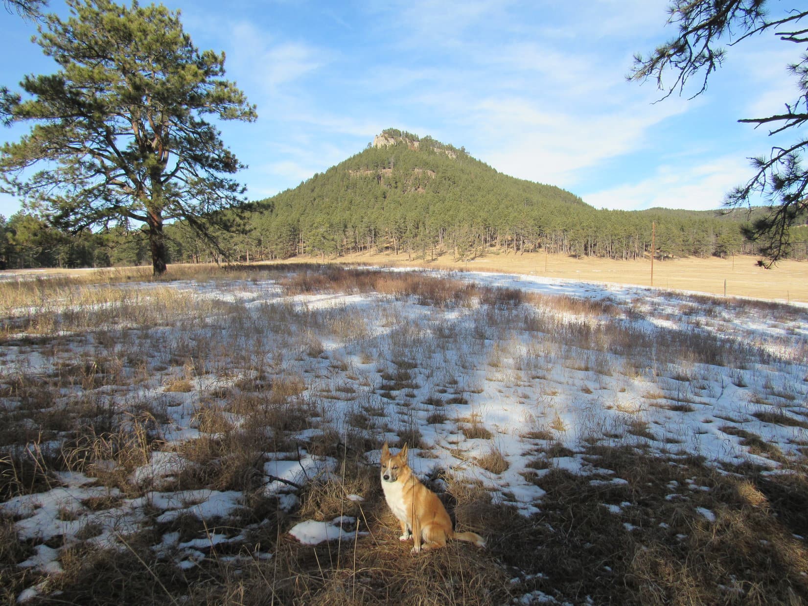
9:42 AM (44°F), a beautiful and warm (for January) sunny day, and Lupe was back!  She had been here once before, almost 3 years ago.  Way back on February 9, 2013, near the end of Black Hills, SD Expedition No. 46, Lupe had tried to climb Steamboat Rock (5,081 ft.).

Back then, Lupe hadn’t succeeded in finding a way up to the summit, but she’d gotten close.  She’d approached from the N, and encountered cliffs just below the mountaintop.  The cliffs weren’t high, only 10-15 feet tall at that end of the mountain, but the sun was about to set.  There hadn’t been time to really look around for a safe way up.

Things were different now.  It was early in the day.  Lupe had time to search the entire circumference of the mountain, if necessary, to find a route up.

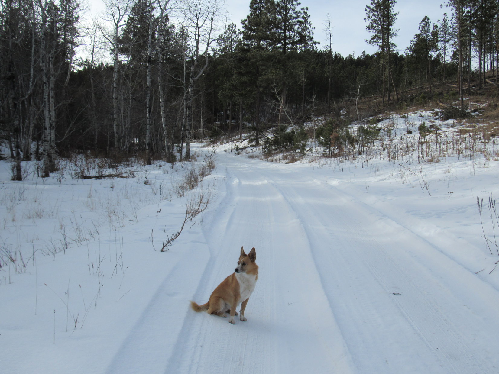
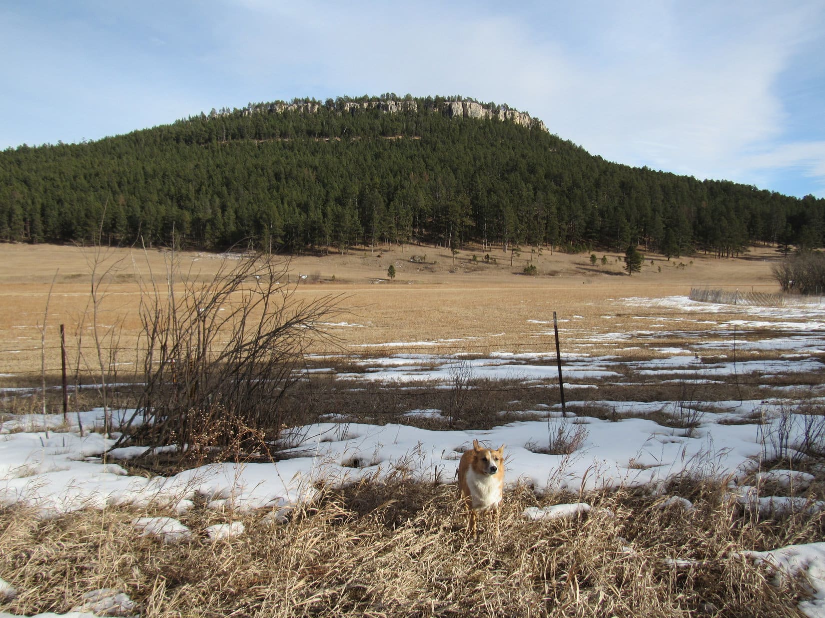
Lupe and SPHP set out from the Steamboat Rock picnic ground along Nemo Road.  Boxelder Creek flows between the picnic ground and Steamboat Rock to the N.  To get across the creek, Lupe followed Nemo Road E to USFS Road No. 147, where there was a bridge.

Lupe arrives at the Steamboat Rock picnic ground. Photo looks N at Steamboat Rock.

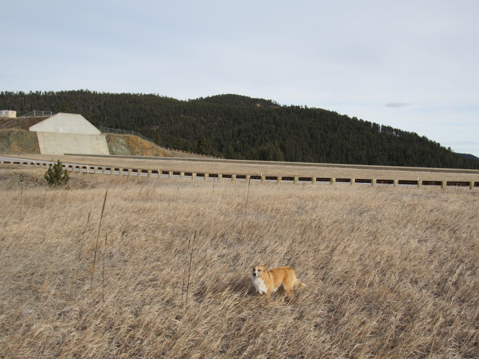
Once across Boxelder Creek, Lupe left USFS Road No. 147 by climbing up an embankment.  She then traveled NW toward Steamboat Rock.  Part of the time she was in the forest, and part of the time out on open ground just S of a big fenced field of privately owned land.

After crossing Box Elder Creek on USFS Road No. 147, Lupe headed NW toward Steamboat Rock.

Lupe had to re-enter the forest to get around the SW end of the field.  She then turned N and started a gradual climb.  Lupe and SPHP headed for the SE end of the E side of the mountain.  The forest had suffered a fair amount of damage from mountain pine bark beetles, but it wasn’t too bad.  Most of the time it wasn’t hard to avoid the deadfall timber.

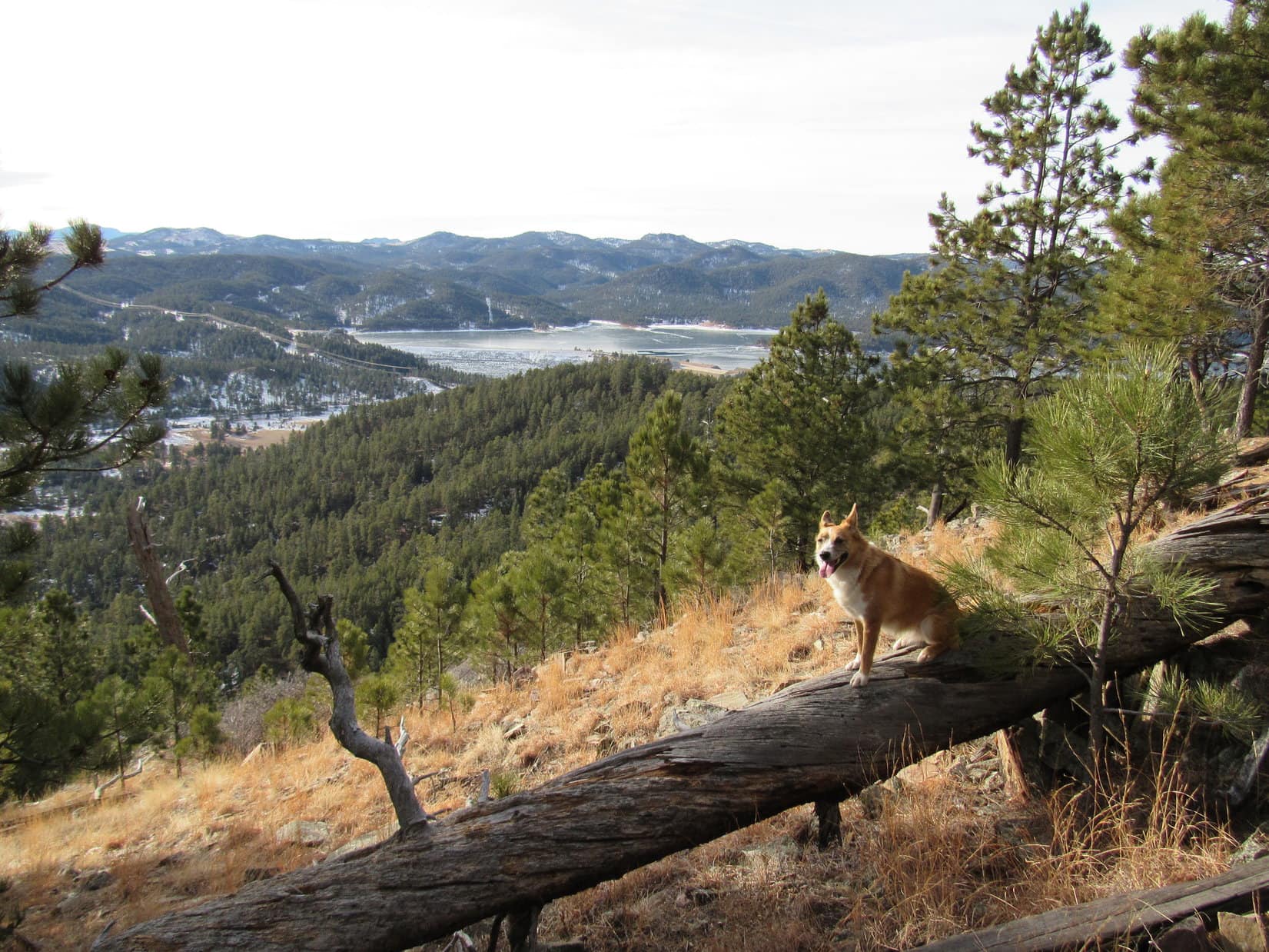
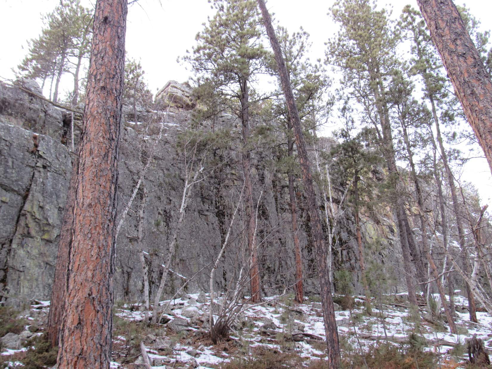
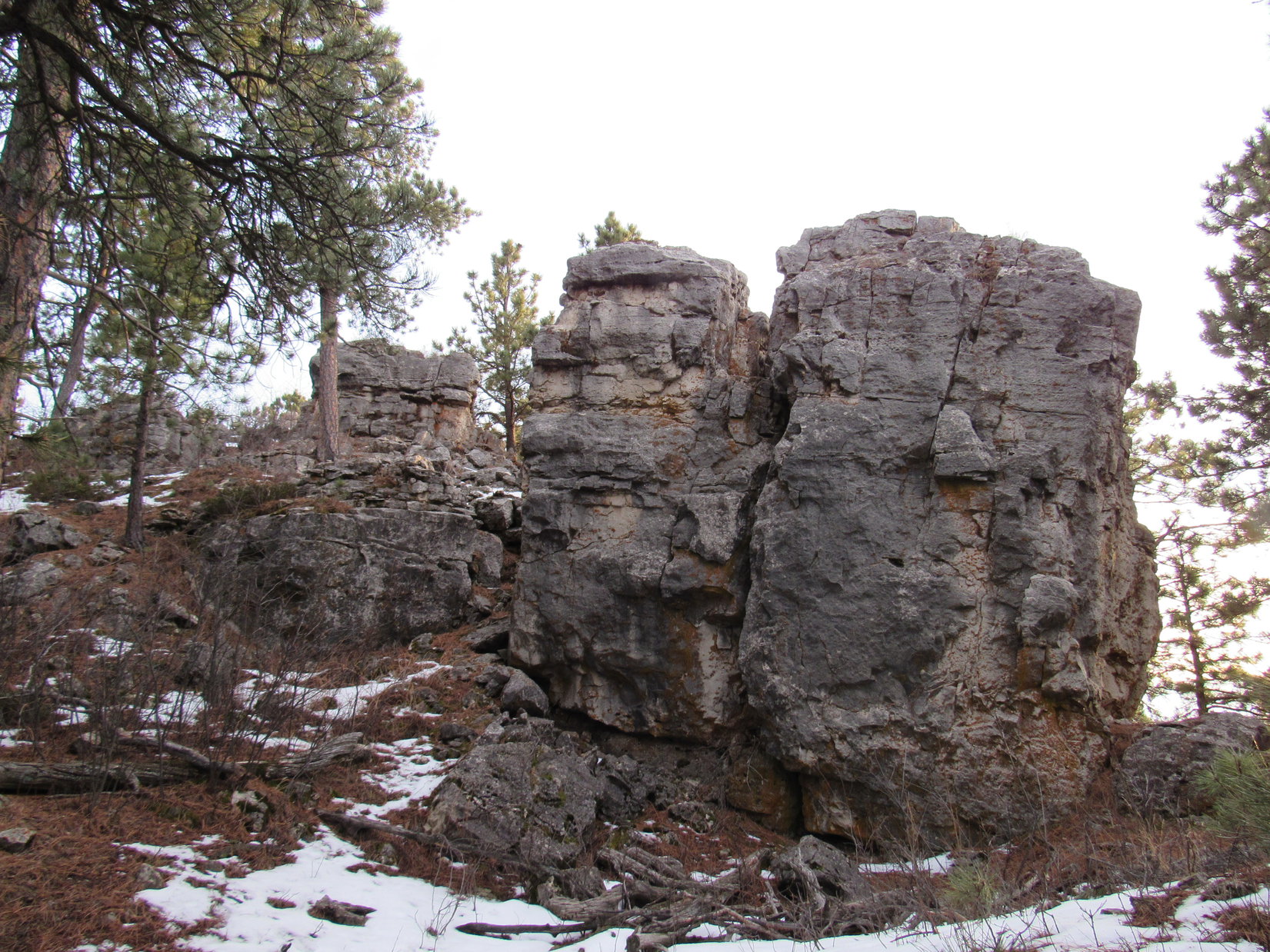
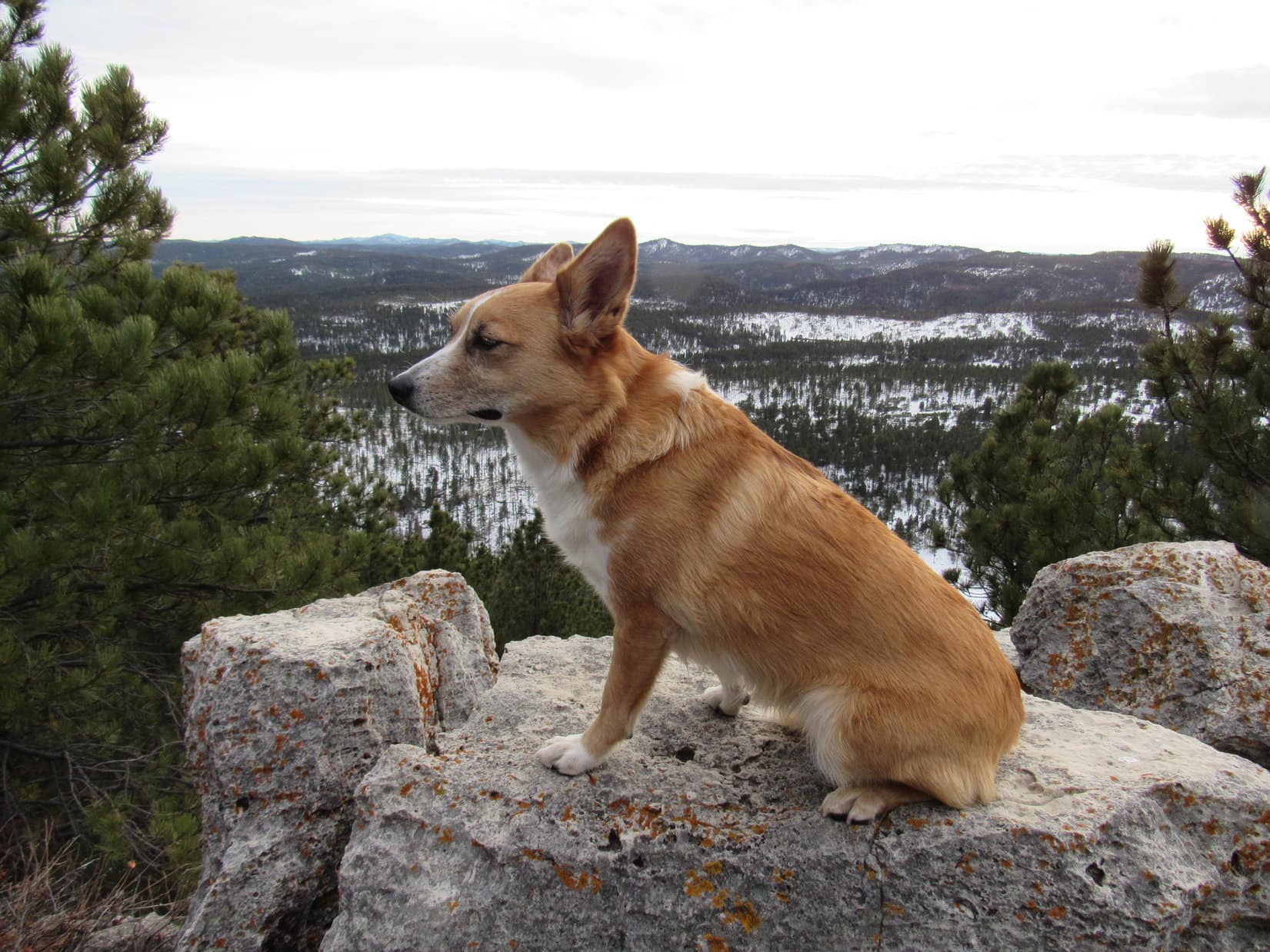
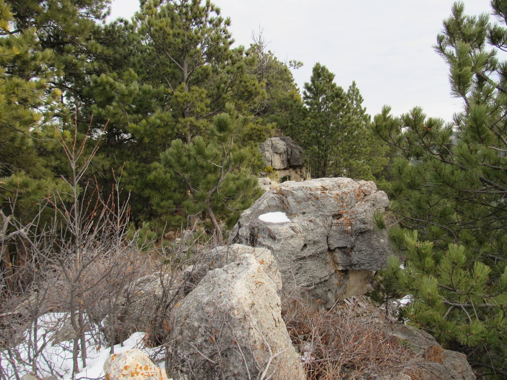
Steamboat Rock contains two bands of rock which are less easily eroded than the geologic formations between and below them, resulting in two bands of cliffs around the mountain.  Lupe needed to find a route up avoiding both.  It was clear Lupe couldn’t just go up the S end of the mountain, where the cliff walls were high and unbroken.  Lupe traveled N along the E side of Steamboat Rock, gaining elevation and looking for an opening.

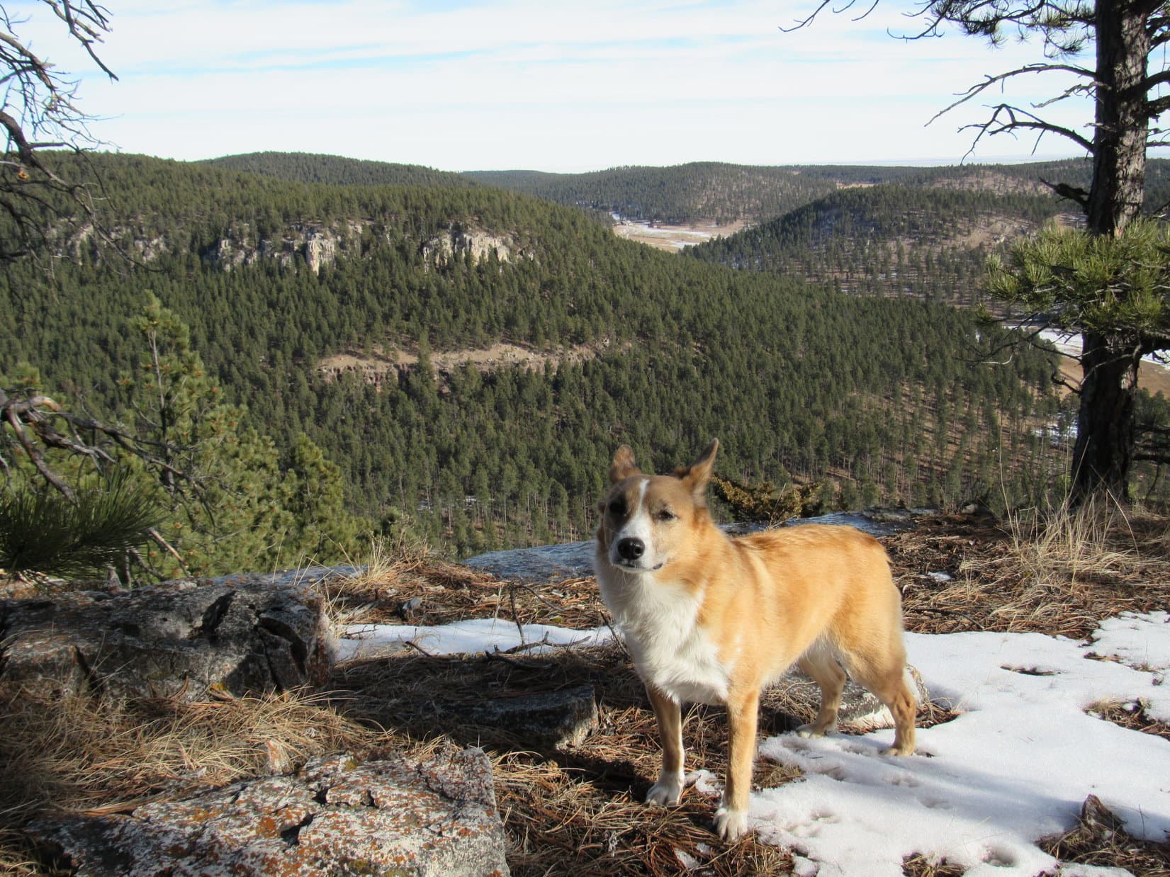
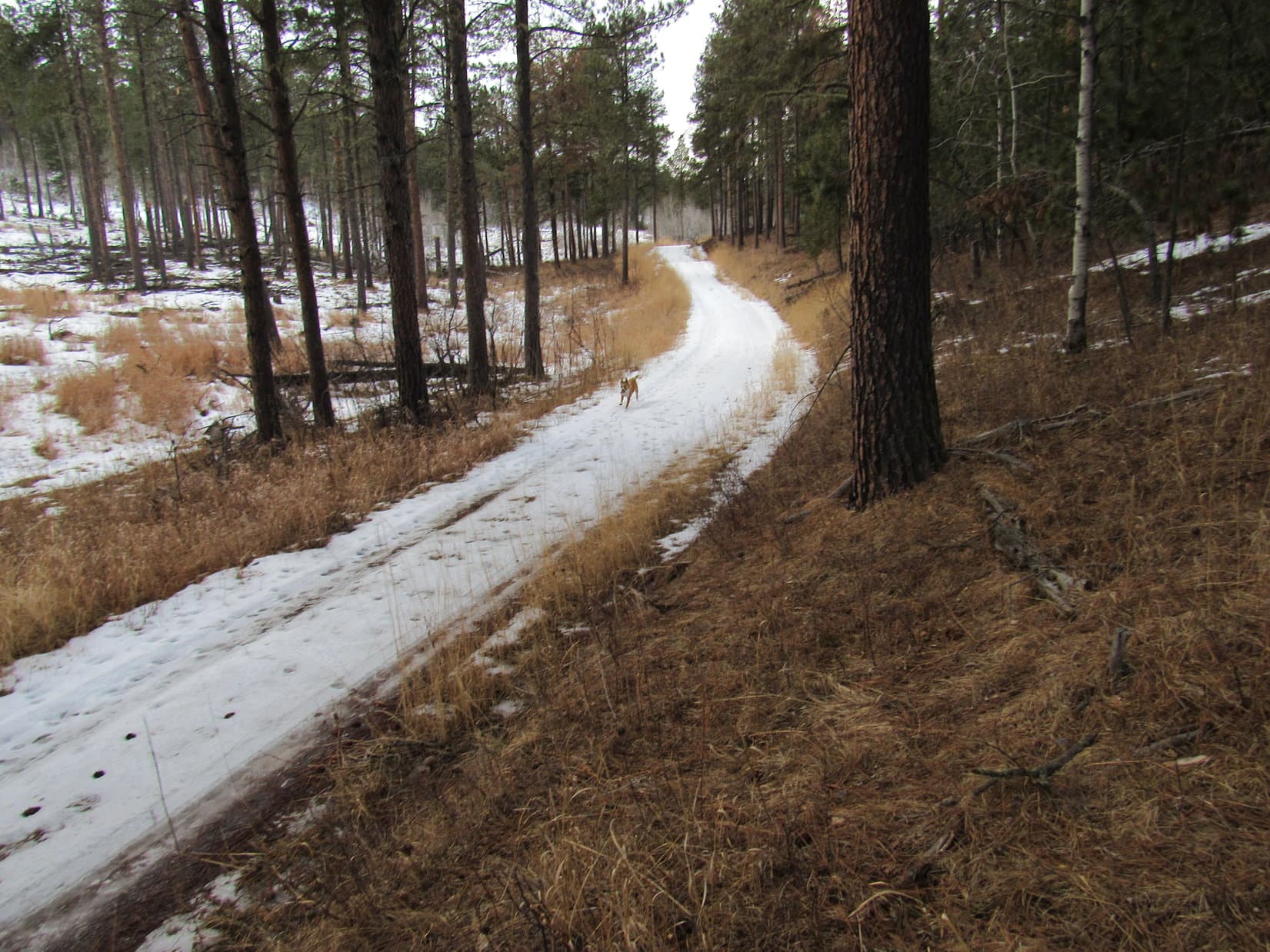
By the time Lupe had climbed high enough to reach the base of the first set of cliffs, she was far enough N to see that just ahead was an area where the cliffs were reduced to an intermittent string of rock outcroppings.  The ground between the rock outcroppings was steep, but easily climbable.  Lupe and SPHP had no problem getting up above the first band of rocks.

At he base of the first set of cliffs. Just a short distance to the N, there were breaks in the cliff wall where it was easy to climb up above.

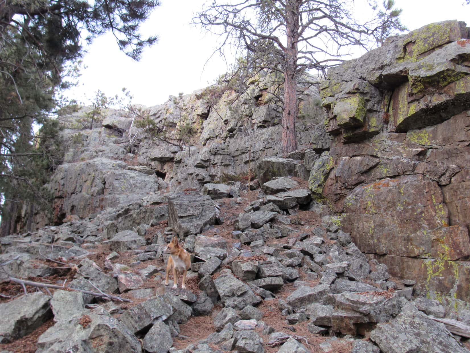
Lupe started climbing up toward the second set of cliffs, a light-colored band of limestone positioned high on the mountain.  She continued angling up and toward the N.  When she got high enough to see the cliffs through the forest, the view was discouraging.  These cliffs were considerably higher than the ones below, and formed an unbroken wall.  The ground below them was very steep, not much of a problem for Lupe, but SPHP had to proceed slowly and carefully.

Lupe and SPHP didn’t have to go too much farther N before there was a glimmer of hope.  The cliff face was less regular, and there began to be some clefts in the rock.  Lupe came to a place where there was a fairly large opening.  SPHP couldn’t see the top of the opening, but it looked like it might be possible to climb up here.

SPHP started climbing, but soon realized that the ground was just too steep.  There were little patches of snow and ice in the shade of the mountain, enough to make this route slick and treacherous.  There were too few firmly anchored rocks to provide decent handholds and footholds.  SPHP went back down.  Lupe and SPHP continued N.

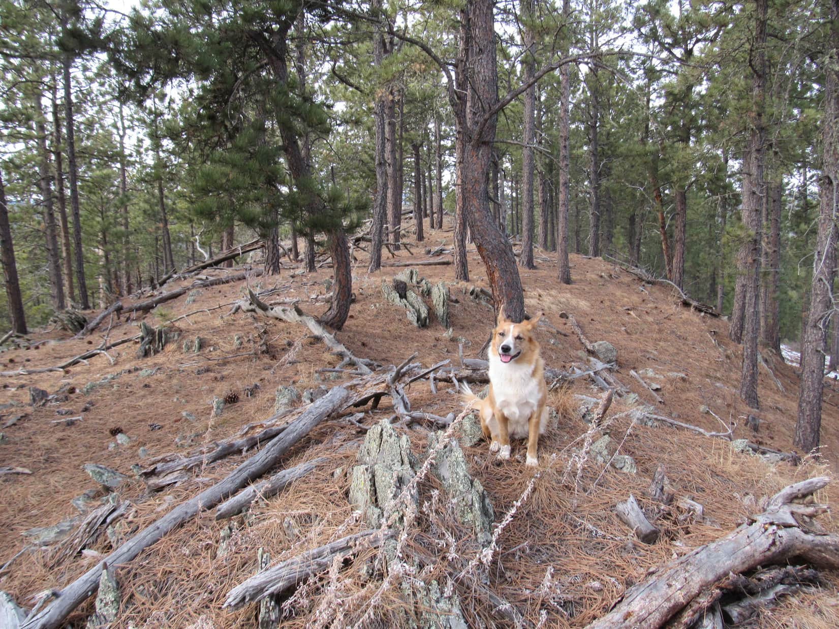
Just a little farther on, there was another break in the cliffs.  Some steep ground led up to a much smaller opening where it looked like Lupe and SPHP should be able to get up on top.  Lupe waited patiently as SPHP made a careful ascent.  Soon both Lupe and SPHP were up above the highest band of cliffs on Steamboat Rock!

Lupe below the highest band of cliffs on Steamboat Rock near where she was able to get up on top.
Lupe up above the highest band of cliffs along the E edge of Steamboat Rock. Photo looks NE.

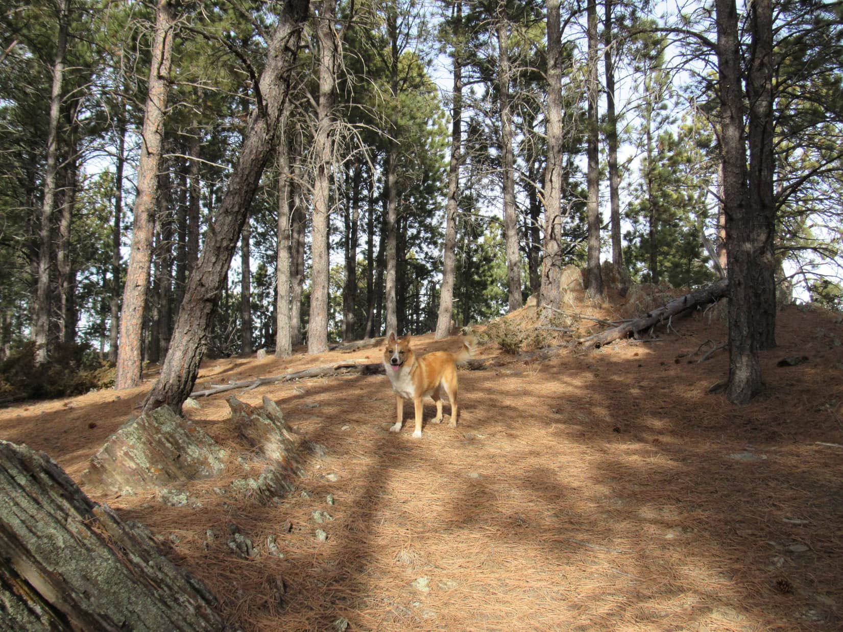
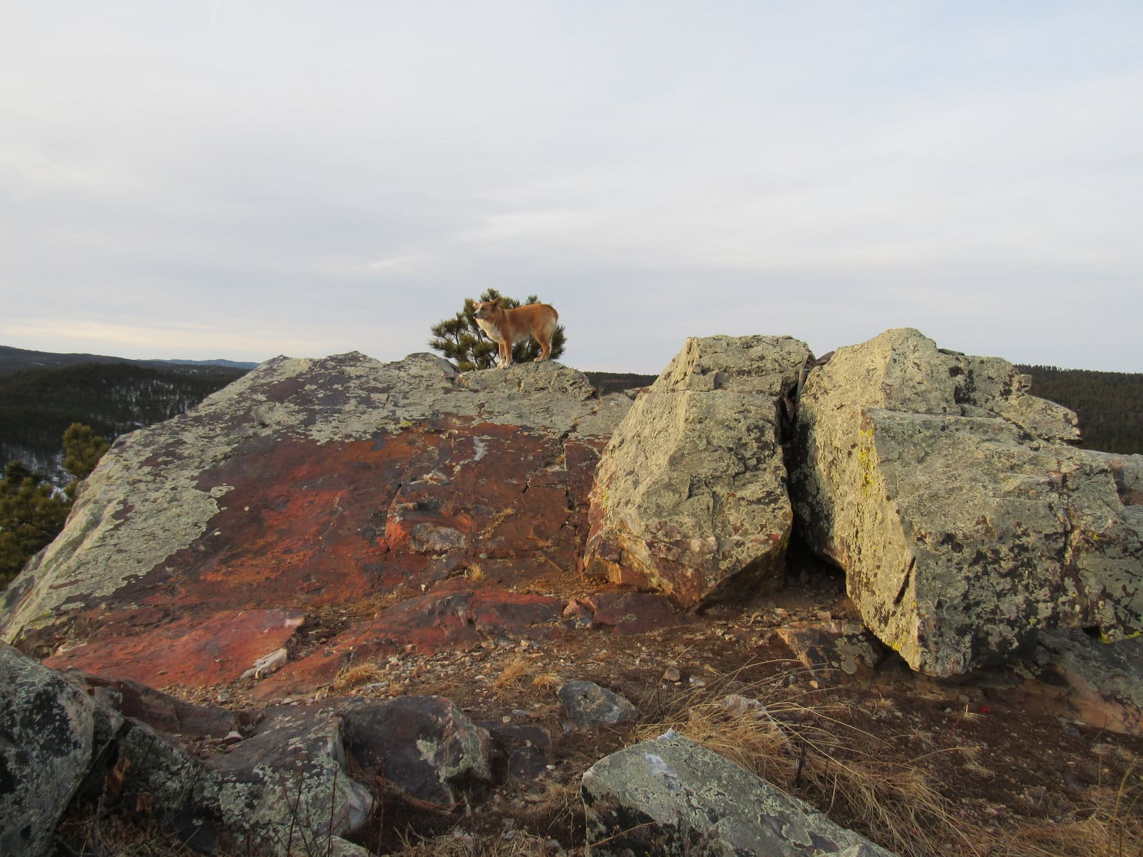
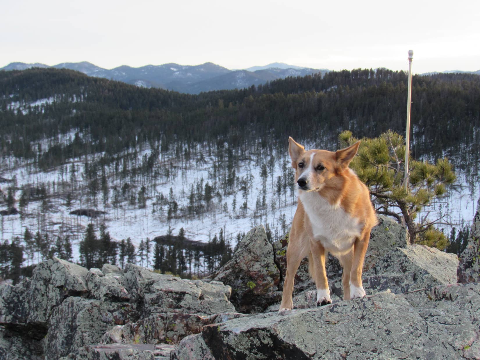
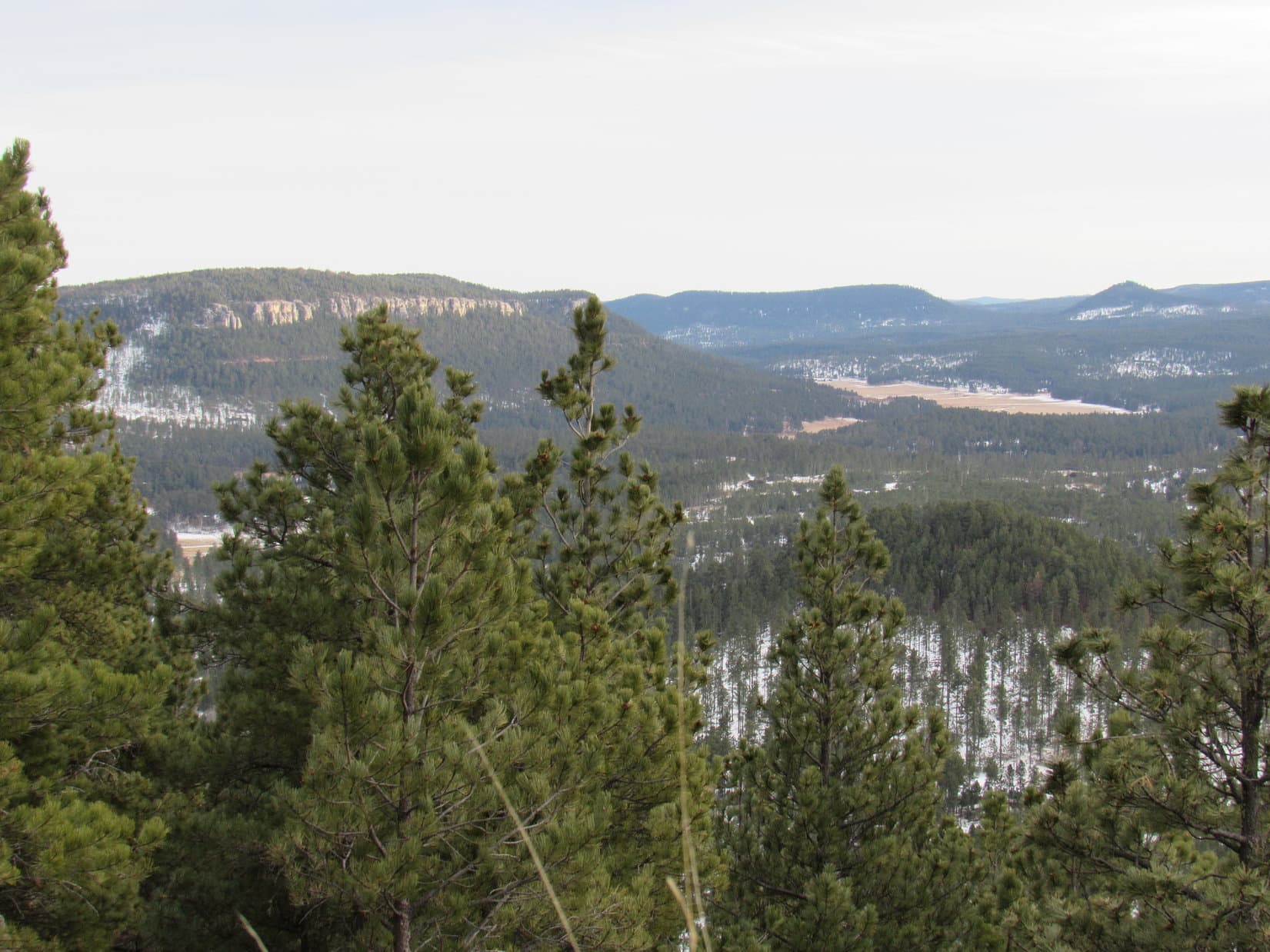
SPHP wasn’t really sure what Lupe would find up on Steamboat Rock.  A glance to the W from where Lupe came up was very encouraging.  An unbroken gentle slope rose slightly toward the W.  The ground was almost flat.  A pine forest covered the top of the mountain, with little sunlit clearings scattered here and there.  Pine needles and patches of snow covered the forest floor.

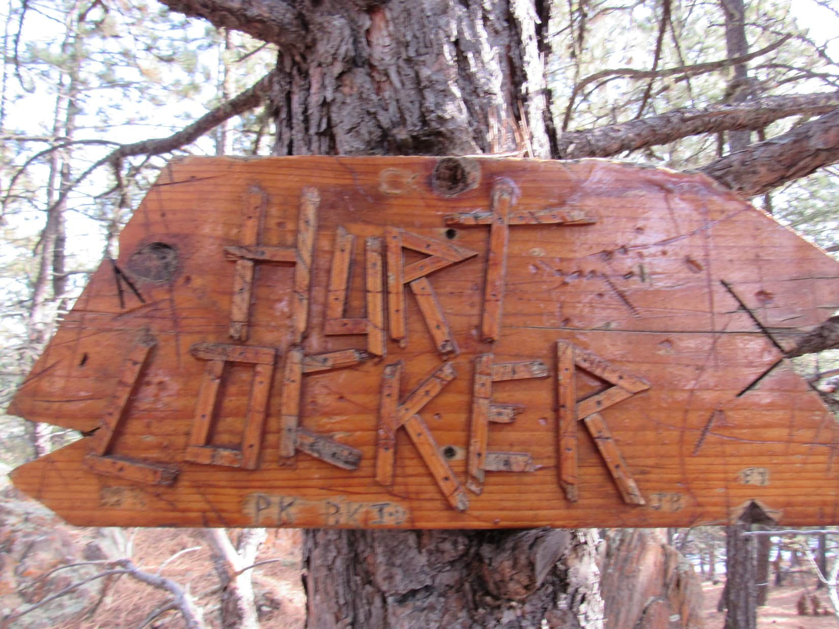
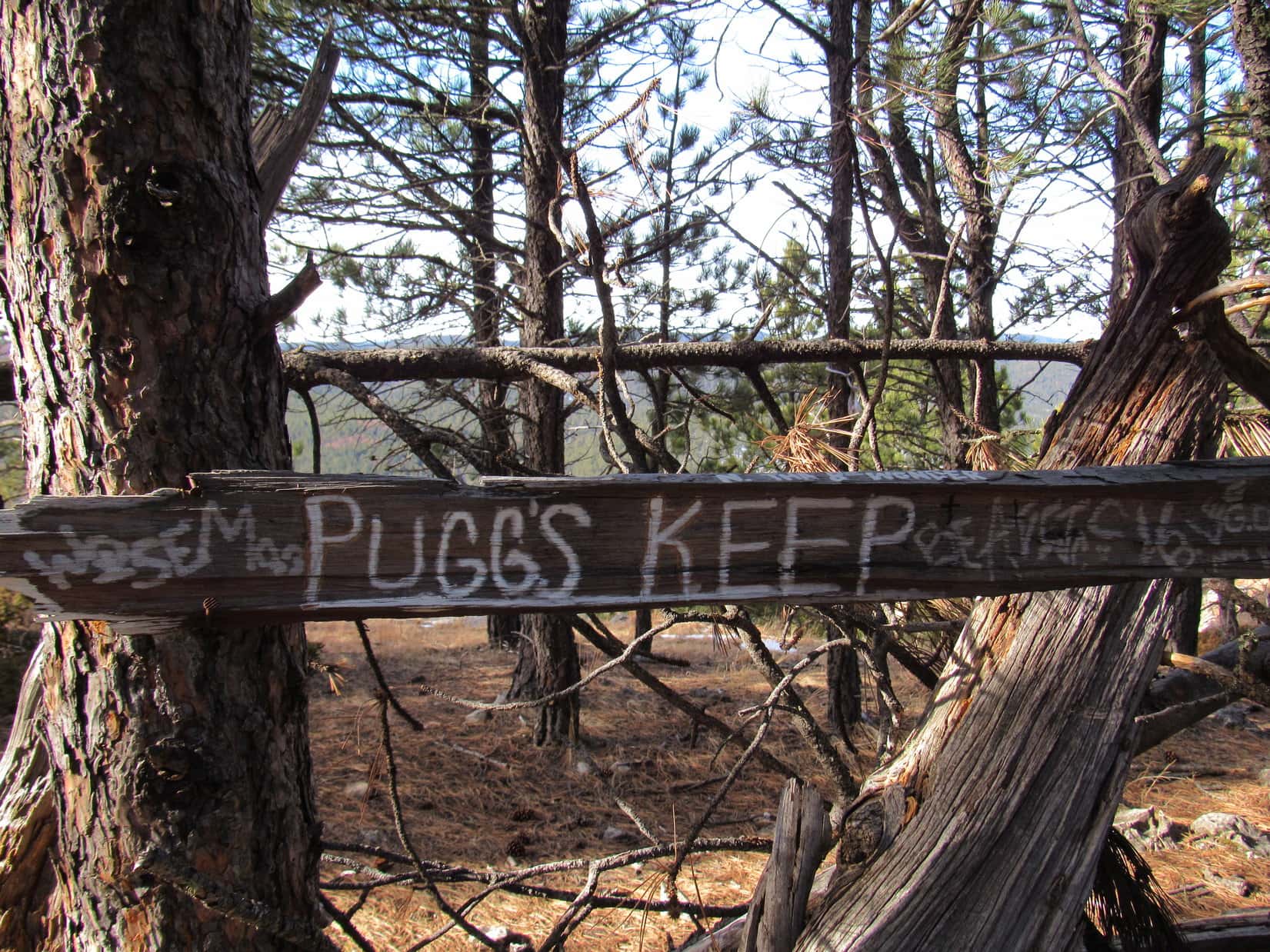
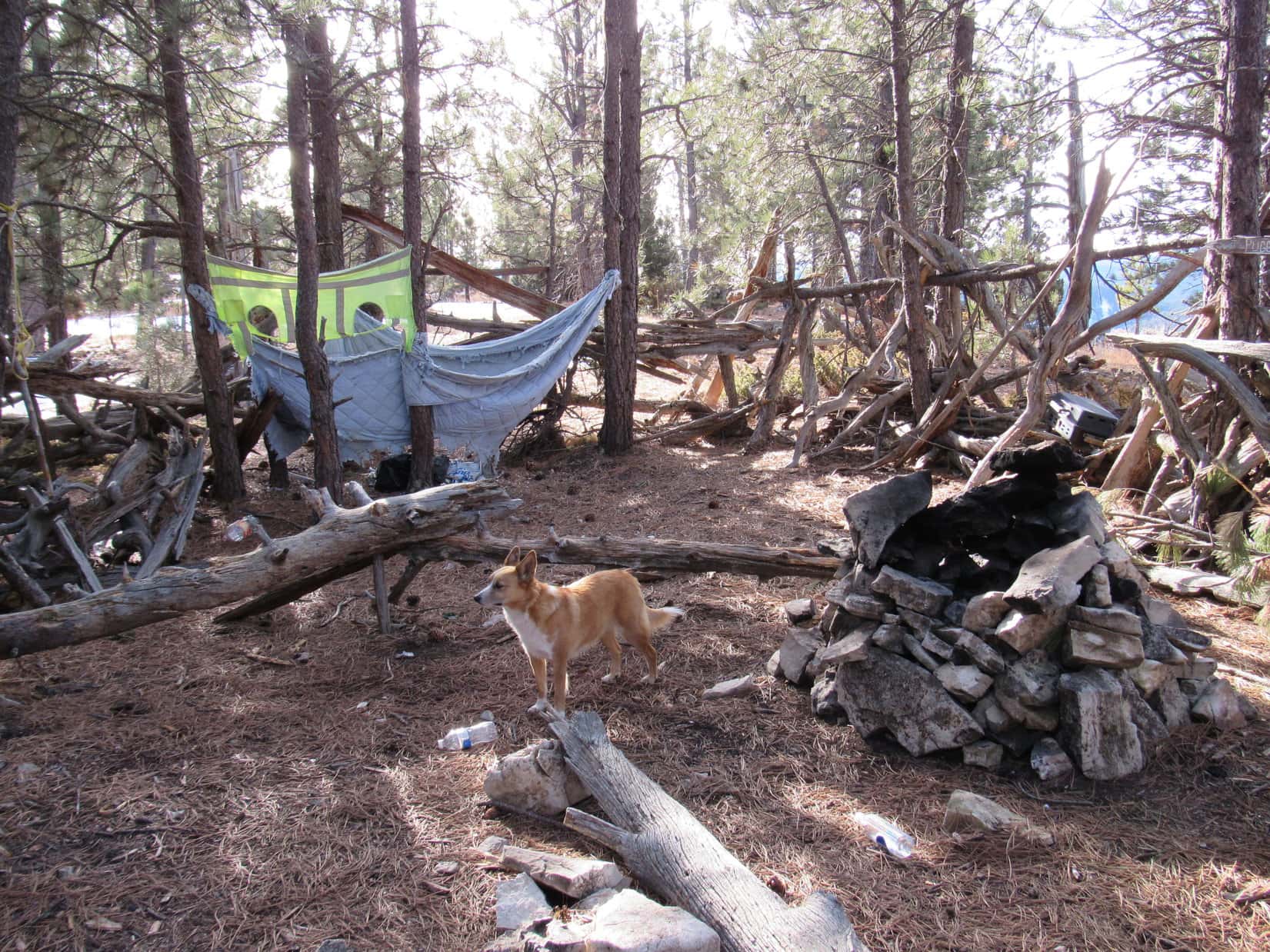
Lupe and SPHP headed W through the forest.  A few minutes later, Lupe reached a strange structure crudely built out of rough wood.  It was about 30 feet long N/S, and maybe 15 to 20 feet wide E/W.  A gap in the 4 foot high walls near the NW end of the enclosure served as the only entrance.  There was no roof.  A sign indicated Lupe had arrived at “Pugg’s Keep”.  Trash, mostly empty beer cans and water bottles, was strewn all over the place.

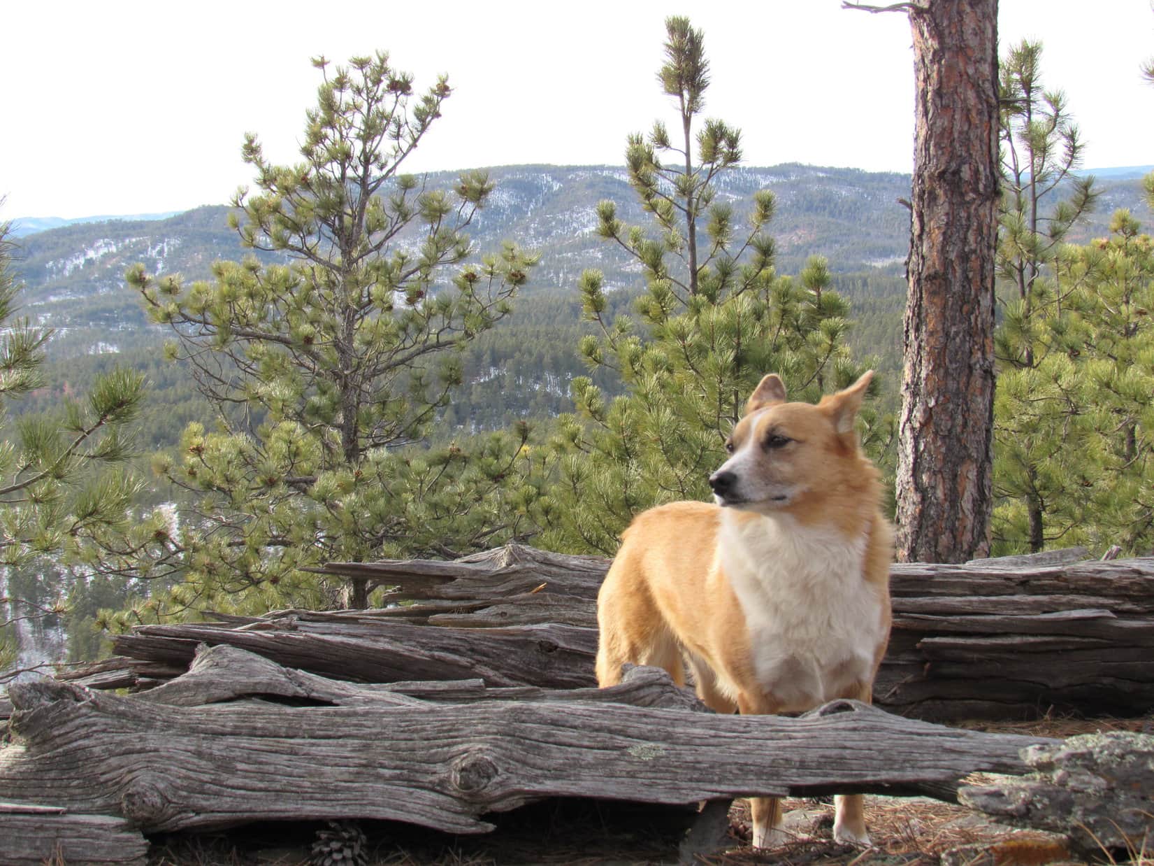
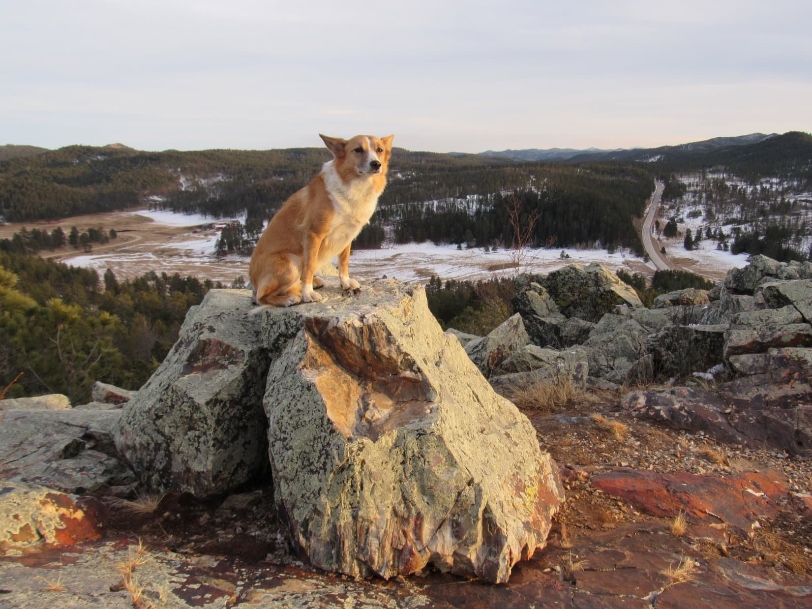
Pugg’s Keep was perched quite close to the cliffs along the W side of Steamboat Rock.  Lupe went to check out the view.  Not too surprisingly, Pugg’s Keep was pretty close to the best view from Steamboat Rock.

Lupe along the W rim of Steamboat Rock. This view to the NW was judged to be the best from anywhere on the mountain by SPHP. Boxelder Creek can be seen in the large field far below.

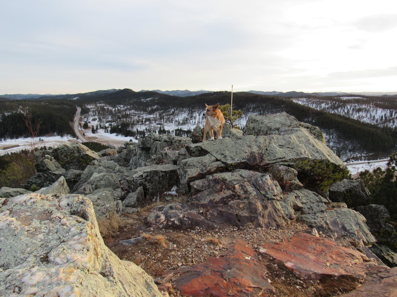
Since Steamboat Rock slopes slightly down toward the E, the true summit had to be somewhere close to the cliffs along the W edge.  Lupe and SPHP explored S along the W rim almost all the way to the S end of the mountain.

Although the top of Steamboat Rock is forested, there were plenty of spots along the W rim where there were nice views from the SW around to the NW.  The forest was thicker, and provided fewer viewpoints along the E rim.

After her explorations to the S, Lupe headed back N along the W rim.  Lupe’s investigations had revealed that the true summit was a relatively small flat area, just a little way S of Pugg’s Keep.

Near a splendid Ponderosa Pine at the true summit of Steamboat Rock. Lupe claimed her peakbagging success nearly 3 years after her first unsuccessful attempt to climb the mountain.

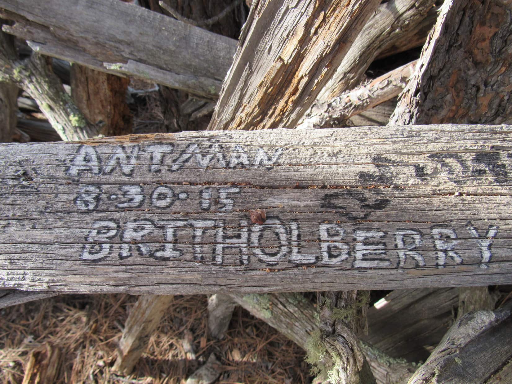
Lupe returned to Pugg’s Keep for another sniff around.  Inside the enclosure was a rather nicely constructed fireplace made of loosely assembled limestone.  On the W side were a number of boards with writing on them, including the Pugg’s Keep sign.

People had painted their names or nicknames on various pieces of wood near the Pugg’s Keep sign.  Most of the dates weren’t from that long ago, just a few months back in the late summer or fall of 2015.  “Antman” on 8-30-15, Brit Holberry, Isaiah S. Shovel 9-7-15, Alex Lewis, Coletrain 9-5-15, McPat, Jim & Susan & Brit on 10-30-15, Caleb Stanley, and Beave S. R. were just some of the names.  Apparently Steamboat Rock was not always a lonely outpost.

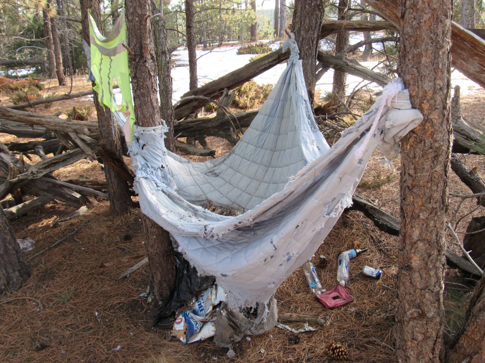
In fact, Pugg’s Keep gave the impression of a sometimes rather lively party place.  Numerous empty beer cans, half a dozen water bottles, a giant empty bottle of New Amsterdam Vodka, a few coke cans and a plastic sports drink bottle were strewn around, along with other garbage.  At the S end of Pugg’s Keep was a tattered blue-gray quilt hanging from some trees.  It looked like a dilapidated hammock.  Beneath it was a decaying black garbage bag full of more cans, bottles, and trash.

The Pugg's Keep sign on Steamboat Rock.
The Pugg’s Keep sign on Steamboat Rock.
Lupe in Pugg's Keep. Photo looks S.
Lupe in Pugg’s Keep. Photo looks S.
Are "Antman" and Brit Holberry one and the same? Who knew?
Are “Antman” and Brit Holberry one and the same? Who knew?
The lovely Pugg's Keep hammock on Steamboat Rock. Sheesh, people!
The lovely Pugg’s Keep hammock on Steamboat Rock. Sheesh, people!

There were more fine furnishings at Pugg’s Keep, too.  An old portable grill just starting to rust was nestled in the W wall.  A couple of short ropes hung from a tree.  An assortment of pens was bungee corded to a tree.  Nearby, a First Aid kit was fastened to another tree.  Someone had written a crude message on the First Aid kit case implying that anyone who actually needed to use it was weak and worthy of despise.

Clearly the word “Keep” in Pugg’s Keep was used in the sense of a fortress.  The top of Steamboat Rock, nearly completely surrounded by cliffs, pretty effectively suited that meaning of the word.  “Keep” certainly didn’t have anything to do with housekeeping.  Pugg didn’t know diddly about housekeeping.

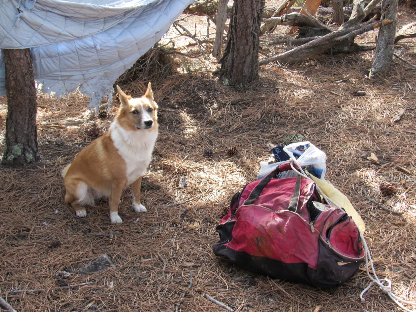
SPHP had 4 good plastic Safeway or Wal-Mart sacks.  While Lupe sniffed around, SPHP started filling them with trash.  An old red tote bag under the hammock was in good enough shape to carry some junk in, too.  SPHP collected close to 3 dozen beer cans, the giant Vodka bottle, at least half a dozen water bottles, and other assorted trash, stuffing it all into plastic bags or the old red tote bag.  One of the ropes hanging from a tree was used to tie together whatever wouldn’t go into SPHP’s backpack.

When the sacks and tote bag were full, there wasn’t much trash left around.  The hideous hammock was still there, the First Aid kit and pens, plus the old grill, but almost everything else was packed up ready to go.  Which way to go, though?  With so much junk to carry out, SPHP was now interested in getting it all back to the G6 as expeditiously as possible.

Lupe and SPHP left Pugg’s Keep to go check out the N end of Steamboat Rock.  Lupe hadn’t been there yet.  Maybe there was an easier way down?

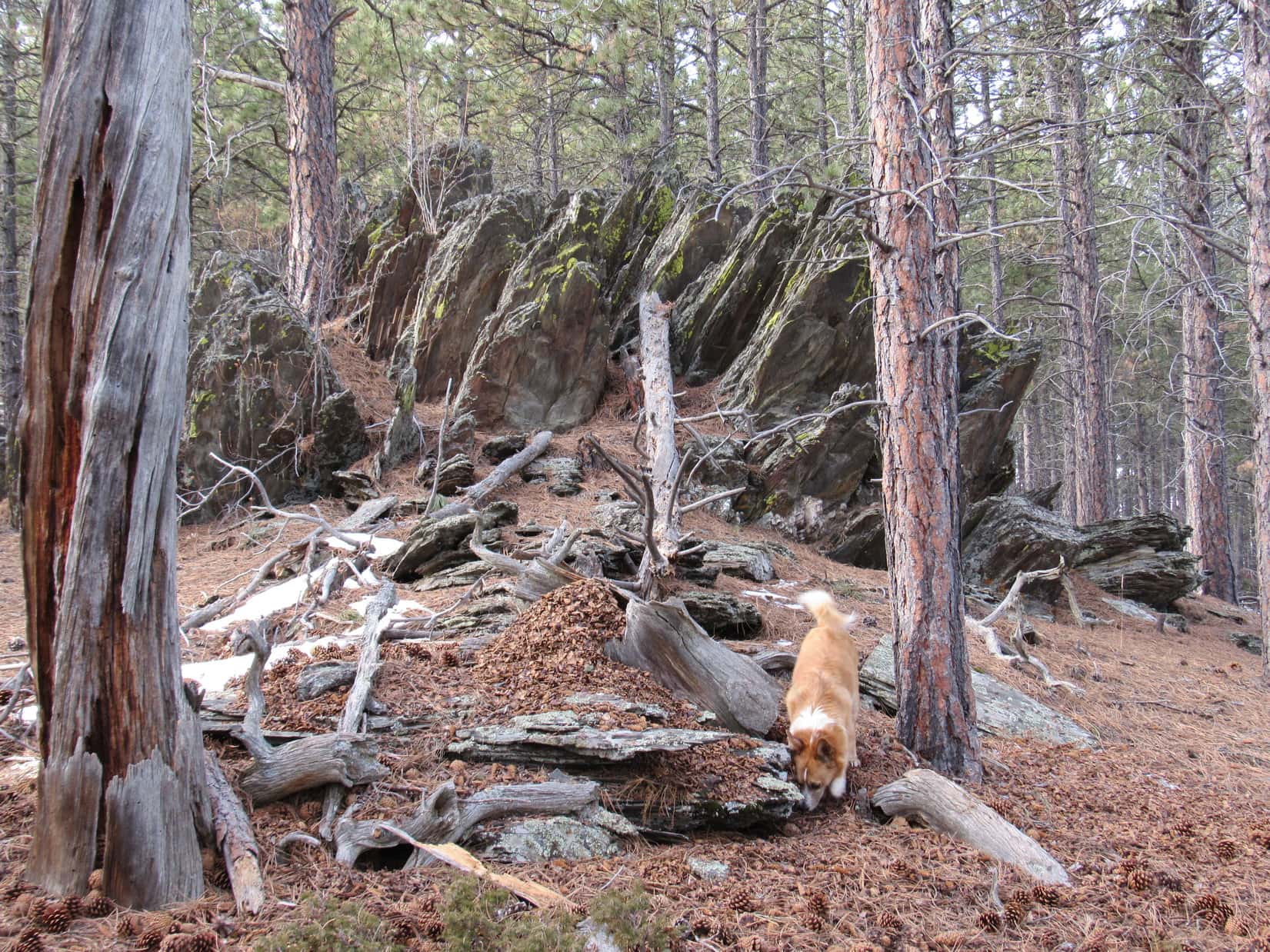
The N end of the mountain turned out to be narrower and rockier than any other part.  The terrain was more broken up.  There were a couple of significant breaks in the cliff line where it might be possible to go down to the W, but it was hard to know for sure without actually going down and scouting out the possibilities.

Lupe on her explorations toward the N end of Steamboat Rock.

Lupe toward the N end of Steamboat Rock, 1-23-16The very N end of Steamboat Rock was a narrow, discontinuous line of stone.  SPHP concluded it was probably best for Lupe to just leave Steamboat Rock the same way she had come up.  Before leaving, Lupe and SPHP returned one more time to Pugg’s Keep to retrieve SPHP’s backpack, and the big bundle of Lupe Treasures destined for recycling or the garbage truck.

Lupe back at Pugg's Keep near the big bundle of Lupe Treasures. This was one of Lupe's biggest single hauls, ever!
Lupe back at Pugg’s Keep near the big bundle of Lupe Treasures. This was one of Lupe’s biggest single hauls, ever!

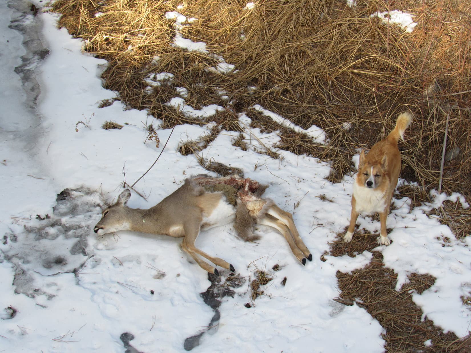
Carting the bundle of Lupe Treasures down off Steamboat Rock didn’t do anything to enhance SPHP’s speed or agility, but the trip back down the steep E slopes of the mountain wasn’t as bad as SPHP expected.  Lupe certainly had plenty of time to sniff around!  A few times she found squirrels in the trees, providing happy moments of enthusiastic barking.

Lupe’s route going down below the upper band of cliffs on the E side of Steamboat Rock. Photo looks S.

Instead of carrying everything all the way back to the G6, SPHP left the Lupe Treasures by the side of USFS Road No. 147.  Lupe and SPHP returned with the car to stuff it all in the trunk.  There were even a few more Lupe Treasures to gather up alongside No. 147 to add to the collection.  The more the merrier, in a way, although it made SPHP pretty disgusted with the human race.  Well, not all of it, but a significant alcohol-soaked part of it for sure.

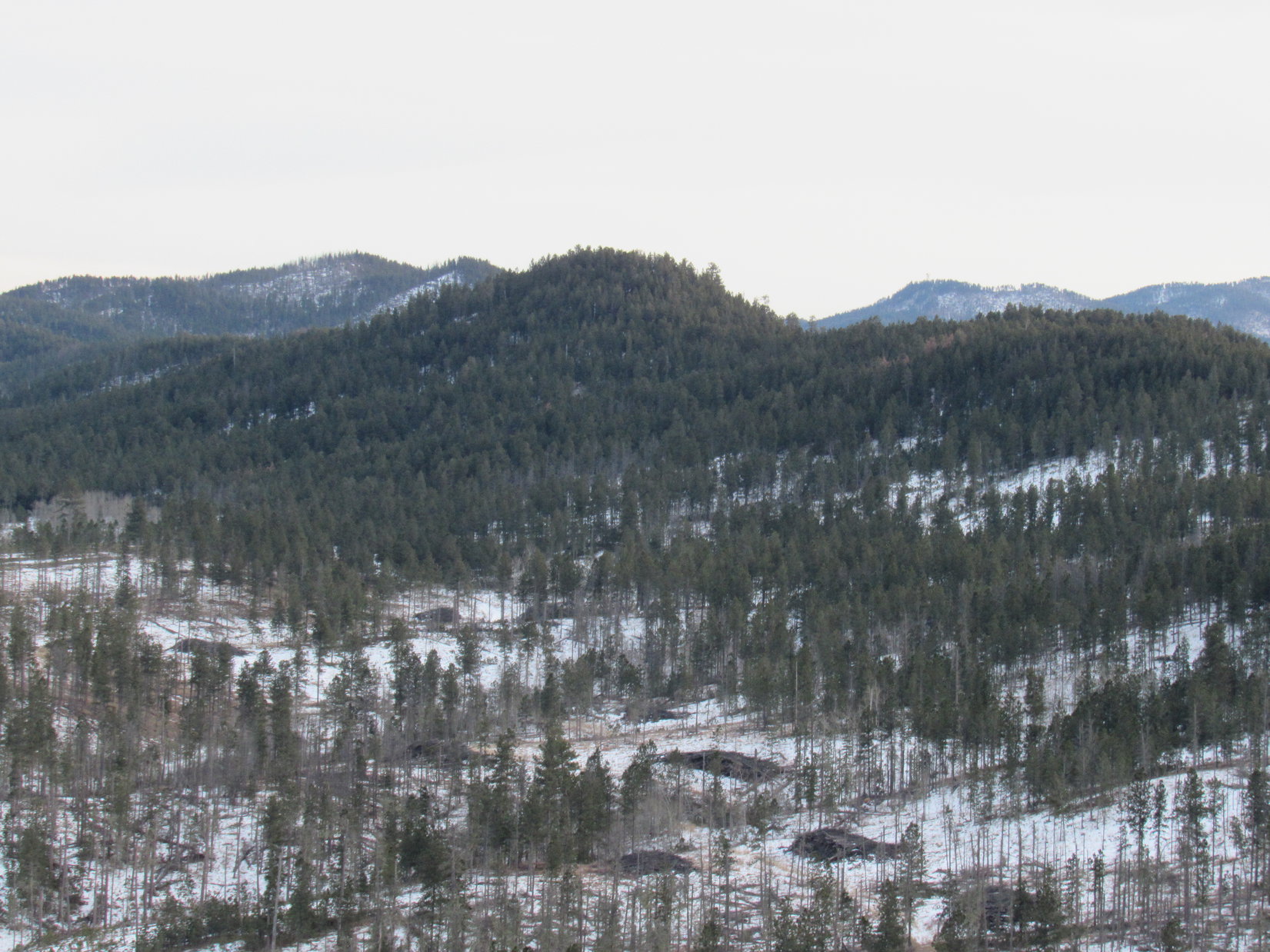
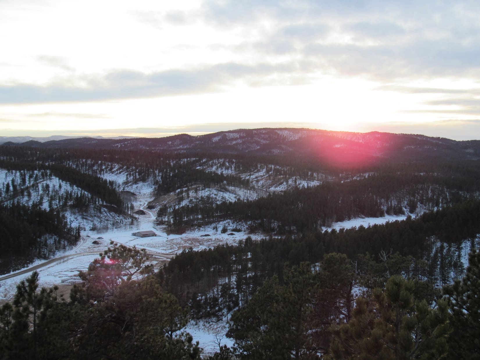
For no farther than it had been to Steamboat Rock, it had sure seemed to take a long time get there and explore it all.  Lupe and SPHP had reached the G6 again at 1:31 PM (55°F!).  There was still time to do something else on Black Hills, SD Expedition No. 153, but not as much time as SPHP had expected.  Before leaving the Steamboat Rock area, Lupe and SPHP drove N along USFS Road No. 147 a half mile or more for a parting view from another perspective.

Steamboat Rock from the SE along USFS Road No. 147.
The high cliffs at the SE end of Steamboat Rock. (Taken with the telephoto lens.)

After a couple photos of Steamboat Rock from the SE, Lupe and SPHP returned to Nemo Road and headed NW toward Nemo.  Lupe stopped again along the highway for a look back at Steamboat Rock from the W.

Steamboat Rock from the W along Nemo Road.

Steamboat Rock from the W along Nemo Road, 1-23-16Lupe and SPHP continued driving NW to Nemo and beyond.  SPHP actually had another couple of peakbagging goals in mind for Lupe, although it was looking like there was probably only time enough for one of them now.  SPHP wound up wasting more time looking for the best starting point, but eventually (2:26 PM, 51°F) parked the G6 near the start of USFS Road No. 414.6K just N of Nemo Road, about 2 miles N of Nemo.

No. 414.6K was snowy and partially snow-packed by vehicle tracks.  It headed N for about a mile toward Lupe’s next two possible peakbagging goals, Green Top (5,360 ft.) and White Mansion (5,340 ft.).  Just S of Green Top, No. 414.6K came to an intersection.  By now SPHP had decided Lupe should go for Green Top instead of White Mansion.

Lupe and SPHP turned W (L) at the intersection.  A sign said Lupe was still on USFS Road No. 414.6K.  No. 414.6K gradually curved to the NW slowly gaining elevation as it proceeded up Green Draw.  There were no vehicle tracks at all in the snow here, just a few animal tracks.  Lupe liked this part of the woods.  She was hearing things in the forest.  Lupe sprinted off in various directions, racing back again every few minutes to check on SPHP’s progress.

Lupe races back along USFS Road No. 414.6K looking for SPHP. This quiet, private section of road W of Green Top seemed remote and beautiful on a winter afternoon.

Somewhere W of Green Top, Lupe and SPHP left No. 414.6K to start climbing NE through the forest.  There were big boulders and occasional rock outcroppings along the way.  The same geological rock formations present at Steamboat Rock were also present here.  It was quite possible Lupe would have to find a way up over two bands of cliffs again to reach the summit of Green Top.  It wasn’t at all certain Lupe would find a route to the top.

Lupe’s final approach up Green Top was from the NW.  Fortunately, the rock outcroppings did not form continuous cliffs along in here.  Lupe had no problem going up the mountain, but it was impossible to see how much farther Lupe had to go.  Green Top was thickly forested.  The young trees were tall, thin and densely packed.

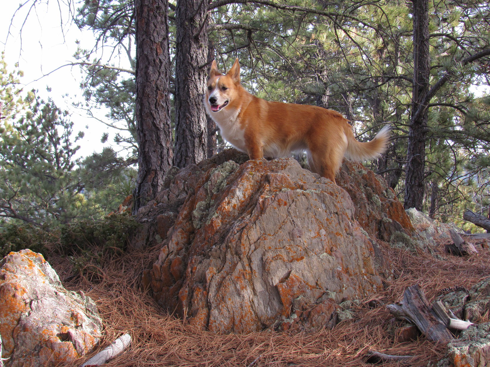
Unlike Steamboat Rock, there wasn’t much left of the original limestone cap up at the top of Green Top Mountain.  A narrow ridge ran NW/SE.  A rocky little scramble up a short slope brought Lupe to the NW end of the summit ridge.

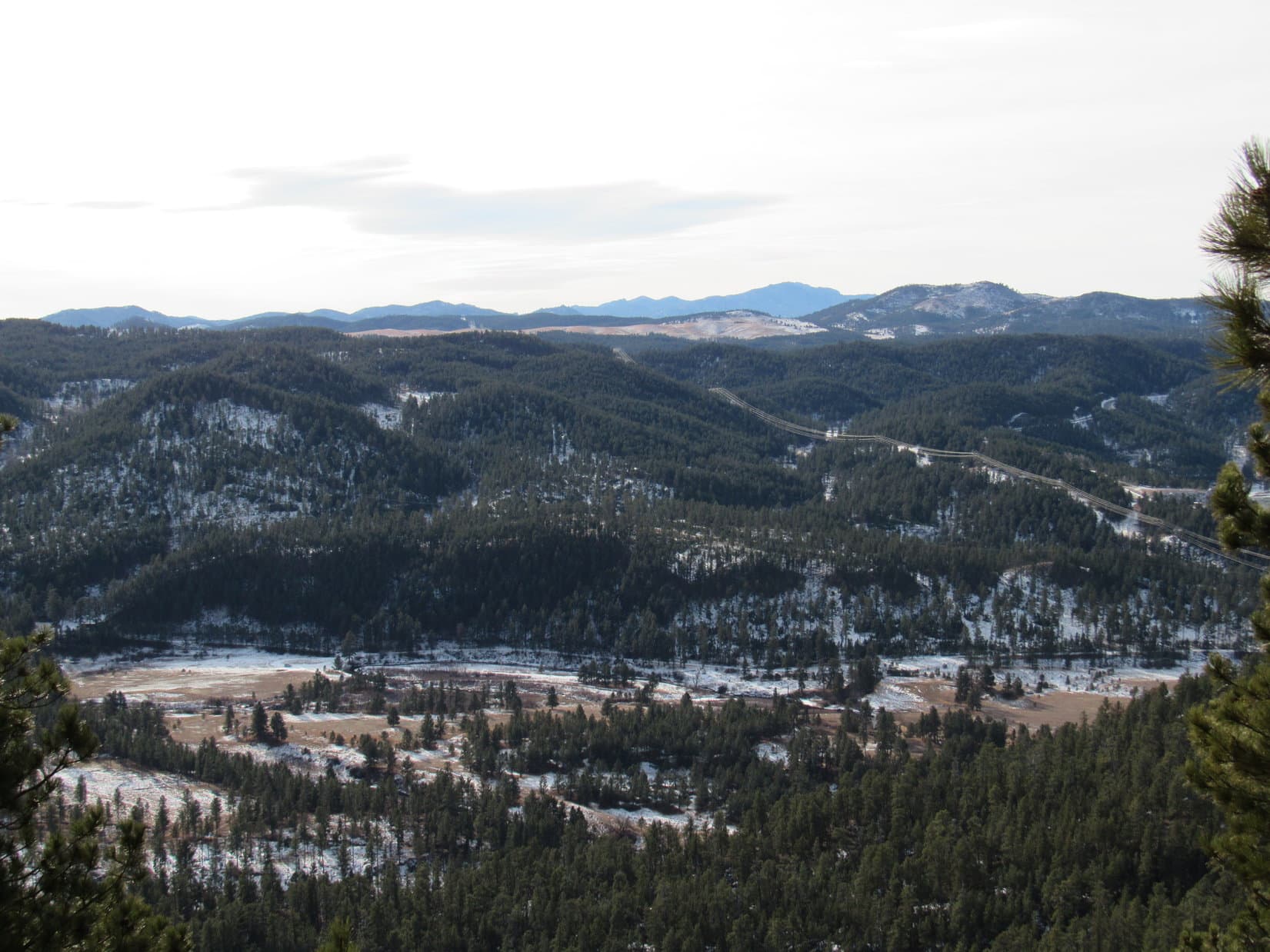
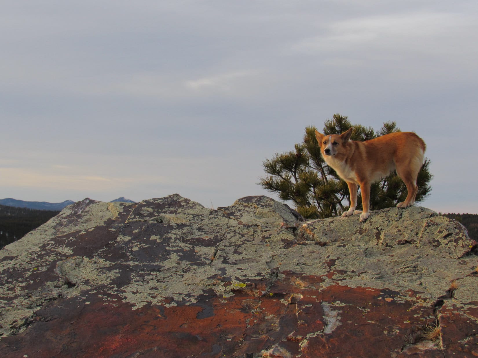
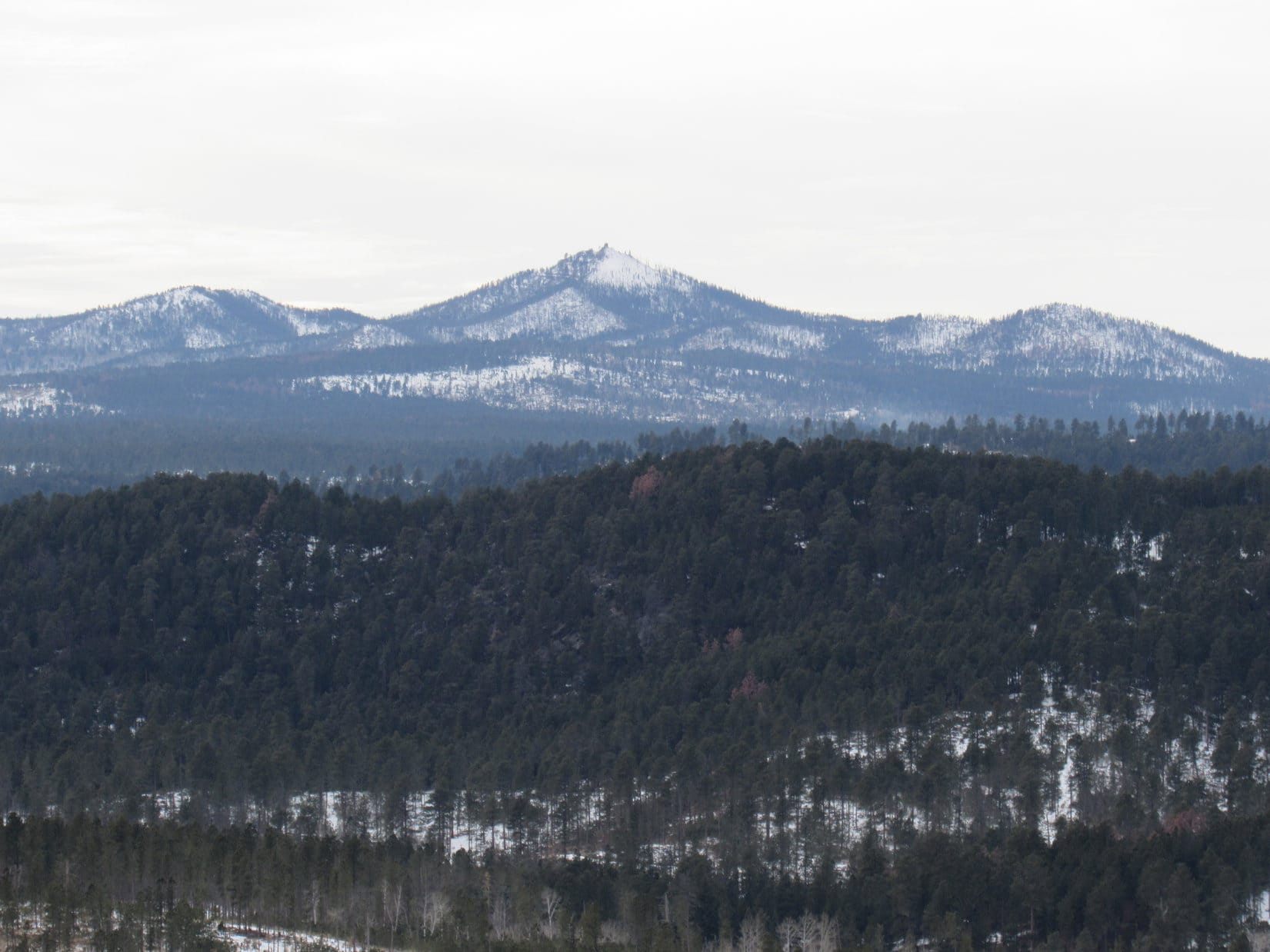
The views were really great!  Snowy Custer Peak (6,804 ft.) off to the WNW was the feature attraction, but Terry Peak (7,064 ft.) and a wide swath of the central Black Hills was all on display, too.

The remnant rocks of the limestone cap at the NW end of the summit ridge on Green Top. Photo looks S.
Lupe up on the NW end of the Green Top summit ridge. Photo looks WNW toward Custer Peak. Terry Peak is also visible toward the R.
Custer Peak from Green Top using the telephoto lens.
Lupe still at the NW end of the Green Top summit ridge. Photo looks S.

Looking SE along the summit ridge, it appeared likely that Lupe wasn’t quite at the true summit of Green Top yet.  The broken ridge was mostly hidden by forest.  It still wasn’t clear if Lupe would succeed in reaching the actual summit.

Looking SE along the summit ridge of Green Top. It looked like there was higher ground in that direction, but the ridge was rather broken up. Would Lupe be able to reach the true summit?

Lupe and SPHP worked their way SE along the ridge, staying on the NE side.  To the SW were cliffs – not high cliffs, but still cliffs.  It wasn’t far to a platform of rock slightly higher than the rest of the ridge.  Fortunately, there was a way to climb up on top with little trouble or risk.  This platform was the true summit of Green Top!  Lupe had arrived!

Lupe on the true summit of Green Top. White Mansion is the line of limestone cliffs seen to the NE.

The entire slightly elevated summit area was only the size of a large room in a house.  The best views were from the SSE around to the SW.  By now it was maybe just 45 minutes until sunset.  Green Top was going to be Lupe’s last peakbagging success of Expedition No. 153.

Lupe and SPHP sat together enjoying the view.  SPHP petted and talked to Lupe.  It was all very deep and profound stuff.  Lupe listened carefully.  She understood it all.  In fact, she already knew it.  SPHP ate an orange.  Lupe wasn’t hungry, even though she hadn’t eaten all day.

The time to go always comes too quickly.  Lupe and SPHP left the summit of Green Top, returning to the NW end of the ridge.  There, after one last look toward Custer Peak, Lupe and SPHP started down the mountain.  This time Lupe stayed farther E than she had been coming up.  She lost plenty of elevation going down through the thick forest of spindly pines.  She passed by lots of purple-gray boulders and rock outcroppings.

The rocks and dense forest ended as Lupe approached the saddle NW of Green Top.   From the saddle, Lupe and SPHP headed ENE through a snowy field of tall grass and widely scattered pines to reach USFS Road No. 155.1A.  To the NW, No. 155.1A went up Wilson Gulch, but Lupe and SPHP followed the road S between Green Top and White Mansion.

Cows were mooing at a very secluded ranch NW of White Mansion.  No. 155.1A was very snowy.  There were deep ruts in the snow where some jeep or high clearance vehicle had spun its way through.  E of Green Top, Lupe and SPHP didn’t see the sunset.  The temperature dropped as SPHP trudged S through the snow.  Two big, erect American Dingo ears, and an arching curly tail led the way.

The cows left behind, the only sound was the soft crunch of Dingo paws on the now hardening snow.  Before Lupe reached the intersection with USFS Road No. 414.6K, she heard them.  It was that moment of twilight when the branches of the trees are an impenetrable black against the palest blue sky.  The wild dogs of the forest, the coyotes, were howling.

For just a few minutes, the coyotes howled to one another.  For just a few minutes, Lupe listened attentively to the call of the wild.  Then she and SPHP crunched on in silence along the snowy road (5:23 PM, 35°).

Looking SSE from Green Top. The big field Lupe had seen from Steamboat Rock is visible on the R. Beyond the field, also on the R is Green Mountain (5,240 ft.).
Looking SSE from Green Top. The big field Lupe had seen from Steamboat Rock is visible on the R. Beyond the field, also on the R, is Green Mountain (5,240 ft.).

Links:

Next Black Hills Expedition                    Prior Black Hills Expedition

Want more Lupe adventures?  Choose from Lupe’s Black Hills Expeditions Adventure Index or Master Adventure Index.  Or subscribe free to new Lupe adventures!

Black Hills, SD Expedition No. 152 – Perrin Mountain, Merritt Peak & Pilot Knob (1-13-16)

A forecast high near 50°F in the Black Hills was only supposed to last one day before colder temperatures returned.  Lupe and SPHP were going to make good use of the opportunity.  Lupe realized what was up.  She followed SPHP around impatiently, urging action at the soonest possible moment.  Lupe couldn’t wait for her next Black Hills, SD Expedition to begin!

At 8:47 AM (35°F), SPHP parked the G6 just off Hwy 44W about 1/8 mile SE of USFS Road No. 167 (the road to Placerville Camp).  Lupe and SPHP marched along a fence line outside of a big open field to get to No. 167.  When Lupe reached the road, she made a sad discovery.

A small deer was laying dead and frozen on the ice over Deer Creek.  Its hind quarters were badly damaged.  Perhaps the poor deer had been hit by a car on Hwy 44, and had managed to drag itself only this far before succumbing to the traumatic injury.

Lupe ready to start Black Hills, SD Expedition No. 152. She would climb the hill in the background on the way to Perrin Mountain. This hill was the first of two high points she reached along the way. Photo looks SW.
Lupe found this poor frozen dead deer laying on iced-over Deer Creek.

Lupe’s first peakbagging goal of the day was Perrin Mountain (5,212 ft.).  Although SPHP originally had another route in mind, it looked pretty easy and enticing to just start up the N ridge.

Lupe on the N ridge on her way to Perrin Mountain. Here she is about to climb up to the first of two high points along the way. Photo looks S.

There were a couple of high points along the easiest route up to Perrin Mountain from the N.  The topo map showed a NW/SE running ridge at the first one, with the highest point at the NW end.  When Lupe got up there, it looked like just another spot in the forest.  There were a few rocks about a foot high around, but that was about it.

Peering SE through the forest, though, it looked like there might be something more interesting over there.  Lupe and SPHP followed the short ridge to its SE end, where there was a large blocky rock formation.  In fact, the rock formation at the SE end of the ridge is almost certainly a little higher than the map’s supposed highest point to the NW.  Lupe and SPHP explored around to the SE end of the rocks, by going around the N side.

Lupe reaches the interesting rock formation at the SE end of the ridge at the first high point on her way to Perrin Mountain. Photo looks E.
Lupe at the SE end of the first high point ridge. Photo looks S at Perrin Mountain, her first peakbagging goal of the day.

The second high point on the way to Perrin Mountain was about 0.25 mile SW of the first one.  There were some interesting rock formations on the way to the second high point, but nothing too spectacular at the top.

Lupe at the top of the second high point on the way to Perrin Mountain. The rocks here weren’t nearly as impressive as at the SE end of the ridge at the first high point.

Lupe went a little farther SW from the second high point, losing some elevation.  Shortly after she started climbing up to the main Perrin Mountain ridge, she came to a snowy little road.  It headed SE toward the summit, but didn’t go all the way there.  At the end of the road, Lupe and SPHP were surprised to see a Subaru.  Someone was inside it, too.  Whoever it was, had car camped overnight.

That really was pretty extraordinary.  In all of Lupe’s Black Hills, SD Expeditions, this was the first time she had come to anyone camped anywhere outside of a designated campground in the national forest.  Since the person didn’t seem to be entirely up yet, Lupe and SPHP didn’t stop to chat, even though it would have been interesting to know more about the hardy soul who chose to car camp in January.

SPHP was surprised when Lupe found a trail leading from the end of the road to the top of Perrin Mountain.  The faint trail looked like it didn’t get much use these days, but wasn’t hard to follow.  The trail went all the way up to the summit.  Actually, it went to a sign nailed to a tree just SE of the summit.  The sign had the cryptic message “Hurt Locker”.  If Lupe knew what the sign meant, she wasn’t saying.  SPHP could divine no relevant meaning, since there was no locker of any sort in sight.

Hurt Locker? Would have made more sense if a locker had been evident somewhere, but Lupe and SPHP found none.

The summit of Perrin Mountain was maybe 25 feet NW of the odd Hurt Locker sign.  There were a few rocks a couple of feet high there, but nothing more dramatic than that.  The forest blocked the view in every direction.

Lupe on the summit of Perrin Mountain.

Perrin Mountain is less than a mile NE of Pactola Reservoir, the largest lake in the Black Hills.  It was rather disappointing that there weren’t any clear views of the reservoir from the summit, or on the way to it.  However, the trail continued SE on past the Hurt Locker sign.  Although it was losing elevation along the way, maybe there would be a viewpoint from somewhere in that direction?

Lupe and SPHP followed the trail all the way down to where it ended, which wasn’t far from the summit.  There were a couple of viewpoints along the trail, not wide open views, but better than anywhere else Lupe had found on Perrin Mountain.  To the S, it was possible to see the large flat meadow Rapid Creek flows through E of the dam.  To the SW, there was one spot with a pretty good look at part of Pactola Reservoir and the dam.

Looking S from the SE end of Perrin Mountain. The large flat meadow where Rapid Creek flows below the dam is seen below.
Pactola Reservoir and dam from the SE end of Perrin Mountain. Photo looks SW.

Lupe and SPHP climbed back up the trail heading NW to return to the summit.  Lupe posed for another photo there, before starting on the way back to the G6.

On Perrin Mountain. The rocks on the R are the true summit. Photo looks NW.

There were other routes Lupe could have taken back to the G6, but the way Lupe had come up Perrin Mountain had been pretty cool.  It was a nice, easy bit of wandering in the forest on ridges and saddles between high points.  SPHP thought it might be fun to chat with the Subaru person on the way back, but by the time Lupe and SPHP got back to the little road, the Subaru was gone.

Lupe returned to both of the high points N of Perrin Mountain on her return to the G6.  The only memorable event of the return trip was when she spotted a squirrel on her way from the second high point back to the first.  The squirrel eluded her near an interesting rock outcropping, but Lupe didn’t give up easily.  She sniffed around there for a while trying to figure out where that squirrel had disappeared to.  SPHP finally made her move on before she had time to resolve the mystery.

Lupe returned to both of the high points N of Perrin Mountain. Here she is back at the 2nd one (actually the closest to Perrin Mountain).
Lupe searches for the tricksy squirrel.

By 12:01 PM (50°F), Lupe was back at the G6.  There were a number of Lupe treasures scattered around, so SPHP picked most of them up for disposal later.  With this much time left in the day, Lupe had at least one more peakbagging goal ahead of her.  First though, Lupe and SPHP went to see if it would be possible to get a photo of Perrin Mountain from Pactola Reservoir.

SPHP parked the G6 at the viewpoint at the N end of the dam near the spillway.  The view of Perrin Mountain from near the spillway was none too impressive.  It was a good thing Lupe went there, though.  The place was kind of a mess.  There were Lupe treasures all over the place.  SPHP filled 5 plastic grocery bags full of them.

Lupe near Pactola Reservoir. Photo looks W.
Mighty Perrin Mountain towers over the surrounding country NE of the Pactola Reservoir spillway. Well, maybe "towers" isn't the word. At least this photo shows why it wasn't very easy to get a clear shot of Pactola from Perrin Mountain.
Mighty Perrin Mountain towers over the surrounding country NE of the Pactola Reservoir spillway. Well, maybe “towers” isn’t the word. At least this photo shows why it wasn’t very easy to get a clear shot of Pactola from Perrin Mountain.

When SPHP was done collecting Lupe treasures at Pactola, Lupe and SPHP drove N on Hwy 385.  SPHP turned W on Broad Gulch Road (USFS Road No. 676) about 0.5 mile S of the Sugar Shack.  There was a place to park the G6 on the left, right after crossing a cattle guard close to Hwy 385.

At 12:53 PM (50°F), Lupe set out on her second peakbagging quest of the day.  Her new goal was Merritt Peak (5,556 ft.).  The first part of the journey was just a walk up snowy Broad Gulch Road.  Lupe followed the road until it reached its highest point at a saddle.

On Broad Gulch Road.

Lupe and SPHP left Broad Gulch Road at the saddle, heading E into the forest.  Surprisingly, there was a trail going this way, too.  The trail went to the N end of the long ridge of which Merritt Peak is a part.  It then turned and followed the ridge line S.  Lupe and SPHP stayed on the trail all the way to Merritt Peak.  The trail didn’t go quite all the way up to the top, instead passing just to the E of the summit.

The trail appeared to continue on to the S, but Lupe and SPHP left it to climb the remaining short distance up to the top of Merritt Peak.  The summit proved to be a ridge a few hundred feet long, and quite flat.  There were small rock outcroppings scattered along the ridge.  It was hard to tell which rock might be the highest point on the mountain.  There were lots of possible candidates, none much higher than any of the others.

Merritt Peak was pretty heavily forested, but here and there it was possible to get a little bit of a view off into the distance in one direction or another.  Enough could be seen between the trees so that it did seem like Lupe was up on a mountain, and not just in a thick forest.  Lupe and SPHP came up near the S end of the ridge, so Lupe explored that end of the mountain first.

A glimpse to the SW from the S end of Merritt Peak.
Lupe at one of the highest points near the S end of Merritt Peak. Photo looks NNW along the ridge.
Buck Mountain (5,553 ft.), where Lupe had gone on Expedition No. 151 on 1-5-16, from Merritt Peak. Buck Mountain is about 4 miles E of Merritt Peak. (With help from the telephoto lens.)
Buck Mountain (5,553 ft.), where Lupe had gone on Expedition No. 151 on 1-5-16, from Merritt Peak. Buck Mountain is about 4 miles E of Merritt Peak. (Taken with help from the telephoto lens.)

The N end of Merritt Peak was a bit rockier than the S end.  Custer Peak (6,804 ft.) could be seen in the distance to the NNW.  Minnesota Ridge was off to the NW.  It was time to take a short break.  Lupe was hearing gunfire off to the N, and was getting a little scared.  She was hungry, too.  She ate some Taste of the Wild.  Whenever she heard the guns, though, she wanted to be right next to SPHP.

SPHP shared a jacket with Lupe.  She was trembling a little bit, probably due to the gunfire, but the light N breeze was a bit cool, too.

Lupe at the N end of Merritt Peak. This might have been the highest point on the mountain. It was hard to tell for sure.
Lupe had some Taste of the Wild at the N end of the Merritt Peak summit ridge.
Looking NW toward Minnesota Ridge.

Lupe had now achieved two peakbagging goals so far on Expedition No. 152.  Both Perrin Mountain and Merritt Peak had turned out to be pretty fun, easy peaks.  Originally, SPHP had a third possible peakbagging goal in mind for Lupe, but it was probably too late in the day to attempt that one.

However, there was another mountain pretty close by that Lupe might still have time to climb.  Pilot Knob (5,440 ft.) was less than 3 miles N of Merritt Peak.  SPHP knew the top of Pilot Knob was pretty rocky looking, maybe Lupe wouldn’t be able to climb it at all?  In any case, there was enough daylight left to find out.  Lupe would make an attempt on Pilot Knob.

After the break up on Merritt Peak, Lupe and SPHP went back down to the trail and headed N.  Lupe didn’t turn W to go back to Broad Gulch Road when the trail did.  Instead she continued N through the forest.  Eventually she wound up down on Broad Gulch Road again, anyway.  When she reached the G6, it was 2:43 PM (50°F).

On her way to the Pilot Knob trailhead of Centennial Trail No. 89, Lupe stopped by for a photo op at the Sugar Shack.

Lupe dropped by the Sugar Shack along Hwy 385. The Sugar Shack is a popular spot known for great hamburgers. Lupe would have loved to go in for a burger, but no doubt the health department wouldn't have approved. Health departments just don't understand that American Dingoes are way healthier than most people. The Sugar Shack business is currently for sale, so the future is a bit uncertain.
Lupe dropped by the Sugar Shack along Hwy 385. The Sugar Shack is a popular spot known for great hamburgers. Lupe would have loved to go in for a burger, but no doubt the health department wouldn’t have approved. Health departments just don’t understand that American Dingoes are way healthier than most people. The Sugar Shack business is currently for sale, so the future is a bit uncertain.

Despite having a Pilot Knob trailhead, Centennial Trail No. 89 does not actually go to Pilot Knob.  The trail stays about a mile E of it.  Lupe and SPHP started for Pilot Knob on Centennial Trail No. 89, but eventually had to leave it to turn W near Boodleman Spring.

Lupe and SPHP wandered through the forest in the general direction of Pilot Knob.  There was a maze of little roads going this way and that.  Lupe and SPHP took them when they seemed to be going the right direction.  Often they weren’t.  As Lupe got closer to Pilot Knob, the ground got steeper.

What Lupe found approaching the summit from the E was surprising.  SPHP had expected the top of Pilot Knob to be rocky, but the E face was a vertical cliff.  It looked like the rock had been sliced with a knife.  There was no way Lupe and SPHP could go up the E face of the mountain!  Would there be another way?

The E face of Pilot Knob was just a wall of rock. No way Lupe and SPHP could climb that!

Since Lupe reached Pilot Knob near the SE end of the mountain, Lupe and SPHP went around the S end over to the W side.  The wall of rock really wasn’t terribly thick, so it wasn’t very far to get over there.  Most of the W face of Pilot Knob was every bit as high and vertical as the E face had been, but at the SW corner there was an area of broken rock that didn’t look too bad.

Broken rock at the SW end of Pilot Knob.

Lupe and SPHP started climbing.  There was some snow and ice in the shady spots, so it was slick in some places.  Lupe and SPHP succeeded in getting up on the very S end of the ridge.  SPHP abandoned the backpack at a cleft in the rock.  The ridge was only 10 or 12 feet wide at the S end, with sheer drops to the E and W, but there were good hand and foot holds.  Lupe seemed to have no trouble at all.  SPHP climbed slowly and deliberately.

The solid rock ridge got wider and higher as Lupe climbed toward the N.  The E & W cliffs got taller, too, but there was more space to stay away from them.  The easiest way up proved to be along the E side of a rock wall up on the ridge.  If the climb had been much more challenging, SPHP would have just given up on it.  As it was, it was a pretty fun little Class 3 scramble.  Lupe and SPHP made it to the summit to claim Lupe’s third peakbagging success of the day!

Lupe on the summit of Pilot Knob. Photo looks N.
Unlike Perrin Mountain and Merritt Peak, Pilot Knob was enough of a rocky crag to provide unobstructed 360° views!

Since Pilot Knob was so rocky, there were unobstructed 360° views from the top.  The views were the best of the day!  SPHP was loving it, but Lupe wasn’t.  Somewhere there was construction going on not too far away, with a lot of banging going on.  There was also a considerable amount of gunfire off to the W.  Someone must have been doing some target practice, since it went on and on.

SPHP persuaded Lupe to get up on some of the rocks for photos, but the gunfire made her quite nervous.  Mostly she just wanted to lay right on SPHP’s lap being petted.  That was OK!  Pilot Knob was a great place to sit and take in the views.  Lupe and SPHP stayed up there at least half an hour gazing at the pretty world.  Pilot Knob turned out to be a great way to end a successful day of peakbagging!

Merritt Peak is the rounded forested high point at the center. Photo looks S from Pilot Knob.
Lupe on one of the highest rocks on Pilot Knob. Hwy 385 is seen toward the right. Photo looks SSE.
Looking S.
Looking S.
Looking S.
Looking S.

The sun was very low on the horizon.  SPHP considered staying for the sunset, but there were quite a few clouds off to the W.  Maybe the sun was just going to sink into the clouds without putting on a show.  Since it was a bit tricky getting up here, perhaps it was best for Lupe to get down off the rocky summit while the light was still good.  Still, Lupe and SPHP would have stayed up there, if the sunset had been more promising.

Getting down was slow, but really no problem.  SPHP retrieved the backpack.  Lupe and SPHP circled around the mountaintop to the W and N, just to see what it all looked like.  The W face was even more impressive than the E face.  There might be an easy way up at the N end of the mountain, but SPHP had doubts it was any easier than Lupe’s route had been.

The N face of Pilot Knob.

As Lupe and SPHP left Pilot Knob behind, heading E again through the forest, the clouds to the W developed a rosy glow.  What little Lupe could see of the sunset looked pretty.  It was better than most, but wasn’t particularly brilliant.  In 10 or 15 minutes, it was all over.  The rosy glow faded from the sky.

Expedition No. 152 ended like so many others, with another march through darkening forests and fields back to the G6.  It had been a fun day.  Three peaks climbed.  All different, but each one a good time in its own way.

Lupe was already back on Centennial Trail No. 89 not far from the G6, when she heard them.  The wild dogs, the coyotes, were howling out there somewhere to the S.  Several times, Lupe stopped and stood still with her ears straight up listening.  She made no sound.  SPHP wondered what she was thinking.

At 5:38 PM (38°F), Lupe was back at the G6.  After eating snow all day, she wanted water.  When she’d had enough, she hesitated just a moment before getting in the G6.  SPHP asked if she wanted to stay out and live with the coyotes?  In January?  At the very thought, the Carolina Dog jumped up into the G6.  Maybe another time.  Tonight – Alpo, a soft bed and warm blankie!

Minnesota Ridge from Pilot Knob.

Links:

Next Black Hills Expedition                    Prior Black Hills Expedition

Want more Lupe adventures?  Choose from Lupe’s Black Hills Expeditions Adventure Index or Master Adventure Index.  Or subscribe free to new Lupe adventures.