Black Hills, SD Expedition No. 115 – Campaign Hill, Peak 6048 & Flag Mountain (1-18-15)

There was too much snow, more than a foot on the ground.  It was everywhere, too.  Lupe sank in up to her belly even where it hadn’t drifted.  Clearly going N had been a mistake.  With a forecast high in the low 50’s °F, SPHP had chosen four peakbagging objectives for Lupe near Galena in the northern Black Hills.  However, as SPHP drove N on Hwy 385, the amount of snow around had increased steadily.

Lupe and SPHP were at Custer Crossing, and hadn’t even reached the starting point for the day’s planned expedition near Galena yet.  Lupe loves the snow, but this wasn’t going to work.  A day spent out here, and even Lupe would wind up freezing and exhausted.  Time for Plan B.  Lupe and SPHP got back in the G6 and headed S.

NW of Hill City, Lupe and SPHP hopped back out of the G6 at Newton Lake, (a little pond really) on Newton Creek.  It was 9:32 AM, but only 35°F.  Maybe the day wasn’t going to be as warm as advertised.  There was still snow around, but much less than back at Custer Crossing.  This would work.

Lupe started off heading W on the Mickelson Trail.  She soon found some squirrels to bark at, so she was happy.  The day was getting off to a good start after all.  Lupe met a couple of cross country skiers on the trail, and sniffed with their big yellow lab.  Less than a mile from Newton Lake, Lupe left the Mickelson Trail and turned S on USFS Road No. 386.USFS Road No. 386 is a major gravel road.  It was slick with packed snow and ice.  The road curved around as it climbed.  SPHP trudged along the uninteresting big road.  Lupe was having some luck finding squirrels to bark at in the forest, though, so she was busy dashing off here and there having a good time.

About a mile S of Deerfield Road, Lupe and SPHP reached the intersection with USFS Road No. 386.1B, a minor road much more to SPHP’s liking.  Lupe and SPHP followed No. 386.1B.  It went E until it got close to the W slopes of Smith Mountain (5,897 ft.) and then turned S.  Lupe stuck with No. 386.1B until it got close to the S end of Smith Mountain.  Then Lupe and SPHP took off heading SSW through the forest.

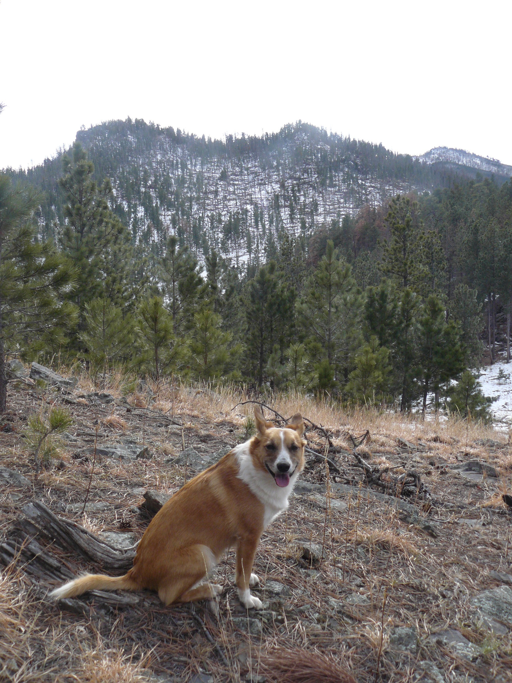
Lupe soon came to a big open field, which she and SPHP crossed, continuing SSW.  Lupe eventually returned to the forest S of the field.  Before long, Lupe ran into USFS Road No. 727.1F at a point just NW of Flag Mountain (5,896 ft.).  No. 727.1F took Lupe S skirting just W of Flag Mountain.  It linked up with No. 727 just a little W of the saddle between Flag Mountain on the N, and Campaign Hill on the S.

Lupe in the big field SSW of Smith Mountain. Photo looks NE.
The huge field had several branches to it. This photo looks W.

Of course, SPHP actually had a peakbagging goal in mind for Lupe.  Back on Black Hills, SD Expedition No. 106 on 11-28-14, Lupe climbed a couple of mountains she had already passed by today – Smith Mountain and Flag Mountain.  On Expedition No. 106, she hadn’t had time to continue S to Campaign Hill (5,800 ft.), but now she was practically there.

Lupe and SPHP went E on No. 727 just a few hundred feet to the high point of the saddle.  There, Lupe and SPHP left the road to start climbing straight up the N face of Campaign Hill.  Lupe only had to gain a little over 200 feet of elevation from the saddle to reach the summit ridge.  She reached the top of the ridge near the E end.

Lupe reached the top of the Campaign Hill summit ridge close to this point near the E end. Lupe went to check out the rock formation seen here a short distance to the W. Photo looks W along the ridge line.
From this first rock formation toward the W end of the Campaign Hill summit ridge, Lupe was able to see higher rocks to the SSW. Even though Flag Mountain was only 1/3 mile to the N, the forest was so dense Lupe could barely see it. Photo looks NE.

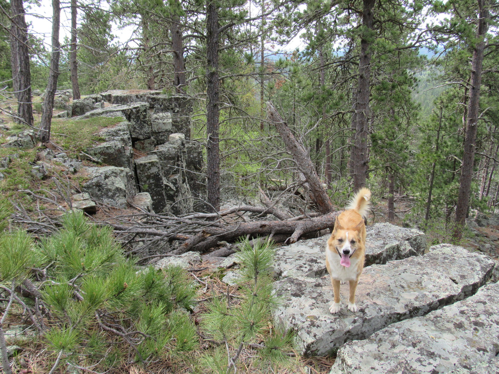
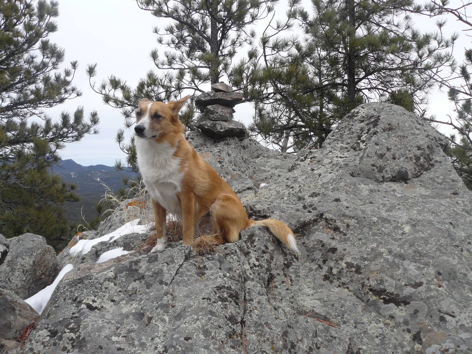
Lupe and SPHP explored the ridge up at the top of Campaign Hill looking for the true summit.  The ridge line went W from the E end of the mountain to the first (NW) rock formation, and then curved SSW.  Lupe climbed up on the first rock formation, but there were so many trees she couldn’t even see Flag Mountain just 1/3 mile to the N.  However, she could see more big rocks off to the SSW.  They looked even higher.  The true summit of Campaign Hill had to be over that way.

Lupe didn’t have to go very far to reach two more high points.  The middle one was higher than the NW high point she had just come from, but the true summit was at the next high point beyond it.  All of the high points featured exposed rock formations.  The largest rock formation was at the summit.

The rock formation at the true summit of Campaign Hill seen from the NE.

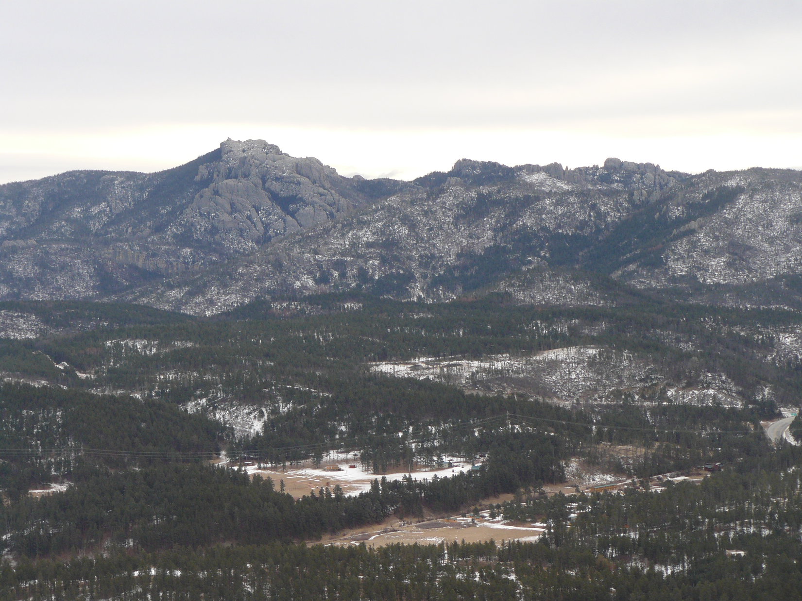
SPHP had to lift Lupe up onto the highest rocks at the true summit of Campaign Hill.  Lupe had accomplished her primary peakbagging goal for the day!  Other than the satisfaction of just being there,  Campaign Hill wasn’t providing much of a reward.  The forest was so thick, there weren’t clear views in any direction.  Lupe could catch only a glimpse of Harney Peak (7,242 ft.) through the trees from the highest rocks, and that was about it.

Lupe on the very top of Campaign Hill. Harney Peak can be glimpsed through the trees toward the L. Photo looks SSE.
Happy Lupe on the rocks just below the summit of Campaign Hill. Photo looks SE.
The summit rock formation from the SW.

There was still plenty of time left in the day.  Why not go visit Peak 6048?  It was just a mile to the S of Campaign Hill, and Lupe and SPHP had never been there before, either.  So Lupe and SPHP headed SSW down along the ridge line from Campaign Hill.  To the E, the terrain dropped off steeply.  To the W, the terrain sloped away much more gently.

A little less than halfway to Peak 6048, there was an opening in the forest along the ridge line as it was dropping down into a saddle.  Here Lupe got her first clear look at Peak 6048.  The steep N face was snowy, and appeared to be covered with a maze of deadfall timber.  Lupe could see that Peak 6048 had a double top, with the true summit being to the E.  It also looked like there were rocks at the E end of the mountain where there might be some pretty decent views.

At this clearing, Lupe had her first clear view of Peak 6048 to the S.

Lupe and SPHP continued down into the little saddle, and then climbed over a small hill heading S.  Beyond the small hill, the ridge line leading to Peak 6048 continued.  The ground to the E still fell off sharply, but to the W the land sloped gently toward sunlit forests and little fields full of snow and light.

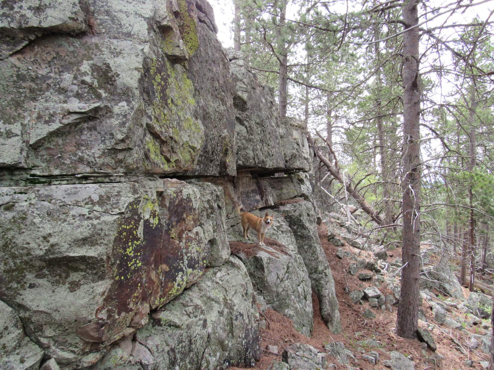
The climb up Peak 6048 from the NW was slow.  A few inches of snow made everything slippery.  The worst obstacle was the large amount of deadfall timber to be navigated.  Lupe reached the NW high point on Peak 6048.  There were some pretty big rocks up here.  Lupe found a cairn at the top of them.  Trees blocked the views in most directions, but it was possible to get a pretty decent view off to the NW.

Lupe reaches the NW high point of Peak 6048. The true summit was farther to the SE.
Looking NW from the NW high point of Peak 6048.

Lupe continued SE looking for the true summit of Peak 6048.  She lost only a little elevation, and then came to another snowy climb through more deadfall.  For a short stretch, SPHP was reduced to climbing up on hands and knees while clinging to rocks and trees.

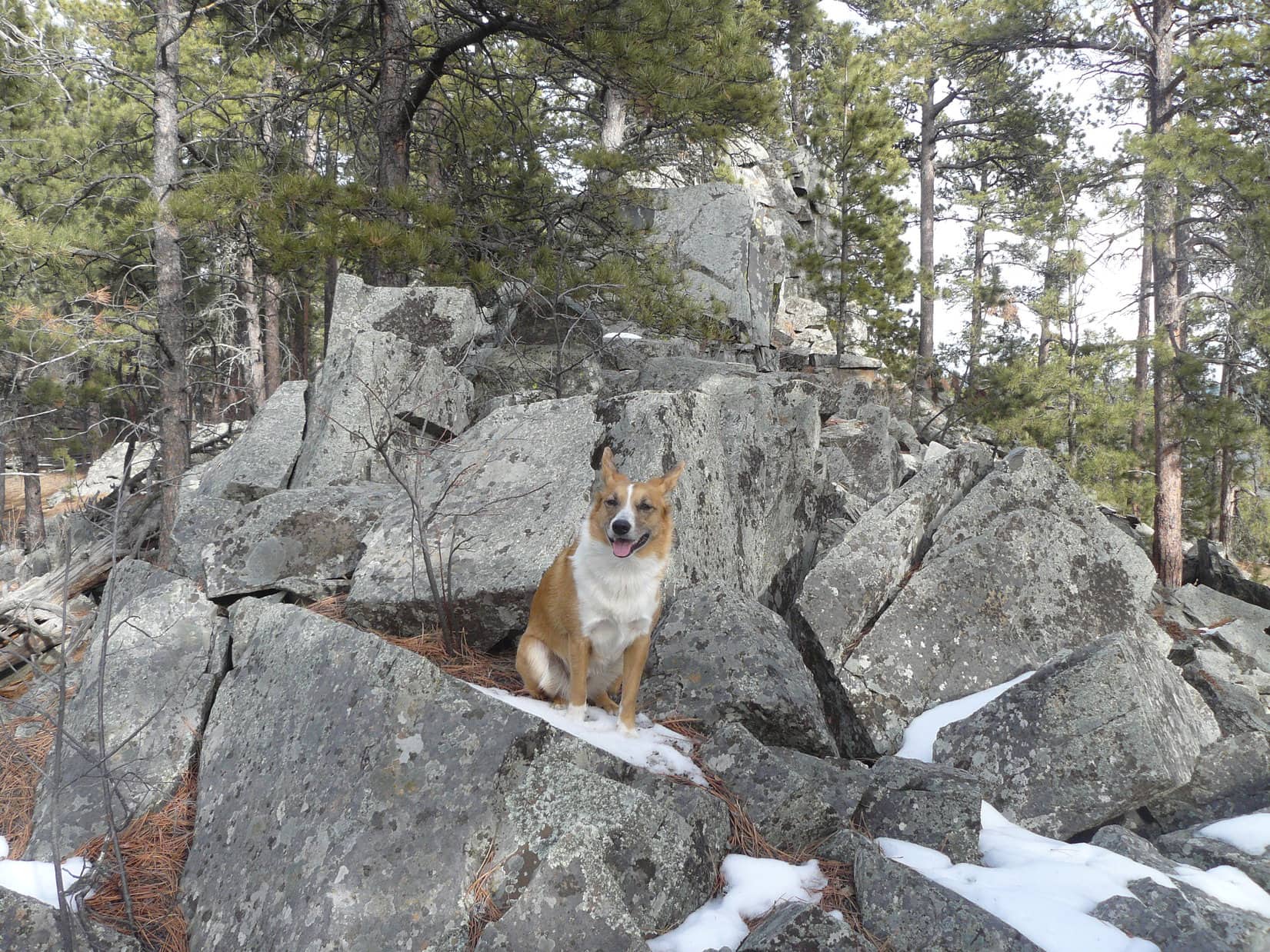
At the SE summit, there were two large rock formations.  The one farthest to the SE seemed to be slightly higher and the true summit of Peak 6048.

Lupe achieves a 2nd peakbagging goal for the day by reaching the true summit of Peak 6048 for the first time. Five Points is seen in the distance just to the L of the dead tree. Photo looks NE.
Lupe achieves a 2nd peakbagging goal for the day by reaching the true summit of Peak 6048 for the first time. Five Points (6,221 ft.) is seen in the distance just to the L of the dead tree. Photo looks NE.
Zimmer Ridge can be seen through a forest of dead trees from Peak 6048. Photo looks SSW.
Zimmer Ridge (6,600 ft.) can be seen through a forest of dead trees from Peak 6048. Photo looks SSW.

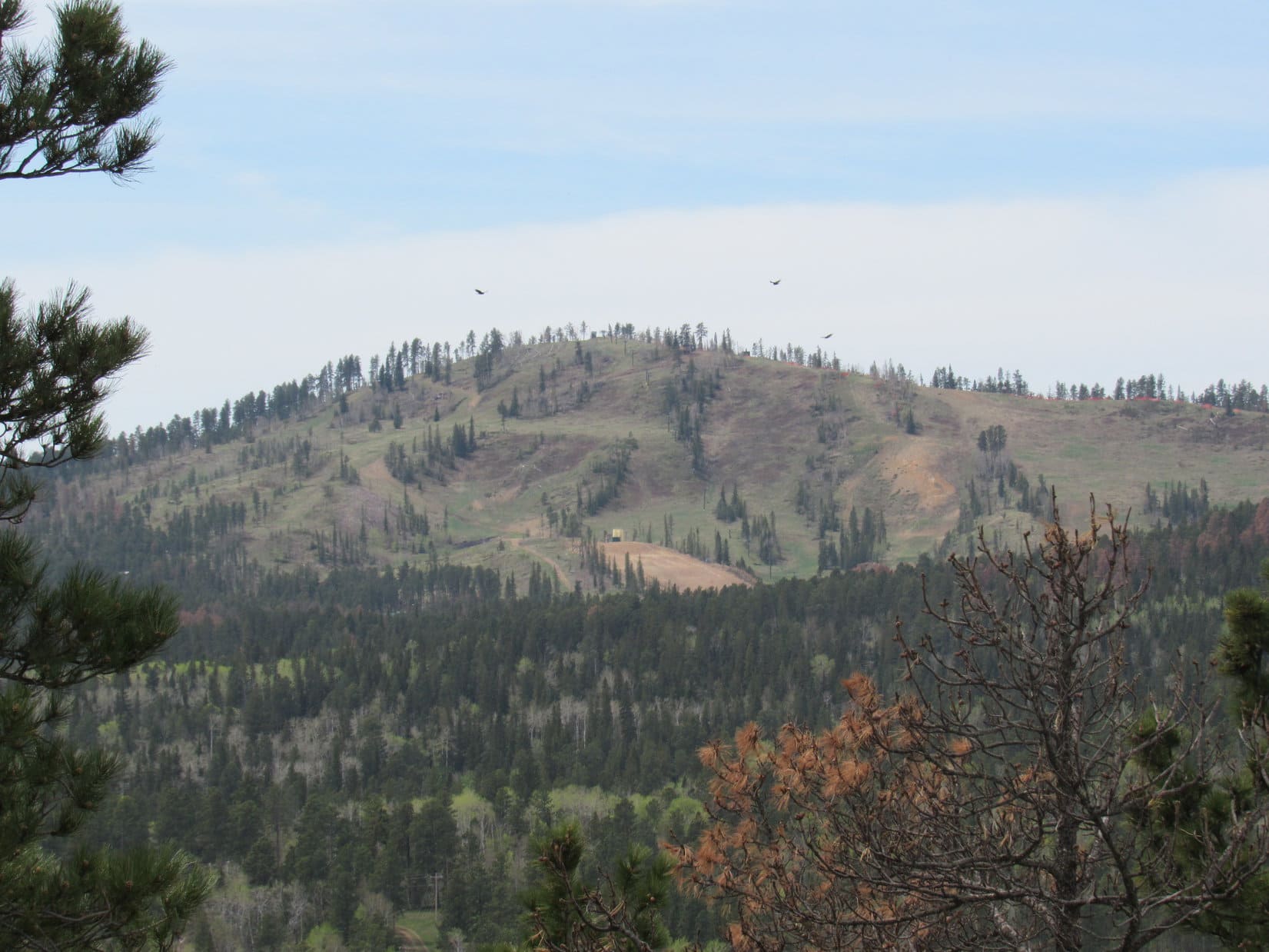
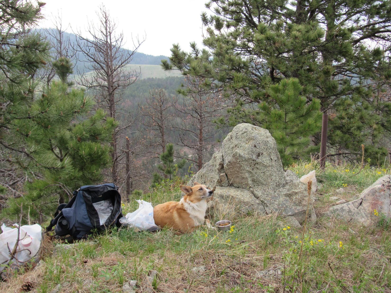
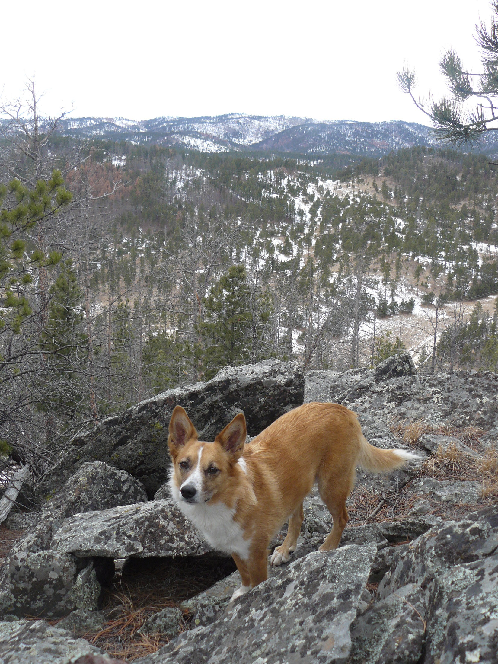
The best views from Peak 6048 were not at the summit.  They were from the top of a cliff about 25 feet lower than the summit and a short distance to the E.  Naturally, Lupe and SPHP had to check it out.  There were sweeping open views all the way from the N around to the SE.  This cliff with the fabulous views was a good spot to take a little break.  Lupe had her Taste of the Wild.  SPHP had an apple.

Yes, this is more like it! Harney Peak from the E cliff on Peak 6048. Photo looks SE.
Another view of Harney Peak. At 7,242 feet, Harney is the tallest mountain in South Dakota.
Campaign Hill is the forested hill in the foreground just R of center. Flag Mountain is just beyond and to the L of it at center. The low forested ridge on the L side of the photo is Smith Mountain. Photo looks N from Peak 6048.
Five Points is just above Loopster's head. Photo looks NE from the E cliff on Peak 6048.
Five Points is just above Loopster’s head. Photo looks NE from the E cliff on Peak 6048.
"I thought Carolina Dogs lived in the swamps. How come you never take me to any swamps, SPHP? It would be more relaxing than all this standing next to the edge of cliffs!"
“I thought Carolina Dogs lived in the swamps. How come you never take me to any swamps, SPHP? It would be more relaxing than all this standing next to the edge of cliffs!”

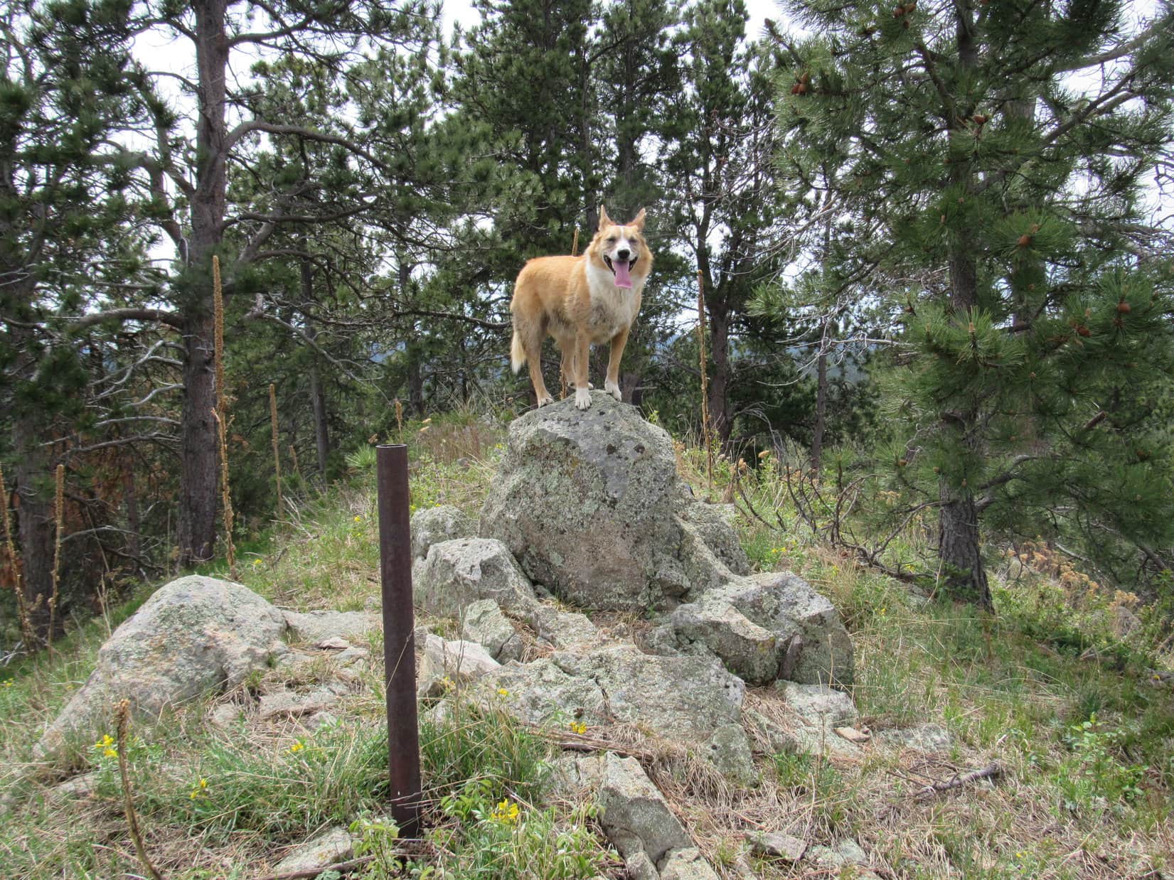
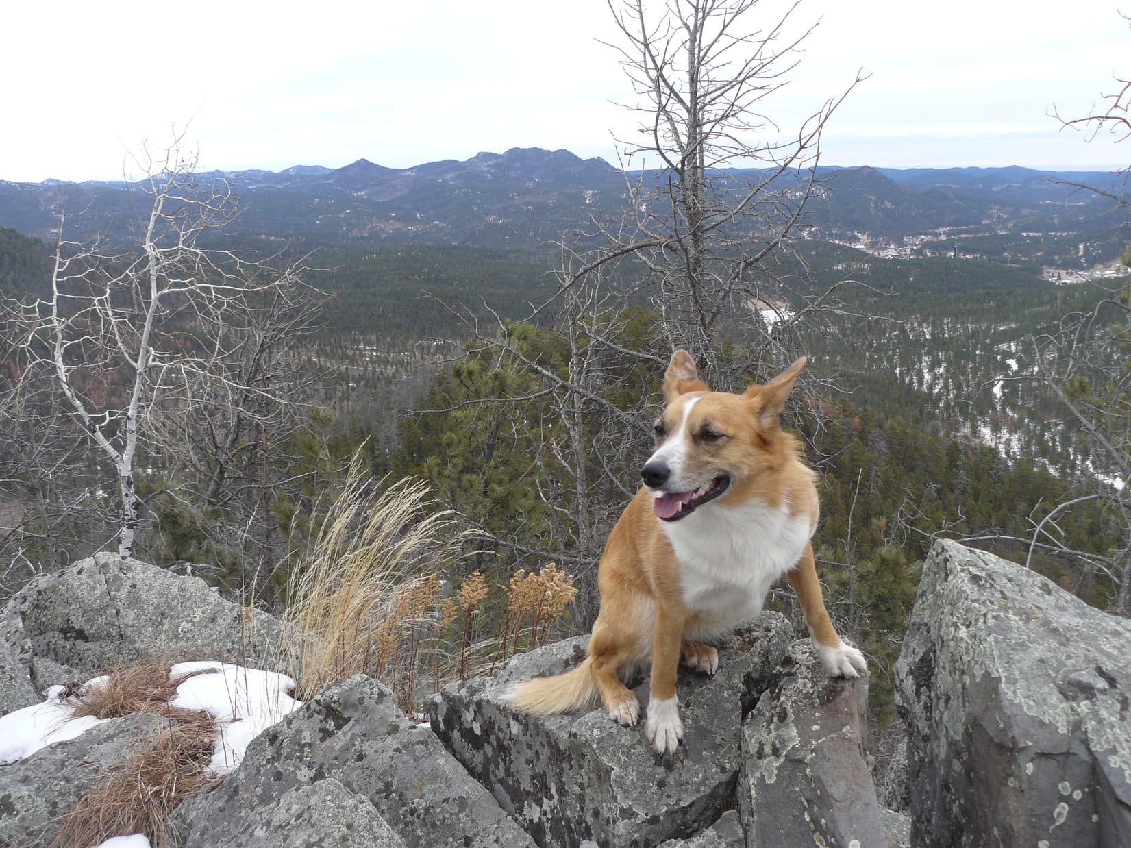
After hanging out at the E cliff for a little while, it was time to go.  Lupe and SPHP climbed back up to the true summit of Peak 6048.  The 2nd large rock outcropping, the one that wasn’t quite as high, was nearby to the NW.  Lupe and SPHP went over there for a few minutes.  Even though these rocks weren’t quite as high as the true summit, the whole rock formation was more interesting.  The American Dingo graciously posed for a couple of photos.

Yeah, these rocks are pretty cool! Glad they aren't really the true summit of Peak 6048, though. The last few feet up to the top look steeper than a Carolina Dog might want to tackle. Would probably call it good right here.
Yeah, these rocks are pretty cool! Glad they aren’t really the true summit of Peak 6048, though. The last few feet up to the top look steeper than a Carolina Dog might want to tackle. Would probably call it good right here.

Lupe on Peak 6048, 1-18-15Lupe and SPHP did a little more exploring of the summit area over towards the W, before beginning the journey down the mountain.  A pleasant sunlit ledge offered a nice view to the NW.

The sunlit ledge with a view to the NW. Lupe and SPHP liked this quiet sunny spot, even though it wasn't the highest point and didn't offer the grandest view from the mountain. Sometimes beautiful places are just where you find them.
The sunlit ledge with a view to the NW. Lupe and SPHP liked this quiet sunny spot, even though it wasn’t the highest point and didn’t offer the grandest view from the mountain. Sometimes beautiful places are just where you find them.

The trek down the NW slopes of Peak 6048 seemed to take a long time for no farther than it was.  Going down, the snow seemed more slippery.  The deadfall seemed denser and more bothersome.  Finally, SPHP was down off the steepest part of the mountain, and Lupe could race on ahead.

Just for fun, and since it was on the way back to the G6, Lupe and SPHP returned to climb Campaign Hill again.  Before reaching it, Harney Peak was visible from the ridge line all lit up in the slanting rays of the January afternoon sun.

Although it had been fairly cloudy out most of the day, by the time Lupe was on her way to climb Campaign Hill for a 2nd time, the skies had cleared enough for the afternoon sun to light up Harney Peak.

Lupe went clear up to the very top of Campaign Hill for a 2nd time, but didn’t stay there long.  SPHP still wanted to climb Flag Mountain to the N, too.  Lupe and SPHP went past the other high points along the ridge, and then headed down the N slope of Campaign Hill.  Lupe crossed USFS Road No. 727 at the saddle, and started up the SW slope of Flag Mountain.

The climb up Flag Mountain from the SW was easier than expected.  It was kind of steep, but there wasn’t any snow.  There wasn’t much deadfall timber either, except near the very top.  The sun was starting to get low in the SW by the time Lupe arrived on top of Flag Mountain.  A cool NW breeze was starting to blow.

Lupe on Flag Mountain, the last mountain she climbed on Expedition No. 115. Photo looks SW.
Yes, yes, it's true! Another shot of Harney Peak from the NW. This one, of course, was taken from Flag Mountain. Read enough of The (Mostly) True Adventures of Lupe, and you will eventually see Harney Peak from just about every conceivable direction.
Yes, yes, it’s true! Another shot of Harney Peak from the NW. This one, of course, was taken from Flag Mountain. Read enough of The (Mostly) True Adventures of Lupe, and you will eventually see Harney Peak from just about every conceivable direction.
The top of Flag Mountain. Photo looks W toward the small rocks that jut up at highest point.

It was getting to be time to hurry on.  Lupe left Flag Mountain heading down the N slope.  SPHP lost a lot of time again picking a way slowly down through the snow and plentiful deadfall timber.  After losing sufficient elevation, the terrain began to level out a bit and there was much less deadfall.  Lupe and SPHP could make progress again.

Lupe crossed Patterson Creek in a big field N of Flag Mountain.  This field connected to the big open field she had traversed earlier in the day.  By now the sun was on the horizon.

Lupe after crossing Patterson Creek. Photo looks WSW at the field the creek flows through.

After crossing Patterson Creek and the big field, Lupe was almost to USFS Road No. 386.1B just SW of Smith Mountain again.  Before Lupe and SPHP could even reach the road, the sunset suddenly developed into a beautiful display of color.  It almost looked like the forest was on fire!

Sunset SW of Smith Mountain.

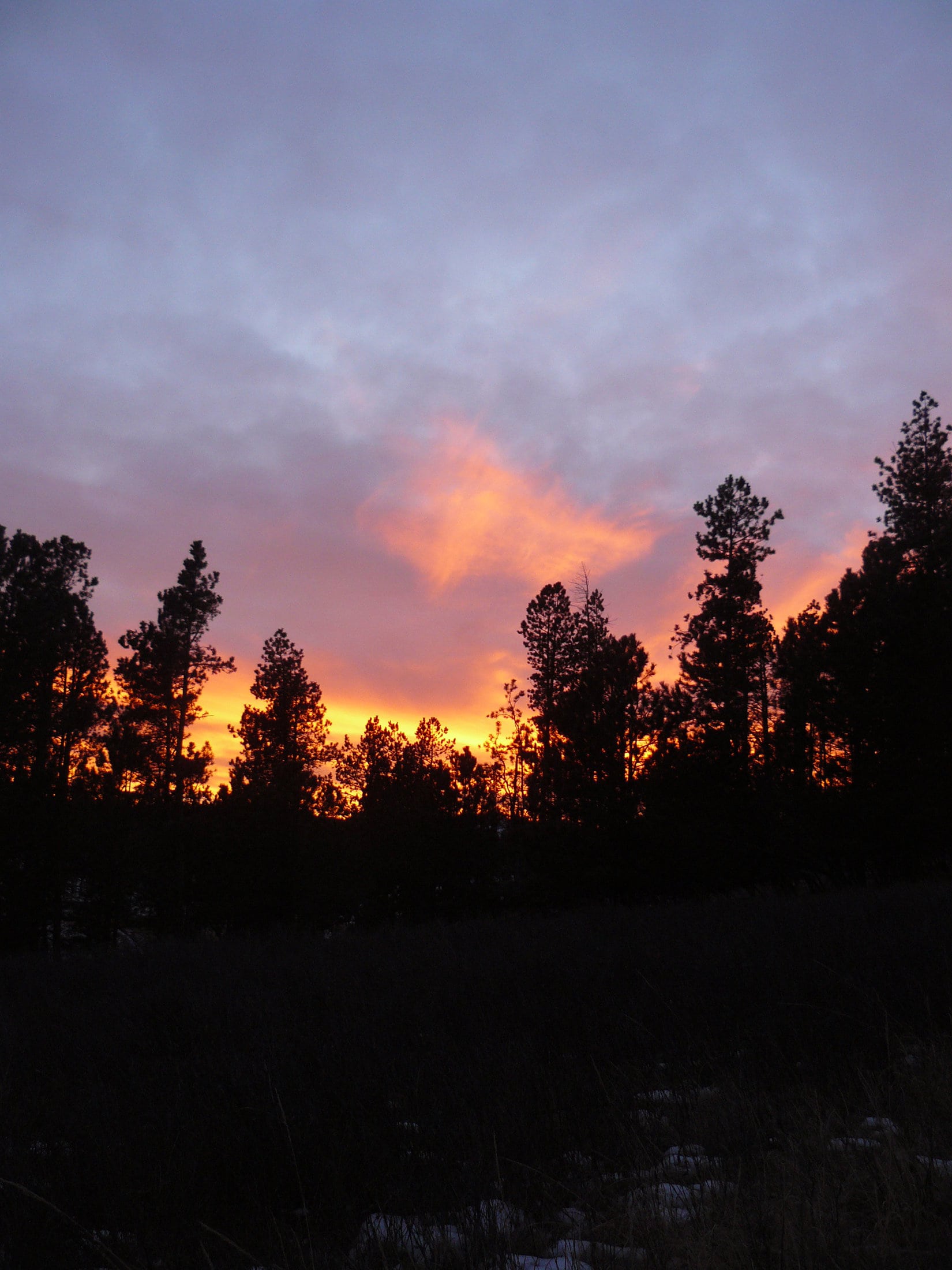
The glorious sky faded as quickly as it arrived.  Lupe and SPHP reached USFS Road No. 386.1B again.  The rest of Lupe’s return trip to the G6 was just a retracement of the first part of her day’s journey.  She still had 3 miles to go to get to the G6.

Lupe and SPHP trudged onward in the gathering gloom.  Every now and then, Lupe would hear something undetectable to SPHP in the forest.  Each time she raced off to investigate, returning to SPHP a few minutes later with a big grin on her face, as if some animal out there had told her a really good joke.

It was 6:40 PM, and still a balmy 43°F out when Lupe reached the G6.  Lupe jumped very willingly into the G6, and curled up.  Black Hills, SD Expedition No. 115 was over.  It had been a great day.  Lupe hardly stirred on the drive home.  She must have had a great day, too!

Links:

Next Black Hills Expedition                 Prior Black Hills Expedition

Want more Lupe adventures?  Choose from Lupe’s Black Hills Expeditions Adventure Index or Master Adventure Index.  Or subscribe free to new Lupe adventures.

Black Hills, SD Expedition No. 173 – Strawberry Ridge, Sugarloaf Mountain & Woodville Hills (5-21-16)

Lupe had been revved up for a couple of days.  SPHP had promised to take her on one of her Black Hills expeditions this morning, yet she almost didn’t get to go.  Lupe was up early, but the morning sky was totally overcast.  Low clouds socked in the nearby hills.  It looked like rain and fog were in Lupe’s immediate future, not fun in the sun.

SPHP was hoping for rain, actually.   May, normally one of the wettest months of the year in the Black Hills, had hardly seen 0.25″ so far, and the month was already 2/3 over.  Moisture is almost always good news in the Black Hills, and it was really needed now.

Rain didn’t come.  A light mist fell, but it didn’t amount to anything.  After a couple of hours, the clouds seemed to be lifting.  SPHP checked the forecast.  Clouds and wind, but only a 20% chance of rain.  Well Loopster, looks like you win!  We may as well try it, although we may not see much if the skies don’t clear up any more than this.

Lupe was thrilled!  She wasn’t worried about clouds.  If she just got to run around sniffing in the forest, that was fine with her.  She could still look for squirrels!

Lupe’s first peakbagging goal of the day was an easy one.  SPHP parked the G6 near the start of Gilt Edge Road, just off Hwy 385 S of Lead/Deadwood (9:44 AM, 58°F).  The top of Strawberry Ridge (5,890 ft.) was only 0.2 mile N.  Lupe charged into the forest, excited to be underway.

SPHP trudged up the hill.  The slope was moderate, until Lupe arrived at the base of a rocky ridge with a line of small cliffs facing SW.  Lupe and SPHP went around the S end of the rocks, and easily got up on top.

Lupe up on the rocky ridgeline along the SW edge of the Strawberry Ridge summit area. Photo looks NW.

The Strawberry Ridge summit area was large and flat.  Nothing stood out as the absolute high point.  The most interesting part of the mountain was the line of small cliffs to the SW.  Forest hid the views in every direction.

Following the edge of the cliffs NW a little way, Lupe came to a small opening where Custer Peak (6,804 ft.) could be seen off to the SSW.  That was about it for views.  At least the clouds had lifted quite a bit by now.  Although hazy ill-defined clouds still dominated the sky, they weren’t nearly so low as earlier in the day.  At times, the sun even came out.

Custer Peak from Strawberry Ridge. Photo looks SSW using the telephoto lens.

Lupe and SPHP looked around for the highest spot on Strawberry Ridge, but it really was all about the same elevation.  SPHP finally chose a spot for Lupe’s summit photo.  She grinned cheerily for the camera.  Then she went and explored some of the interesting rocks along the line of small cliffs.

Lupe grins at the summit of Strawberry Ridge (5,890 ft.). It was getting warm out, which kept her panting, which made her look so happy. She actually was happy, though, too! Photo looks NNW.
Lupe grins at the summit of Strawberry Ridge (5,890 ft.). It was getting warm out, which kept her panting and made her look happy. She actually was happy, though, too! Photo looks NNW.
Near the edge of the SW cliffs. Photo looks SSE.
Exploring the low cliffs. Photo looks SSE.
Starting down the mountain. Photo looks N.

After exploring Strawberry Ridge, the short march back to the G6 was uneventful except that Lupe found a squirrel to bark at, and SPHP found the first Lupe Treasure of the day.  A big black tarp had been abandoned in the forest near Gilt Edge Road.  SPHP managed to get it stuffed into the trunk of the G6 (10:24 AM, 62°F).

For a moment, Lupe was reluctant to hop into the G6.  She was worried that Strawberry Mountain was going to be it for the day.  Why, the day was hardly getting started.  She didn’t want to go home yet!  SPHP persuaded her there was more fun in store.  Lupe leaped in.  She mostly enjoyed the ride to the next stop, but whined a little when there weren’t enough cows, horses or deer to bark at along the way.

SPHP parked the G6 at the Sugarloaf trailhead of the Mickelson Trail along Hwy 85 SW of Lead (10:37 AM, 66°F).   Lupe wasn’t going to take the Mickelson Trail, however.  She had another peakbagging goal nearby, and the trail didn’t go to it.  Lupe was going to climb Sugarloaf Mountain (6,037 ft.).

Sugarloaf Mountain was only 0.33 mile SW of the trailhead, but SPHP didn’t know how to get to it.  A private home blocked the way through the valley E of the mountain.  Lupe and SPHP tried finding a way past the private property by following Whitetail Creek upstream along Hwy 85.  The creek was pretty, but due to its proximity to the highway, there were a lot of Lupe Treasures along it.

Whitetail Creek next to Hwy 85. Photo looks W.

The exploration up Whitetail Creek was a failure.  Lupe kept coming to more private property along the creek.  It didn’t look like there was any access to Sugarloaf Mountain from here.  Lupe had to turn around and go back.

SPHP finally found a way up onto a ridge E of Sugarloaf Mountain.  Lupe never got to the top of the ridge, but followed it S until she could cross the valley to the W.  Down in the upper reaches of the valley, Lupe came to a tiny stream flowing over an abandoned road.  The stream was full of silt and mud.  Lupe laid right down in it to cool off.  A two-toned American Dingo emerged from the mud.

Lupe emerges from the muddy little stream E of Sugarloaf Mountain. The American Dingo seemed proud of her new two-toned look!

Lupe seemed quite pleased with her new two-toned look!  Or maybe it was just that the cool mud felt good.  It was getting warmer and sunnier out.  The air was very humid.  As Lupe headed NW up out of the valley toward Sugarloaf Mountain, SPHP started sweating.  SPHP stopped to put on sunscreen, as much for the breather as for protection from the sun.

While Lupe climbed Sugarloaf Mountain, SPHP started thinking about how it was getting to that time of year when Lupe needs to be exploring higher mountains than the Black Hills.  Heat always saps SPHP’s energy.  Lupe isn’t immune either.  Climbing mountains in the heat is even worse wearing a fur coat!

The Carolina Dog soon arrived at the top of Sugarloaf Mountain (6,037 ft.).  The summit area was a narrow ridge maybe 50 feet long running N/S.  A big rock toward the N end was clearly the highest point on the mountain.  A few feet N of it, a 3″ diameter pipe stuck up several feet out of the ground.  Lupe hopped up on the summit rock to complete her ascent.

Lupe on the summit of Sugarloaf Mountain (6,037 ft.). Photo looks S.
Looking N.

Sugarloaf Mountain was forested, but there were several places along the narrow summit ridge where it was possible to get a distant view.  Lupe could see Terry Peak (7,064 ft.) and Deer Mountain (6,652 ft.) to the W.  To the NE was the town of Lead.

The snow was all gone from the ski runs on Terry Peak (7,064 ft.) Photo looks W.
The town of Lead, SD was in view to the NE. Photo taken with telephoto lens.
Big birds were circling near Deer Mountain (6,652 ft.). Photo looks SW using the telephoto lens.
The old Homestake Gold mine in Lead, SD could be seen from Sugarloaf Mountain. The former mine now serves as a physics underground research facility. Photo looks NE using the telephoto lens.

After a lengthy rest break on Sugarloaf Mountain, Lupe and SPHP headed S down off the mountain.  Lupe was on her way to her last peakbagging goal of the day, the highpoint of Woodville Hills (6,280 ft.).  The journey started out well.  As expected, Lupe came to a gravel pit shown on the maps while still coming down Sugarloaf.  The gravel pit had a number of very small ponds along the E side of it.  Frogs were croaking away, but stopped abruptly when Lupe drew near.

S of the gravel pit, Lupe found a road.  Lupe and SPHP started following it SW, but came to a No Trespassing sign.  A big house could be seen off to the W, a short distance ahead.  Lupe and SPHP went S to avoid it, but came to a big housing subdivision at the W end of Ruby Flats.  The housing subdivision was quite new.  Many of the lots were undeveloped, although beautiful new homes were scattered around, too.

Lupe and SPHP passed through the subdivision on paved streets named Rubys Way and Outlaw Pass.  Outlaw Pass seemed appropriate enough, but no one stopped outlaws Lupe or SPHP.  Lupe made it through the subdivision without incident, and returned to the forest heading SE.  It wasn’t too far to a new obstacle – a deep gash in the land.

The gash was man-made.  Lupe and SPHP followed the gash to the S from up above.  At the S end, Lupe went down an embankment to arrive at a rough road that came through the gash.  Lupe needed to continue SE, but a log entrance across the rough road was marked with a “private property, no trespassing” sign in that direction.  Reluctantly, Lupe and SPHP turned N going through the gash.

Lupe in the gash. Photo looks N.

Lupe had hardly started on the way N, when an ATV suddenly appeared at the N end of the gash and came toward her.  Lupe and SPHP got off the rough road to let the ATV go by, but the driver stopped to chat.  The couple in the ATV turned out to be the owners of the private property to the S.  They quickly informed SPHP that the rough road was part of Old Rail Road, and wasn’t part of their property.  No problem going S following the road.

That was good news!  As soon as the ATV roared off, Lupe and SPHP turned around and headed S again.  A small pond was down below the W bank of Old Rail Road just beyond the log entrance.  Frogs croaked in the pond as Lupe passed by above.  Old Rail Road stayed almost level as it wound its way around to the E and then S again.  Lupe was now making good progress toward Woodville Hills.

Lupe on Old Rail Road on her way to Woodville Hills. Photo looks ESE.

After more than 0.25 mile on Old Rail Road, other roads started coming in from the W.  Old Rail Road got bigger and turned to gravel.  Lupe started passing by homes on large forested lots.  Old Rail Road led to a valley where it intersected Englewood Road near Aqueduct Creek.  The Mickelson Trail ran through the valley paralleling the creek.  Lupe and SPHP paused at the Englewood trailhead for a short break.

Lupe cools her paws off in Aqueduct Creek shortly after her break at the Englewood trail head of the Mickelson Trail. Photo looks SSW.

After the brief break at the trailhead, Lupe continued S a short way upstream near Aqueduct Creek.  While SPHP gathered a few Lupe Treasures along the bank, Lupe cooled her paws off in the stream.

Brownsville Road intersects Englewood Road just S of the Englewood trailhead.  Lupe could have followed Brownsville Road 1.5 miles around to the S end of the Woodville Hills ridge to a point not far from the summit, but the wide gravel road was a rather dull option.  Instead, Lupe left Aqueduct Creek, and crossed over to the E side of Brownsville Road.  Lupe and SPHP disappeared into the forest.

The Woodville Hills ridge is all forested, and runs for more than a mile in a NNW/SSE direction.  Lupe and SPHP made a steep climb up onto a secondary ridge protruding out to the W.  Lupe followed the secondary ridge E toward the main ridge.  She came to an interesting big rock formation of fairly sharp rocks along the way.  Lupe and SPHP skirted around to the S of it.

Lupe sits at the base of the big sharp rock formation first encountered on her way to the main Woodville Hills ridge. This photo was actually taken on her return trip from the summit, when she passed by it again. Photo looks E.

Beyond the sharp rock formation, Lupe still had to keep climbing to the E in order to get up onto the main ridge.  She reached it not too far from its N end.  The true summit of Woodville Hills was still a mile or more to the S.

Shortly after starting S on the main ridge, Lupe found an abandoned fort.  She promptly took possession of it, proudly proclaiming it Fort Dingo!

Lupe establishes Fort Dingo in the Woodville Hills! Photo looks NE.

Lupe and SPHP expanded American Dingo territory exploring the Woodville Hills ridgeline to the S.  Lupe came to a series of minor high points along the way.  She climbed most of them.  Although there was elevation loss between each high point, overall Lupe was still clearly gaining elevation.

Yellow flowers like these were common along the Woodville Hills ridgeline.
Lupe on a high point that SPHP initially thought might be the true summit of Woodville Hills. As it turned out, the true summit was still a little farther S. Photo looks SW.

Lupe finally reached the true summit of Woodville Hills (6,280 ft.) very close to the S end of the ridge.  SPHP had hoped there would be a good view of Custer Peak (6,804 ft.), but the Woodville Hills summit was buried in the forest like the rest of the ridgeline.  There really wasn’t much of a view in any direction.

Lupe reaches the true summit of Woodville Hills! Photo looks S.
Looking N at Lupe on the true summit.

Lupe and SPHP explored a bit farther S along the ridgeline.  Lupe had hardly left the true summit, when she arrived at a dirt road that came up from the E.  Clearly, Lupe hadn’t taken the easiest route to the summit, but SPHP remained convinced her route had been more interesting.

Nearby, a narrow gap in the trees offered a still hazy look at Custer Peak.  Brownsville Road could be glimpsed through the forest down below to the S.  Lupe’s explorations of the Woodville Hills were now complete.  It was time to turn around.  Lupe returned to the summit briefly, before pressing on to the N.

A short distance from the true summit of Woodville Hills was a small gap in the trees offering this view of Custer Peak. Photo taken with the telephoto lens looking SE.
A short distance from the true summit of Woodville Hills was a small gap in the trees offering this hazy view of Custer Peak. Photo taken with the telephoto lens looking SE.

For the most part, Lupe’s return route was the same.  She returned to Fort Dingo, she followed Old Rail Road again, and passed through the new subdivision at the W end of Ruby Flats.  Lupe even returned to make a second ascent of Sugarloaf Mountain.

Lupe relaxes on her 2nd ascent of Sugarloaf Mountain. Photo looks N.

However, the last part of Lupe’s journey back to the G6 was different.  Lupe followed a dirt road S of the summit around the E side of Sugarloaf Mountain.  SPHP expected it to descend down into the valley to the E, but it did not.  Instead it curled around the N side of the mountain, dropping steeply, before finally coming out between a couple of cabins at the NE end of the White Tail Court Resort along Hwy 85.

From the White Tail Court Resort, it was only 0.25 mile back to the G6 parked at the Sugarloaf trailhead of the Mickelson Trail.   It took Lupe and SPHP quite a long time to get there, though.  Along the way, SPHP collected the great majority of the Lupe Treasures found during the day between Hwy 85 and Whitetail Creek.

There were more Lupe Treasures available than SPHP was able to carry, but  Lupe was satisfied.  Once she got back to the G6 (7:34 PM, 57°F), she didn’t want to go back for more.  She had accomplished all three of her peakbagging goals, established Fort Dingo in the Woodville Hills, and been on top of Sugarloaf Mountain twice.  That was enough!  She hopped in the G6.  The next treasures she wanted to see were a nice bowl of Alpo and a soft bed at home.

Lupe on Sugarloaf Mountain, 5-21-16Lupe Treasures collected: 11 plastic bottles, 19 glass bottles, 34 aluminum cans, a large black tarp, a baby’s sweater, and miscellaneous trash.

Links:

Next Black Hills Expedition                       Prior Black Hills Expedition

Want more Lupe adventures?  Choose from Lupe’s Black Hills Expeditions Adventure Index or Master Adventure Index.  Or subscribe free to new Lupe adventures.