Black Hills, WY Expedition No. 176 – Elkhorn Divide, Fish Mountain & Hooker Peak (10-9-16)

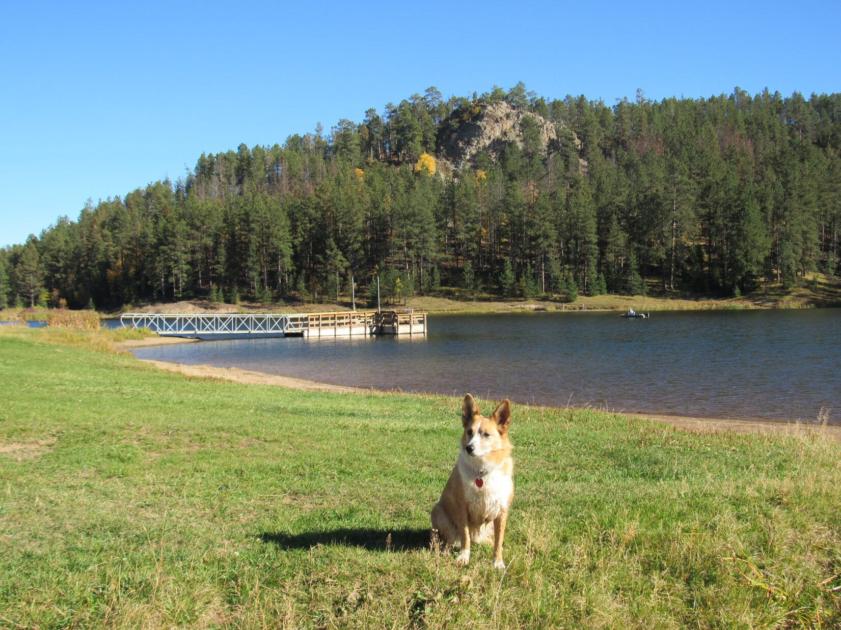
The names on the sign looked familiar.  They had been on the Peakbagger.com topo map SPHP had been looking at online early this morning.  SPHP parked the G6 next to the sign (1:56 PM, 70°F).  Let’s try it from here, Looper!

Lupe near the intersection of USFS Roads No. 872.3 & No. 878 in the Black Hills of Wyoming. Her day's adventures started here. Photo looks WSW.
Lupe near the intersection of USFS Roads No. 872.3 & No. 878 in the Black Hills of Wyoming. Her day’s adventures started here. Photo looks WSW.

It was a beautiful day, sunny and warm, but Lupe had arrived late for her Black Hills of Wyoming expedition.  Back at home this morning, the printer wouldn’t print.  SPHP had fought with it for hours.  The reason it wouldn’t print was still as clear as mud.  It was nearly noon by the time SPHP had given up on it.

Normally, SPHP brings along a topo map or two printed out from Peakbagger.com on Lupe’s expeditions.  Today, all SPHP had to go on was a hand-sketched map drawn with a couple of contours for each of the peaks Lupe hoped to climb.  Of course, SPHP had the old Black Hills National Forest map along, too, but it showed very little detail.

We might have quite a time trying to figure out what’s what around here, Loop!  Let’s hope we can find and recognize these peaks you’re looking to climb.  Lupe and SPHP started off going WSW on USFS Road No. 872.3 toward a bright yellow grove of aspens where there was a fork in the road.

Fall colors were in full swing at this bright yellow grove of aspens near the intersection of USFS Roads No. 872.3 & 872.1F. Photos looks SW.

At the intersection, the main road angled W on its way to Fish Canyon.  A less traveled road curved S.  It was marked No. 872.1F.  According to SPHP’s old Black Hills National Forest map, it should have said No. 872.4F.  That is, if Lupe was really where SPHP thought she was.  Hmmm.

Loopster, let’s try to find Fish Mountain first, OK?  Lupe had no objections.  Lupe and SPHP returned to the G6.  Fish Mountain was supposed to be only a mile or so N.  A faint grassy road left No. 872.3 and went NNE up a little valley.  The faint road was evidently what was left of USFS Road No. 878.  SPHP started following it.  Lupe, however, streaked away to the W.

She had found a squirrel!  The valley echoed with joyous Dingo barking.  The good times continued for several minutes, after which Lupe raced N looking for SPHP.  As far as Lupe was concerned, if these woods were full of squirrels, she was going to have a great day whether she ever found Fish Mountain or not.

USFS Road No. 878 soon faded away entirely.  Lupe and SPHP climbed a ridge to the NNW.  The ridge was forested, but not so densely as to make it impossible to get an idea of the general lay of the land.  Off to the NNW were a couple of forested hills.  Another high spot was to the SW along this ridge.  A smaller hill was to the NE, with a bigger one farther NNE.

Fish Mountain was probably one of the hills to the NNW.  A lower grassy ridge to the N on the other side of a shallow valley appeared to lead in that direction.  Lupe and SPHP started down into the valley.  Suddenly, there was gunfire!  Lupe, who had been having a great time exploring and looking for more squirrels, was immediately concerned.

The gunfire was much too distant to be a genuine threat.  Hunters?  Maybe.  Unfortunately it had come from the NW, in the general direction of Fish Mountain.  Now Lupe was begging SPHP not to go that way.  Well, OK.  SPHP decided to take another look at things from the small hill to the NE, while Lupe calmed down.

Lupe at the top of the little hill to the NE. SPHP eventually concluded this hill was the middle high point along Elkhorn Divide. Photo looks NE.

Lupe reached the top of the little hill.  As SPHP gazed around, only one thing was really clear.  Distant views were going to be hard to come by in these heavily forested hills.

The nervous American Dingo stuck to SPHP like glue.  Unfortunately, the gunfire was continuing intermittently.  The good news was that meant hunters weren’t the source.  Hunters wouldn’t fire off a round or two every 4 or 5 minutes.  The bad news was that the source was almost certainly someone doing target practice.  Lupe might have to endure the terrifying noise for hours.

SPHP peered through the forest, repeatedly referencing the maps.  Surprisingly, the crudely hand-drawn topo map was actually of some use!  Suddenly, things made sense, at least partial sense.  This hill Lupe was on was the middle high point along Elkhorn Divide (5,944 ft.), wasn’t it?  If so, the true summit would be somewhere on that higher hill Lupe had seen to the N.

SPHP led Lupe N down into a broad, flat saddle area on the way to the Elkhorn Divide summit hill.  In the saddle, Lupe came to a fence.  Beyond the fence, she crossed a road going NW.  She continued N up the big hill.

The highest ground was over toward the W side of the mountain.  Lupe soon arrived at an edge where the ground dropped off steeply.  A short stroll N along the W edge brought Lupe up to a big flat area, which appeared to be the summit of Elkhorn Divide.  This area was all forested, but open enough so it was pretty sunny.

Lupe on a big dead tree at the summit of Elkhorn Divide. Photo looks N.
Lupe on Elkhorn Divide. Here she's sitting on what appeared to be the highest spot, but there was lots of ground around at virtually the same elevation. Photo looks W.
Lupe on Elkhorn Divide. Here she’s sitting on what appeared to be the highest spot, but there was lots of ground around at virtually the same elevation. Photo looks W.
The Elkhorn Divide summit area. A huge dead pine tree had fallen over toward the E, but gotten hung up on other trees before hitting the ground. Photo looks N.

Lupe and SPHP explored far enough N along the W edge of the Elkhorn Divide summit hill to make certain Lupe had actually been to the true summit.  She had.  The forest made it hard to tell, but there didn’t seem to be any promising routes toward the NW to Fish Mountain from here.

Lupe turned S retracing her route along the W edge back to the summit of Elkhorn Divide.  She continued on down the hill.  Along the way, she came to several rock outcroppings.  From one of them was a narrow view of a mountain off to the W.  SPHP was almost certain that mountain had to be Hooker Peak, another one of Lupe’s peakbagging goals.

Hooker Peak, another of Lupe's peakbagging goals. Photo looks W from a rock outcropping S of the Elkhorn Divide summit using the telephoto lens.
Hooker Peak, another of Lupe’s peakbagging goals. Photo looks W from a rock outcropping S of the Elkhorn Divide summit using the telephoto lens.

Lupe and SPHP reached the saddle area again, and got on the road going NW.  Lupe followed the road for only a few minutes.  Glimpses of the grassy ridge she had seen earlier on were becoming visible through the forest.  Lupe left the road heading W.   She came to a fence up on the grassy ridge.  The fence line pointed almost directly at Fish Mountain (5,942 ft.).

Lupe on the grassy ridge on her way to Fish Mountain, the most distant hill on the R. The hill on the L is High Point 5922. Lupe didn't climb HP 5922, but she did climb the lower sub peak seen at (Center) on her way to Fish Mountain. Photo looks NW.
Lupe on the grassy ridge on her way to Fish Mountain, the most distant hill on the R. The hill on the L is High Point 5922. Lupe didn’t climb HP 5922, but she did climb the lower sub peak seen at (Center) on her way to Fish Mountain. Photo looks NW.

Lupe followed the fence line toward Fish Mountain.  The fence turned WNW as it drew near two sub-peaks E of High Point 5922.  Lupe climbed both of these sub-peaks without having to cross the fence.

Climbing the second, higher sub-peak proved to be quite unnecessary.  The rocky summit didn’t provide much of a view of Fish Mountain, despite high hopes for one.  Lupe then had to lose all the elevation she had just gained traversing a steep slope toward the saddle over to Fish Mountain.

While exploring the steep slope, Lupe made an intensely exciting discovery.  She found a squirrel on the ground!  The squirrel alertly made a narrow escape by springing nimbly to the safety of a nearby tree.  Unfortunately for the poor squirrel, the tree was either dead or an aspen that had already lost all its leaves.  Lupe could see the frightened squirrel scrambling around up there, and raised a tremendous ruckus.

The squirrel was 35 feet above the ground and perfectly safe, but totally unnerved.  It desperately wanted to get out of sight.  Dashing around from one spindly little branch to the next, it lost its balance.  Down fell the squirrel!  Clear back to the ground.  Lupe was after it immediately.

Now, if SPHP ever falls out of a tree 35 feet straight down to the ground, that will be the end of the ole’ ballgame right then and there.  The squirrel, however, sprang up like Lazarus from the dead, totally unfazed.  Nevertheless, if there hadn’t been so much tall grass, brush and deadfall timber around to slow Lupe down, things might well have ended badly for the squirrel.  As it was, Lazarus the squirrel escaped again to a big pine tree and disappeared.

Lupe was so excited, for a little while she didn’t even think about the gunfire, which was still going on.  She was convinced that where one squirrel could be found on the ground, there might well be more.  Lupe sniffed frantically everywhere.  She didn’t calm down until she was past the saddle and climbing the S slope of Fish Mountain.

Near the top of Fish Mountain, was a band of small limestone cliffs.  The cliffs were quite broken up, so it wasn’t hard at all for Lupe to find a route through them.  Lupe arrived up on a summit ridge about 200 feet long E/W, and 25 or 30 feet wide N/S.  Several different stones closer to the E end vied for the title of true summit.

Lupe at the summit of Fish Mountain. Photo looks W.

The E end of the summit ridge was surprisingly barren, but still ringed by enough trees to block the views.  However, there was one exception.  A small gap in the trees provided a glimpse of Inyan Kara (6,360 ft.) off to the SSW.

Inyan Kara Mountain as seen from Fish Mountain using the telephoto lens. Photo looks SSW.

Lupe and SPHP took a break up on Fish Mountain.  By now, Lupe was back to worrying about the gunfire again.  Apparently target practice was going to last all day.  SPHP tried to comfort Lupe, but the truth was her next peakbagging goal was Hooker Peak, even closer to the source of Lupe’s torment.

Instead of heading back down the steep S slope of Fish Mountain, Lupe and SPHP explored the summit ridge to the W.  It went farther than SPHP expected, before beginning to lose elevation steadily.  Lupe arrived at an opening in the forest along the S rim of the ridge where there was a clear view to the SSW.  Inyan Kara could be seen again, along with a couple more peaks Lupe hoped to climb tomorrow.

At the viewpoint along the S rim of Fish Mountain, well W of the summit. Inyan Kara is seen in the distance. Duling Hill (6,005 ft.) is L of the dead tree. Iron Mountain (5,887 ft.) is in the foreground to the R of Inyan Kara partially obscuring it. Photo looks SSW.
Another look with the telephoto lens. Photo looks SSW.
Duling Hill (Center) from Fish Mountain. Photo looks S.

Lupe and SPHP continued W from the viewpoint.  Lupe didn’t have to go much farther before the terrain dropped down to a more heavily forested area where she found an old road.  The road took her SE down to the W side of the saddle between Fish Mountain and High Point 5922.  There it turned sharply W continuing down a side valley all the way to Fish Canyon.

By the time Lupe reached Fish Canyon, the sun was already so low it was only shining on the mountaintops.  However, Lupe was quite close to another peakbagging objective, Hooker Peak (5,862 ft.).  Maybe she could still make it up Hooker Peak before sunset?  She would have to hurry!  Lupe and SPHP went a short distance NNW on the road in Fish Canyon before turning SW to climb Hooker Peak’s NE ridge.

Most of the climb wasn’t bad, but Lupe was a nervous wreck.  The continuing gunfire was now quite loud, originating from somewhere much lower, but not too far away to the NW.  SPHP could hardly move without tripping over or stepping on the psyched out American Dingo.  Just like Lazarus the squirrel, Lupe was desperate to hide.

Despite the gunfire and steep final trek to the summit, Lupe arrived up on top of Hooker Peak.  The sun was on the horizon.  The summit ridge proved to be a short, narrow line of rock, with fairly high cliffs to the S, an arrangement which provided a panoramic view in that direction.  In all other directions, there was forest.

Lupe on Hooker Peak, WY. Inyan Kara is seen in the distance. Photo looks SSW.
Looking SW along part of the short rocky summit ridge of Hooker Peak.
Inyan Kara from Hooker Peak. Photo looks SSW using the telephoto lens.

There was more to the Hooker Peak summit ridge than SPHP originally realized.  Lupe explored it farther to the WSW.  It remained quite high, part of it perhaps as high as where Lupe had her summit photos taken on the rocks.  There were more trees and bushes to deal with here.  SPHP hoped for a clear view of the fast fading sunset, but there really wasn’t one.

Lupe near the WSW end of the Hooker Peak summit ridge. Photo looks WSW.

The sun was gone.  Twilight began fading fast.  Lupe and SPHP spent maybe 20 minutes total up on Hooker Peak before having to retreat.  Lupe went down the mountain following the NE ridge, retracing her route up.  Darkness came on so quickly that SPHP had to bring out the flashlight before Lupe even made it back down to Fish Canyon.

At last, Lupe was happy again.  Target practice was finally over.  (Thank heavens, the would-be sharpshooter didn’t have night vision goggles!)  Beneath a star-studded sky, Lupe and SPHP followed the road up Fish Canyon.  At first it went S, then SE.  After a mile or so, there was an intersection not shown on the old Black Hills National Forest map.  The hand-sketched topo map was useless too.  SPHP guessed, taking the road going S instead of E.

There were doubt-filled moments, but finally, 1.5 miles later, after the road had wound around before turning E, Lupe came to the intersection near the grove of yellow aspens she had been to before.  Three minutes later, she was at the G6 (8:07 PM, 46°F) feasting on an entire can of Alpo.

For once, Lupe wasn’t going straight home following a Black Hills expedition.  She was staying right here.  A long night was ahead, but Lupe’s adventures in the Black Hills of Wyoming weren’t over yet!

On Hooker Peak, Black Hills, WY 10-9-16

Links:

Next Black Hills Expedition                  Prior Black Hills Expedition

Want more Lupe adventures?  Choose from Lupe’s Black Hills Expeditions Adventure Index or Master Adventure Index.  Or subscribe free to new Lupe adventures.

Black Hills, SD Expedition No. 175 – Citadel Rock, Beartown Hill, Iron Creek Lake & The Needles (9-28-16)

SPHP parked the G6 at the intersection of USFS Roads No. 134 and No. 626.1F (9:08 AM, 64°F).  Lupe leaped out.  She seemed surprised.  Yeah, Loop, it has been a while, but summer is over.  It’s time to resume your Black Hills expeditions again!  Lupe was all in favor of that.  Soon she was running through the forest sniffing madly, while SPHP struck out along No. 626.1F.

The road went NW a short distance before turning SSW.  Near the turn was a big mud puddle off the W side of the road.  The leaves of the aspen trees beyond the puddle were turning yellow, contrasting nicely with the green pines, murky brown water of the puddle, and clear blue skies.  Come on over here, Loopster!  Fall colors are going to be near their peak today.  Let’s get a picture.

Lupe at the first big mud puddle she reached along USFS Road No. 626.1F. Lupe would see plenty of golden aspens this day, since fall colors were near their height in the Black Hills.

Lupe passed more mud puddles as she continued SSW along USFS Road No. 626.1F.  The puddles were of little interest for her, except as occasional sources of mineral water.  Lupe was far more interested in trees, specifically the exciting possibility that they might contain squirrels!  She dashed through the forest, frequently stopping to check out the most promising prospects.

Lupe engages in one of her favorite pastimes, checking trees for squirrels.

In addition to her squirrel objectives, Lupe also had several peakbagging objectives for the day.  The first one was Citadel Rock (5,480 ft.), located over 2.5 miles SW of the G6.  Lupe’s route, though, was going to be circuitous and considerably longer.

Lupe followed USFS Road No. 626.1F for a couple of miles to an intersection with No. 626.1 at a point a mile E of Citadel Rock.  Instead of immediately turning W, Lupe and SPHP followed No. 626.1 going NW to No. 626.1A.  No. 626.1A subsequently went W, and then SW, to No. 626.1C.

No. 626.1C wasn’t really even a road any more.  It was overgrown with weeds, and blocked at many points by mounds of dirt and rock that had scooped up out of the roadbed for that very purpose.  Lupe and SPHP finally got a glimpse of Citadel Rock high above while heading S up a valley on No. 626.1C.  The road passed to the W of Citadel Rock before curling E and climbing to the top of a ridge.

From the ridge it was possible to get the first halfway decent look at Citadel Rock, which was now 0.25 mile N.

Citadel Rock juts up above the trees. Photo looks NNW.

A single track trail led NNW through the forest following the ridgeline toward Citadel Rock.  Lupe soon reached the base of the rock formation.

Lupe reaches the base of Citadel Rock. Photo looks NW.

Citadel Rock was only about 40 feet higher than the rest of the ridge, but the walls of the rock formation were nearly vertical.  Although experienced rock climbers would have no problem reaching the top, Lupe could only get part way up the S face.

Lupe and SPHP went counterclockwise around the base of Citadel Rock looking for an easier way up.

Looking up at Citadel Rock from the ESE.
Below the N face.
The N face of Citadel Rock was even higher and more vertical than the S face.

There was no route up from the E.  As Lupe proceeded around the shady N face, it began to dawn on SPHP that maybe there wasn’t a way up for the American Dingo.  The N face was even more vertical than the S face had been.

By the time Lupe was around to the SW face, things were looking better.  However, after some initial investigation, SPHP didn’t think Lupe could get up from here either.

The W face.
The SW face. At first SPHP thought Lupe might be able to climb up the steep slope seen on the R and find a route to the top, but further investigation proved discouraging.

Lupe went clear around Citadel Rock, but found no safe way up for a Carolina Dog.

To SPHP, it seemed just ridiculous.  Lupe had found a way up many a towering, impressive peak on her Summer of 2016 Dingo Vacation.  In fact, she had ultimately succeeded in reaching the top of every peak she attempted.  Now, here, back in the Black Hills of South Dakota, there was no way up to the top of the very first little peak she tried!

Back at the S face of Citadel Rock, Lupe and SPHP made one last attempt to find a way up.  She could get higher here than anywhere else, but there simply wasn’t a reasonably safe route to the top.

Lupe stands as high up on Citadel Rock as she was going to get. Photo looks WNW.

Well, Loopster, looks like you are either going to have to sprout wings or leave this one to the rock climbers.  Although SPHP was a bit disappointed, Lupe took it all in stride.  She took a break, enjoying Taste of the Wild, water, and half of SPHP’s chocolate coconut granola bar.

Lupe was more interested in what was going on in the forest than in reaching the top of Citadel Rock.
Loop relaxes after circumnavigating Citadel Rock. She didn’t get to the top, but was in fine spirits nevertheless.

Lupe had a couple more peakbagging goals for the day after Citadel Rock, but they were far enough away so she needed to return to the G6 to get closer to them.  Lupe and SPHP gave up on Citadel Rock, and followed the trail along the ridge back to the S.  Instead of returning to the G6 the way she had come, Lupe continued S up onto a larger ridge before turning E.

A single track trail wound along the bigger ridge past scenic aspens before continuing on down to USFS Road No. 626.1F.  Lupe reached the road well S of its junction with No. 626.1 where she had left it earlier.

Colorful aspens decorated the big ridge S of Citadel Rock. Photo looks SE.

Fall colors SE of Citadel Rock, 9-28-16

Loop on her way down to USFS Road No. 626.1F again. Terry Peak (7,064 ft.) is seen in the distance on the R. Photo looks SE.

Lupe followed USFS Road No. 626.1F all the way back to the G6 (1:48 PM, 72°F).  Despite failure at Citadel Rock, Lupe still had two more peakbagging goals – Beartown Hill and The Needles.  After a short drive, she would start first for Beartown Hill from the intersection of USFS Roads No. 222 and No. 222.1N (2:16 PM, 72°F).

Getting to the top of Beartown Hill (5,880 ft.) took hardly any time at all.  Lupe gained only a little elevation from where she started.  She followed USFS Road No. 222.1N less than 0.25 mile NE to reach two high points a little E of the road that appeared to be candidates for the true summit of Beartown Hill.  The high points were separated by perhaps 400 to 500 feet.  Lupe visited both.

Lupe on the first high point that was a candidate for the true summit of Beartown Hill. Photo looks NE.
Lupe at the second candidate for the true summit of Beartown Hill. The summit area was so large and flat that it hardly seemed like Lupe was on a mountain at all. Photo looks N.

Well, that was easy.  Too easy, actually!  The summit area on Beartown Hill was so flat and wide it hardly seemed like Lupe was even on a mountain.  At least going to Citadel Rock had involved some elevation gain, even though Lupe hadn’t been able to reach the top.  Now, here she was at the top of Beartown Hill with virtually no effort.  So far, Lupe had enjoyed nice outings in the woods, but as a peakbagging day, the results were not inspiring.

Only one peakbagging goal remained – The Needles (5,880 ft.).  In the Black Hills of South Dakota, the area normally referred to by locals and tourists alike as “The Needles” is in the southern Black Hills in NW Custer State Park.  That area includes the Cathedral Spires (6,840 ft.) as well as other granite spires commonly viewed from along The Needles Highway (Hwy 87).  The Needles in Custer State Park are a rather famous tourist attraction.

However, The Needles that Lupe intended to climb this day, was in the far NW part of the Black Hills of South Dakota.  In fact, SPHP had never even heard of this The Needles before noticing it labeled on an old USFS map.  Was it another grouping of granite spires?  Was it just another mountain?  SPHP had no idea, but Lupe was going to find out.  This The Needles was located about 2 miles NNE of Beartown Hill.

From the second high point on Beartown Hill, Lupe and SPHP returned to USFS Road No. 222.1N.  Quite encouragingly, the road continued NNE in the general direction of The Needles.  As Lupe followed the road, SPHP was hoping it might continue all the way to The Needles.  No such luck.  The road soon reached a dead end.

Lupe left the road, temporarily turning NNW to stay up on a ridge, which hopefully would eventually lead to The Needles.  At first, the terrain along the ridge seemed encouraging, but after 0.25 mile or so, Lupe came to a dense part of the forest.  Ahead to the N, the ridge seemed to end, dropping steadily down a forested slope as far as SPHP could see.  Other ridges and valleys were partially in view to the NW and NE.

SPHP consulted the maps.  To get to The Needles, Lupe needed to stay up on the ridge, although she would have to drop temporarily down into a couple of saddles along the way.  Although the topo map made the ridge look like an easy thing to follow, in the real world, the terrain seemed confusing and more complicated.  Already, SPHP wasn’t quite sure Lupe was even on the right ridge.

Staring down the densely forested slope, SPHP lost confidence.  There weren’t many landmarks around.  It looked like it would be easy to get turned around and lost in this territory.  If it had been earlier in the day, that wouldn’t have been too big a deal, but it was already close to mid-afternoon.  Lupe waited expectantly, wondering what the hold up was, while SPHP pondered.

SPHP wasn’t at all confident that Lupe would even be able to climb The Needles, assuming she could find them.  She certainly couldn’t climb any of the vertical granite spires called The Needles in Custer State Park.  Maybe it didn’t make any sense to continue.  On the other hand, if Lupe didn’t climb The Needles, Expedition No. 175 was going to be pretty much a complete peakbagging dud, however much Lupe enjoyed her romp in the woods.

Sigh.  We better turn back Loopster, I don’t like the looks of this, not this late in the day.  How would you like to go see Iron Creek Lake instead?  Lupe barked enthusiastically.  She was fine with Iron Creek Lake or wherever, as long as SPHP started moving again.  Lupe wanted action, not all this indecisive dawdling around!  Lupe and SPHP turned around and headed back to the G6 (3:20 PM, 72°F).

A short drive brought Lupe to Iron Creek Lake, a small lake hidden at the end of a gravel road (3:36 PM, 70°F).  There were cabins on private property around the W end of the lake.  Along the N shore was a store (closed for the season), a boat launch, small beach and a dock.  The lake looked great to Lupe!  She was thirsty.  Lupe immediately ran down to Iron Creek Lake for a big thirst-quenching drink.

Lupe dashed down to Iron Creek Lake for a drink. Photo looks SW.
Iron Creek Lake. Photo looks SW.

Although Iron Creek Lake looked like it might be quite a busy place in the summer, it was pretty quiet this time of year.  A few people were fishing along the shore, and one was fishing from a small boat trolling slowly around the lake.  Other than that, no one seemed to be around.

The little lake was quite beautiful, sparkling in the sunlight.  A path led around the E end of the lake.  Lupe and SPHP took a pleasant stroll not only around the E end, but clear around the lake.  The people Lupe passed by were having some luck catching rainbow trout.  Lupe saw a few ducks fly off, and even saw a family of ducklings paddle away.

Lupe on the N shore of Iron Creek Lake. Photo looks E.
Lupe along the E end of the N shore. Cattails grew in profusion around much of the lake. Photo looks WSW.
Lupe stands on the dam at the E end of Iron Creek Lake. There are no natural lakes in the Black Hills. Photo looks WNW.
Looking WNW from the SE corner of Iron Creek Lake.
Looking W.
Looking W.
Ducklings on Iron Creek Lake.

Although Lupe and SPHP were in no hurry, it took less than 40 minutes to stroll all the way around Iron Creek Lake (4:14 PM, 70°F).  By then, SPHP had a new idea.  Maybe Lupe could still climb The Needles?  Although The Needles was 2 miles N of Beartown Hill, there was another possible approach from a much closer starting point.  USFS Road No. 130 passed only a little over 0.5 mile to the E of it.

Earlier, SPHP had rejected the notion of climbing The Needles from the E.  The topo map showed Lupe would have to leave the road, drop down into Beaver Creek canyon and find a way across the creek, before even attempting to ascend The Needles.  SPHP had thought that the E side of the canyon might be a cliff from the close spacing of the contour lines on the topo map, or that Beaver Creek might be difficult to cross.

What if these obstacles really weren’t that bad?  It was now pretty late in the day, but why not at least take a look?  Lupe and SPHP left Iron Creek Lake (4:14 PM, 69°F) determined to at least drive far enough along USFS Road No. 130 to see if there was any realistic possibility of climbing The Needles from the E.

Initially, the drive N along USFS Road No. 130 was not encouraging.  Although the road was on high ground E of Beaver Creek canyon, the forest hid any views to the W.  SPHP parked the G6 briefly at a junction with USFS Road No. 222.1D, intending to follow it W at least far enough get a view of the canyon.  Lupe, however, refused to budge from the G6.

SPHP reviewed the maps again.  Maybe the Carolina Dog was right.  Another mile N, and USFS Road No. 130 would be at its closest point directly E of The Needles.  SPHP got back in the G6.  OK, we’ll try it your way, Loop!  Lupe grinned, but said nothing as SPHP started driving slowly N again.

After going more than 0.75 mile, two hills close together could be glimpsed off to the W.  The view didn’t improve much as SPHP continued driving N.  At 1.25 miles, SPHP parked the G6 along USFS Road No. 130 at a point already a little N of the two hills.  Lupe again refused to leave the G6, preferring to wait until SPHP returned with a quick scouting report.

Loopster, come on out!  This must be it.  That highest hill toward the W has to be The Needles.  Let’s see if we can get there.  Lupe wasn’t sure this was a good idea, but with a little coaxing, she hopped out of the G6.  It was already 4:50 PM (69°F).  Rough terrain and lack of daylight might prove an insurmountable combination of obstacles.  Lupe and SPHP struck off to the W through the forest, regardless.

Almost immediately, the ground started falling off more and more steeply.  Lupe descended rapidly into the Beaver Creek canyon.  SPHP hoped she wouldn’t cliff out, and she didn’t.  After losing nearly 200 feet of elevation, a creek bed of light gray rocks appeared below.  It was totally dry.  Lupe and SPHP were soon down there, following the creek bed N.

The creek bed was rough terrain full of stones.  The canyon made a sharp turn to the W, after Lupe had followed it only a few hundred feet N.  If anything, the creek bed was even rockier after turning W.  Lupe and SPHP abandoned the creek bed and scrambled up the opposite bank.  Lupe headed SW through forested territory full of brambles, gaining elevation as she went.

For a while, SPHP wasn’t certain if Lupe had crossed Beaver Creek, or if she had only made it over a dried up tributary in a side canyon.  As Lupe continued gaining elevation steadily, though, it slowly became apparent that she actually was across Beaver Creek.  That was encouraging!

Lupe soon got more good news.  She got out of the worst of the brambles, and reached the top of a low forested ridge.  The two hills to the W were in view again, closer than before.  The S hill was lower than the N one, but they weren’t too far apart.  The ridge Lupe was on rose toward the SW.  A check of the topo map showed that Lupe should probably follow this ridge toward the lower hill.

The ridge went SW farther than SPHP expected.  Finally, Lupe found a saddle leading W toward the two hills.  Lupe crossed the saddle and started climbing.  Near the top, the climb up the S hill was tougher than expected.  A combination of large boulders and deadfall timber made the going very slow.

By the time Lupe reached the top of the S hill, it was decision time.  The N hill wasn’t far away, but the sun was low in the sky.  Clearly, going on to climb the N hill meant Lupe wouldn’t be able to get back to the G6 before dark.

Nope!  No way Lupe was turning back!  As long as Lupe could get halfway back before dark, SPHP was confident the terrain was distinctive enough so that Lupe wouldn’t get lost.  Lupe and SPHP hurried down into a shallow saddle leading to the N hill.  Soon Lupe was gaining elevation again.  The climb was moderately steep, but without all the big boulders and deadfall that had slowed her down on the S hill.

It looked like Lupe didn’t have far to go to reach the top of the N hill.  What would she find there?  Would she be able to reach the summit?  Was this hill really The Needles?

The sun was sinking, as Lupe reached a collection of medium-sized stones at the top of a very small summit area.  And sure enough, there it was!  A survey benchmark saying “Needles” was affixed to a rock next to the highest rocks on the mountain.  Lupe had her first notable peakbagging success of the day!

The Needles survey benchmark. Finding this benchmark up at the top of the N hill confirmed that Lupe had really found and climbed The Needles, despite failure earlier in the day. Suddenly Lupe's peakbagging efforts on Expedition No. 175 finally seemed successful and worthwhile.
The Needles survey benchmark. Finding this benchmark up at the top of the N hill confirmed that Lupe had really found and climbed The Needles, despite failure earlier in the day. Suddenly Lupe’s peakbagging efforts on Expedition No. 175 finally seemed successful and worthwhile.
Lupe up on top of The Needles! Photo looks N.
Lupe up on top of The Needles (5,880 ft.)! Photo looks N.
Looking SW from The Needles summit. The small granite spires on the R likely gave the mountain its name, although they are tiny compared to the famous Needles in Custer State Park.

Lupe and SPHP stayed up on The Needles as long as the sun remained above the horizon.  The mountain wasn’t particularly high or prominent.  The views were nice, but not particularly impressive.  Yet it was still fun to be here, up on a seldom visited remote outpost of the northern Black Hills – a remote outpost that had almost eluded Lupe on this beautiful early autumn day.

Ladybugs were having a major convention up on The Needles when Lupe came along.
Lupe at the summit. The survey benchmark is in view below and to the R of her. Photo looks SSW.
Lupe in the fading light on The Needles. Photo looks NNW.
Looking NE up at the summit.
Lupe just below the highest rock. She looks concerned, because she heard a single gunshot a moment earlier. Photo looks NE.

Before leaving The Needles, Lupe went down near the granite spires that likely gave the mountain its name.  When the sun disappeared from view, it was time to go.  Lupe and SPHP hurried through the darkening forest, bypassing the S hill to the E.

Lupe near the granite spires. Photo looks WSW.

Granite spires of The Needles, 9-28-16

Sunset from The Needles.

Stars were shining by the time Lupe made it back to the low ridge W of Beaver Creek.  It was so dark out, SPHP had to bring out the flashlight.  The batteries were dead!  They had been dying for a long, long time.  SPHP had been carrying spare batteries around for more than 2 years.  Would they work?  They did!

By the light of the little flashlight, Lupe and SPHP scrambled down a steep bank to the dry creek bed of Beaver Creek.  Lupe was somewhere S of where she had crossed it on the way to The Needles.  Climbing up the E side of the canyon, cliffs came into view above.  Fortunately, there was a narrow passage between them.  Lupe made it above the cliffs.  The steep slope began leveling out.

Lupe and SPHP plunged E through the inky forest for a long way after the ground was almost level.  Sooner or later Lupe had to come to USFS Road No. 130, no matter where she had crossed Beaver Creek.  SPHP looked to the Big Dipper in the night sky to stay oriented.  Suddenly the road appeared only a few feet away.

In darkness and silence, Lupe and SPHP enjoyed a surprisingly long march N beneath the faint glow of the Milky Way.  When Lupe finally reached the G6, her Black Hills Expedition No. 175 adventures were over.  (8:32 PM, 57°F)Sunset at The Needles, 9-28-16

Links:

Next Black Hills Expedition                      Prior Black Hills Expedition

Want more Lupe adventures?  Choose from Lupe’s Black Hills Expeditions Adventure Index or Master Adventure Index.  Or subscribe free to new Lupe adventures.