Black Hills, SD Expedition No. 187 – New Year’s Eve Peak (12-30-16)

A few miles S of Pactola Reservoir, SPHP parked the G6 at the junction of Hwy 385 and USFS Road No. 710 (11:55 AM, 50°F).  Lupe was early, a whole day early.  The weather dictated her timing.  It was 50°F out!  Tomorrow would be 15°F cooler, and New Year’s Day colder yet.  No sense waiting another day, only to suffer in the cold, when this afternoon was going to be so nice!

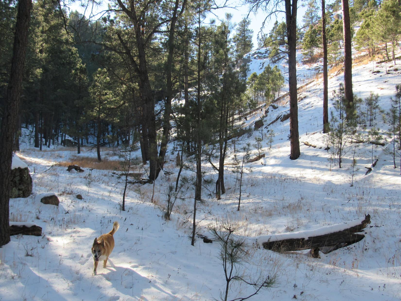
Lupe and SPHP set off following USFS Road No. 710.  At least 6″ of snow was down here in the shadow of Peak 5800.  The snowy road went W for nearly a mile up a long draw.  Other than a few animal tracks, the snow was pristine.  No one comes here this time of year.  Lupe ran sniffing around in the forest.

New Year’s Eve Peak (6,046 ft.) was Lupe’s destination.  The mountain’s name is a private one.  Officially, no name is shown on the maps.  Lupe was on her 4th trip to the mountain.  She had first climbed it on the last day of 2012, which was how it got it’s name.  Two years later, she returned on the last day of 2014.  Since then, climbing New Year’s Eve Peak on or close to the last day of each year has become a Lupe tradition.

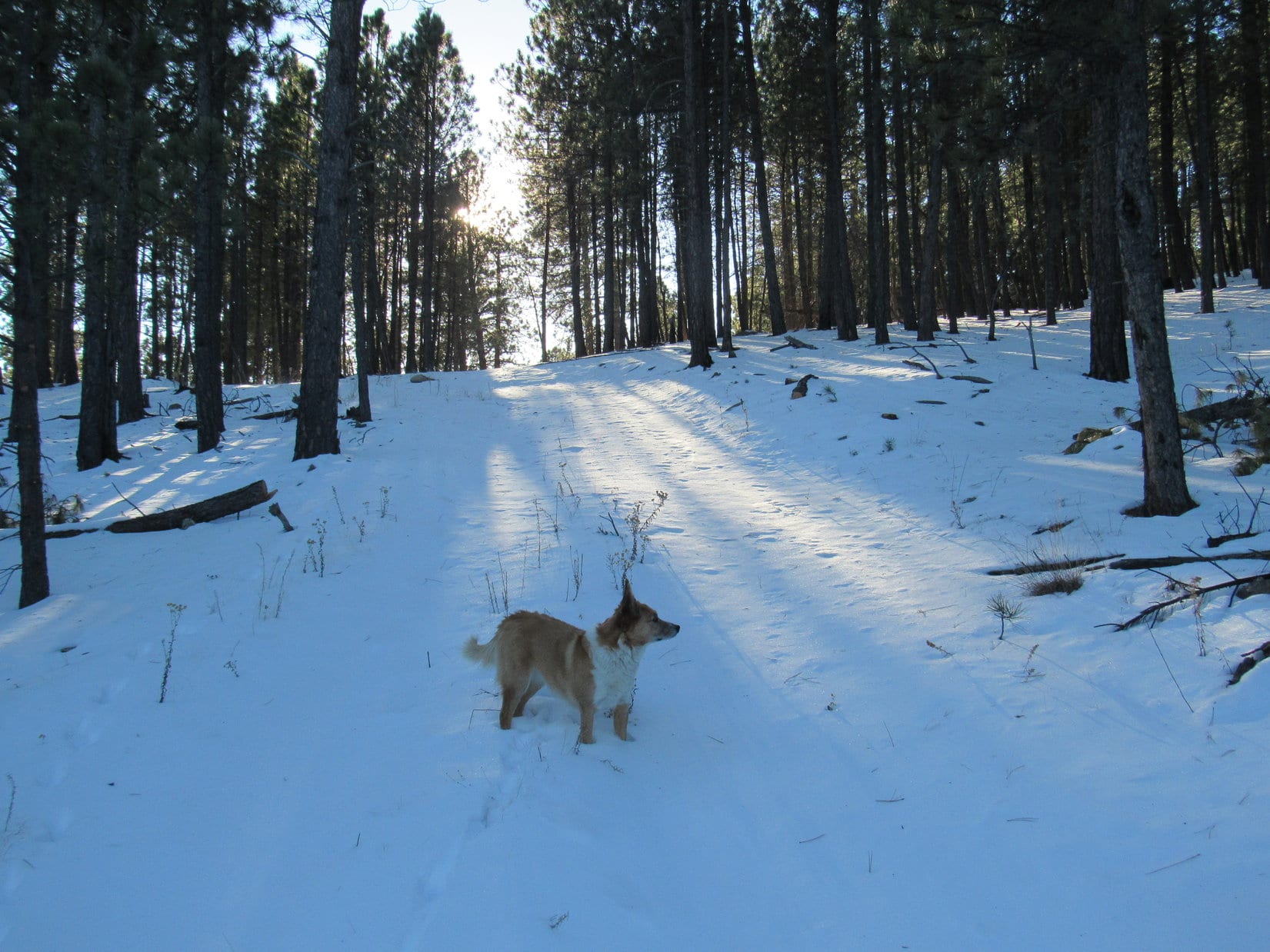
The scenic part of the journey starts as USFS Road No. 710 reaches the upper end of the long draw, and enters a thin forest of tall pines.  The road starts to curve S here.  Soon there are views of open country ahead.

Lupe on USFS Road No. 710 as it reaches the thin forest of tall pines at the upper end of the draw. Here, the road begins to curve S. Photo looks W.

In only a few minutes, Lupe was beyond the thin forest of tall pines.  She followed No. 710 S for a little way into open country, then left the road to climb gradually up through a snowy field toward higher ground to the SW.  She reached a minor ridge from which she had nice views of white hills and valleys toward the S and W.

Lupe reaches the minor ridge SW of the tall, thin forest. Five Points (6,221 ft.) is the wavy ridge in the distance on the L. Photo looks SSW.
On the minor ridge. Photo looks SW.
From here, Lupe would pass over the hill seen on the R on her way to the higher hill on the L. The higher hill is privately known as Pistol Point. Photo looks WNW.

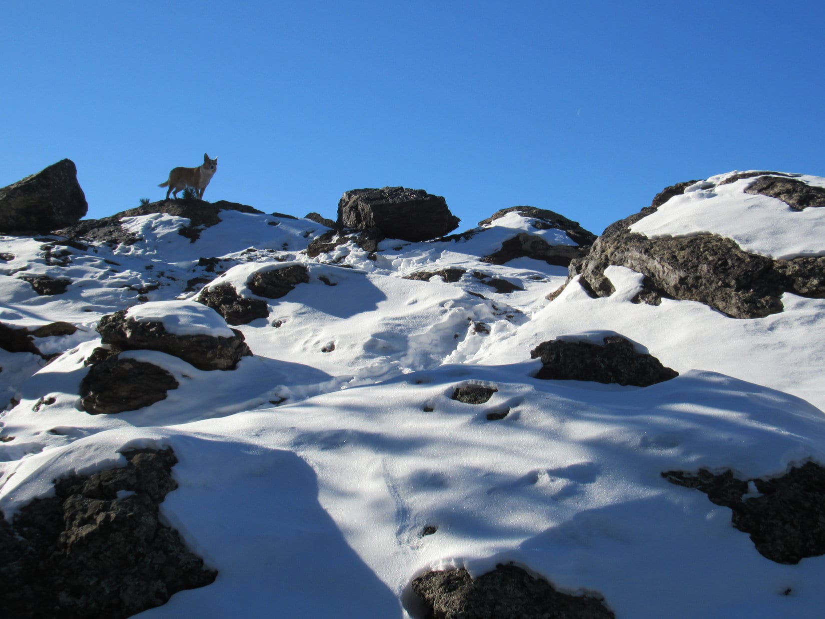
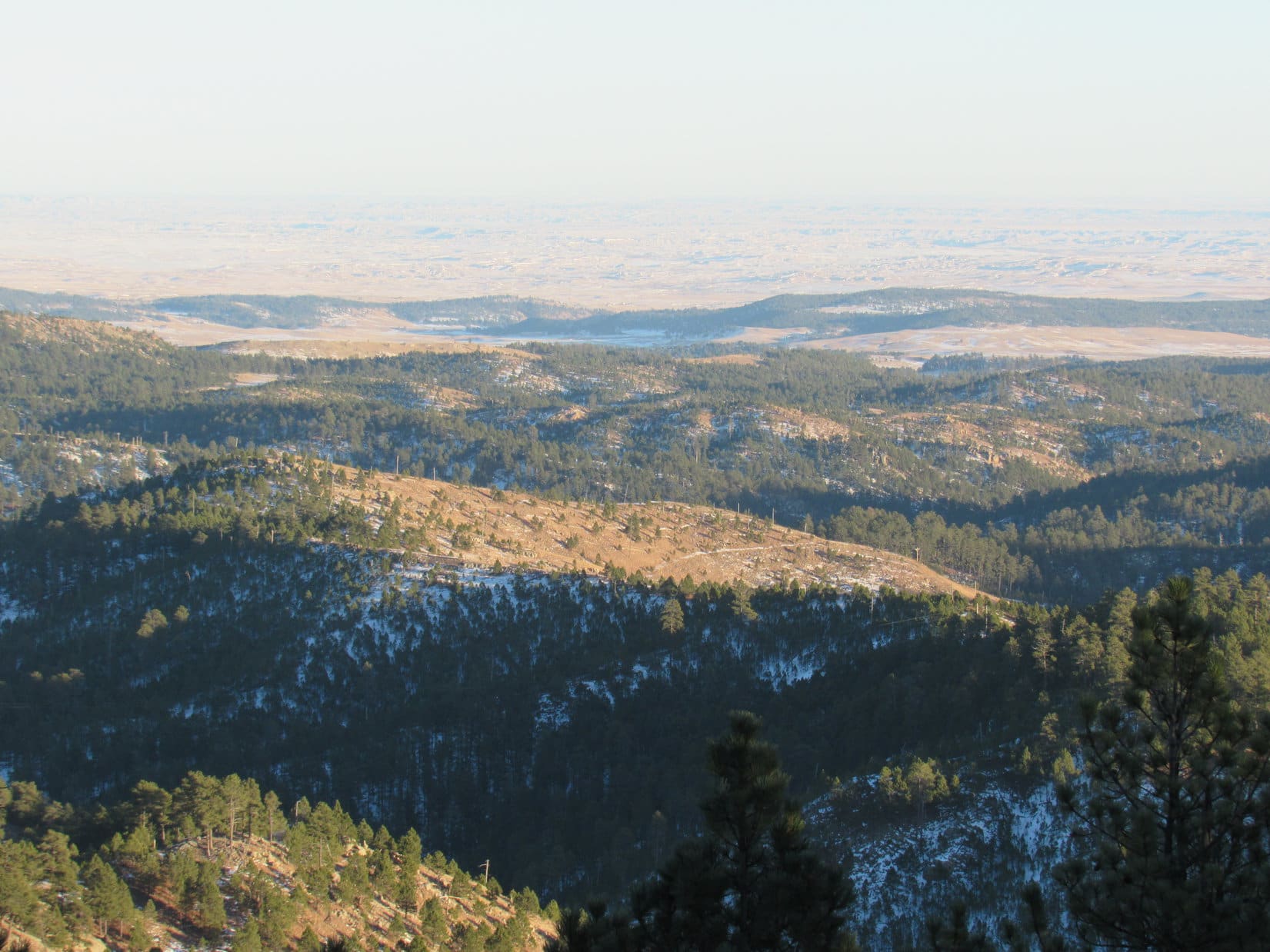
The vast majority of the Black Hills is thickly forested with Ponderosa pines.  One of the fun things about going to New Year’s Eve Peak is that Lupe gets to travel along quite a bit of high ground that burned in a forest fire years ago.  Consequently, there are open views along the route, which is unusual for most Black Hills territory.

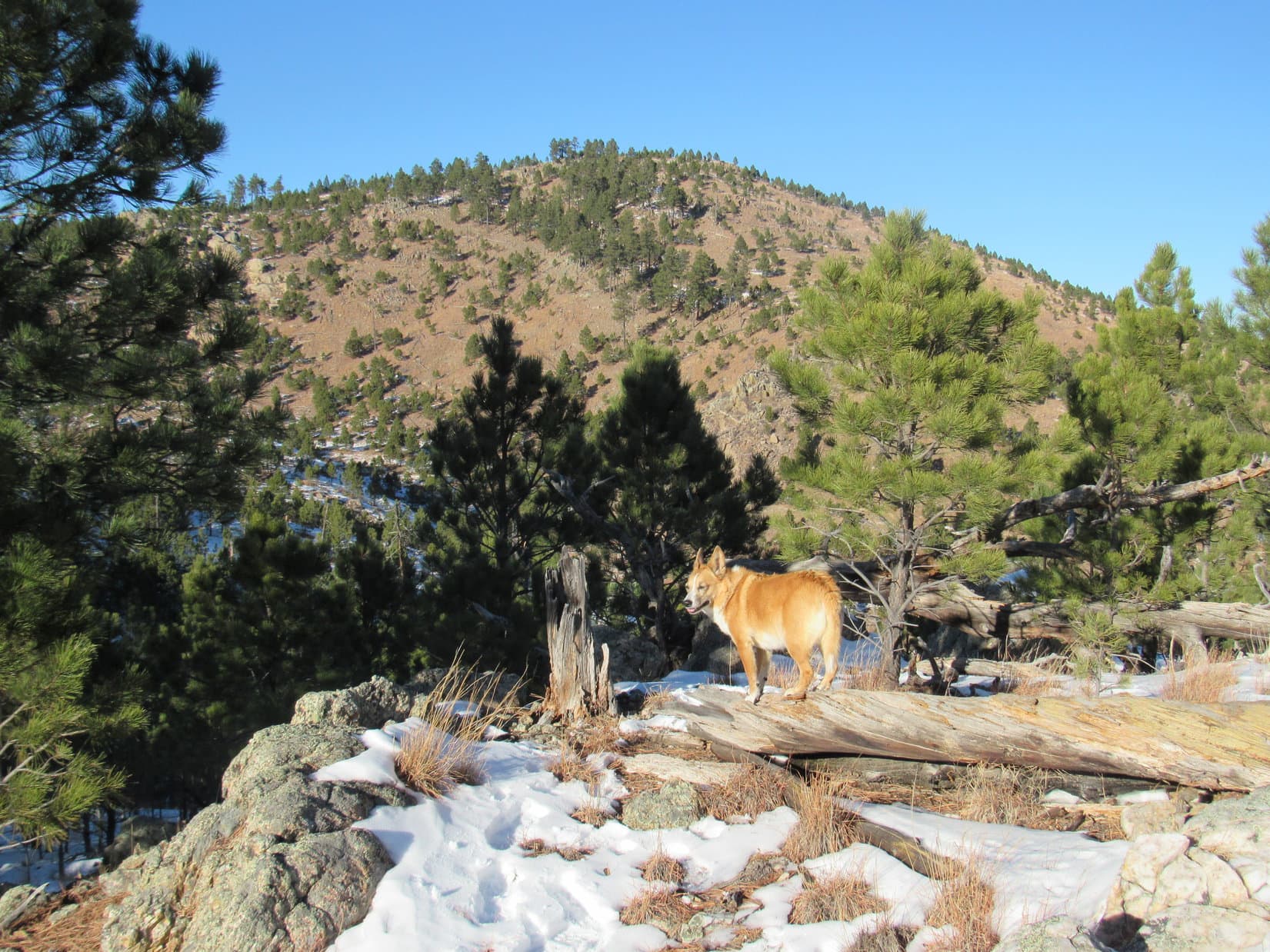
From the minor ridge, Lupe headed for Pistol Point, the highest ground she would reach in the open territory on her way to New Year’s Eve Peak.  To get there, she skirted to the S of High Point 5917, crossed a saddle to the W, and made a steep double climb up to the end of the ridge that sweeps down to the S and then SE from New Year’s Eve Peak.  The high point at the end of this ridge is Pistol Point.

Lupe reaches the rock formations at Pistol Point. New Year’s Eve Peak is the high point seen in the distance beyond her. Photo looks NW.
Peak 5800 is the semi-bare high hill at Center. Lupe started her expedition from the valley to the N (L) of Peak 5800. Photo looks ESE from Pistol Point.
Looking W from Pistol Point. Lupe would continue on toward the closest small hill, then turn R (N) to follow the ridgeline to New Year’s Eve Peak.

From Pistol Point, Lupe lost a little elevation going W to the closest small hill, then turned N to follow the long ridge leading up to New Year’s Eve Peak.  This ridge is fairly narrow, with rock outcroppings and various small prominences along the way.  Lupe went over all of them, and started the final climb up New Year’s Eve Peak.

Lupe sits on a big rock she reached not too far below the summit of New Year’s Eve Peak. Photo looks NW.
Peak 6070 is in the distance on the L. Photo looks NW.

Lupe reached the top of New Year’s Eve Peak.  She had returned to say good-bye to another year, even if she was a day early.  She hopped up on the highest rock on the mountain, near a small cairn.

Lupe reaches the summit of New Year’s Eve Peak to say good-bye to 2016. Photo looks W.
Looking WSW. The small summit cairn is in view.

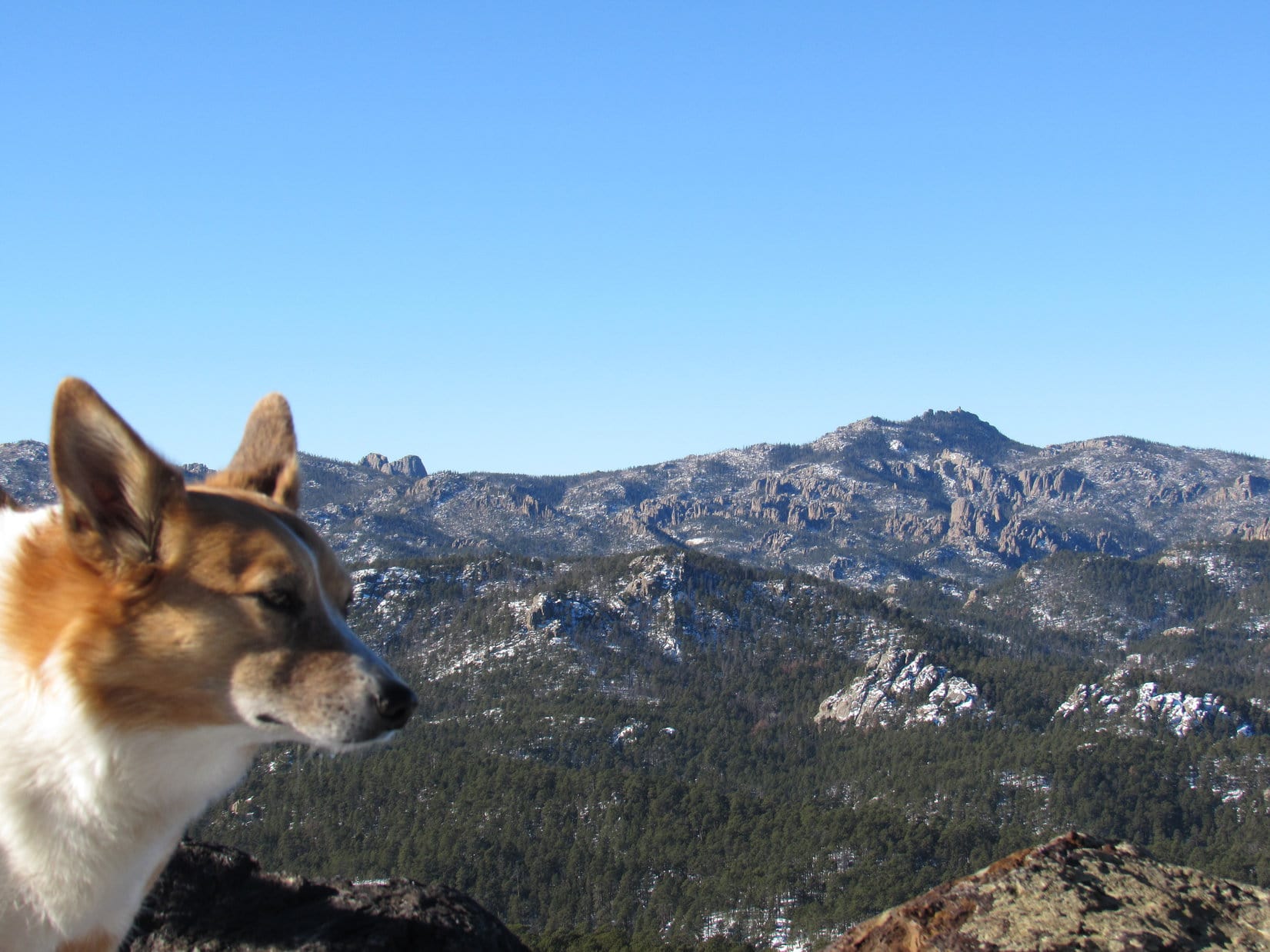
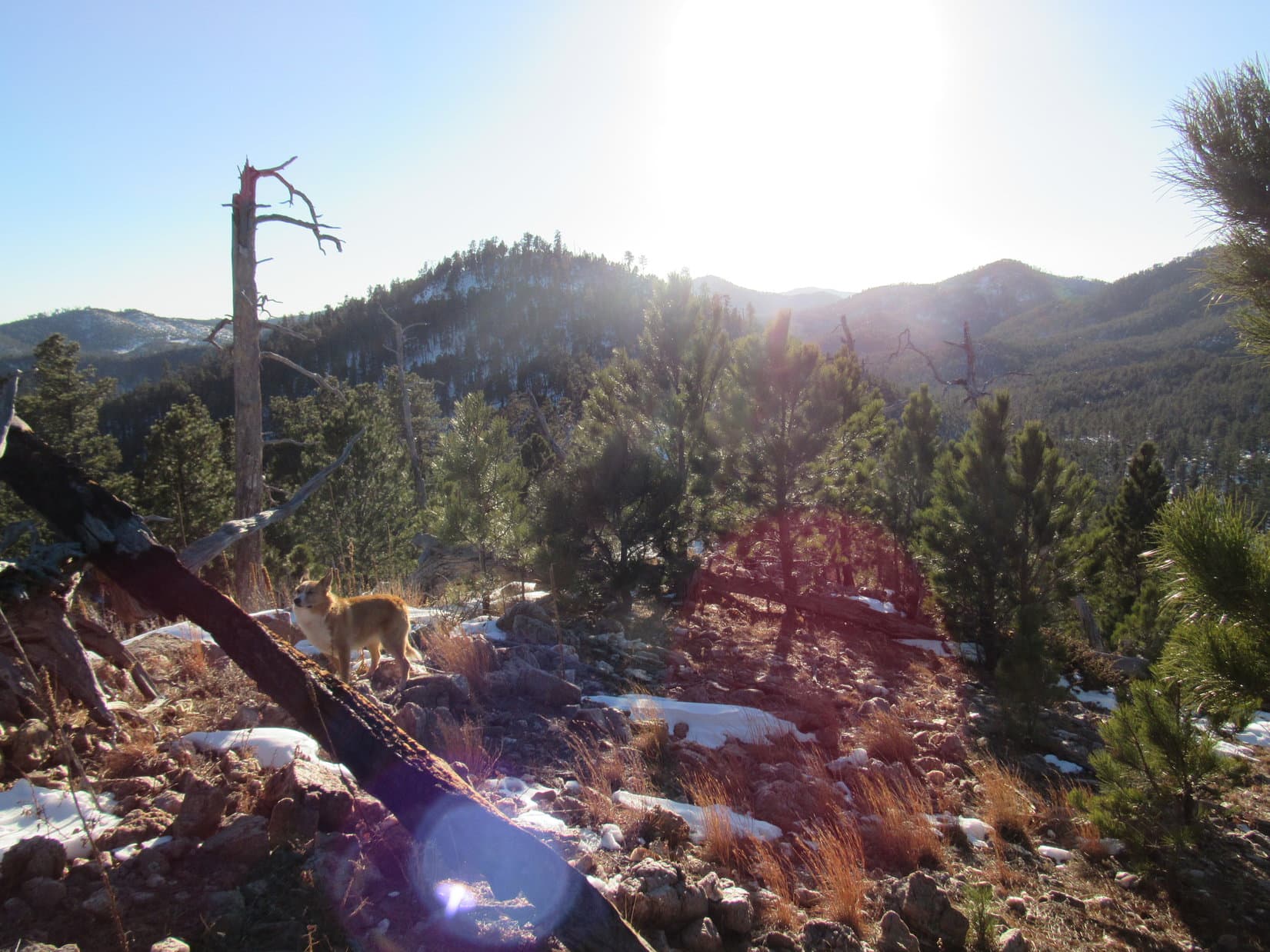
The first two times Lupe had been to New Year’s Eve Peak, on the last day of both 2012 and 2014, the top of the mountain had all been heavily forested.  However, when she’d returned on New Year’s Day in 2016, there had been a big change.  The upper S slope of the mountain had been heavily logged.  Now there are good views toward the S.

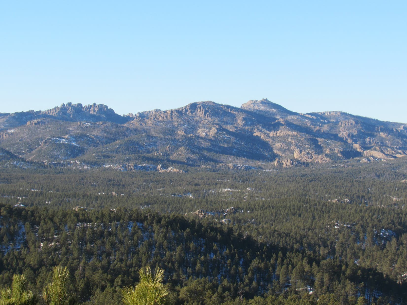
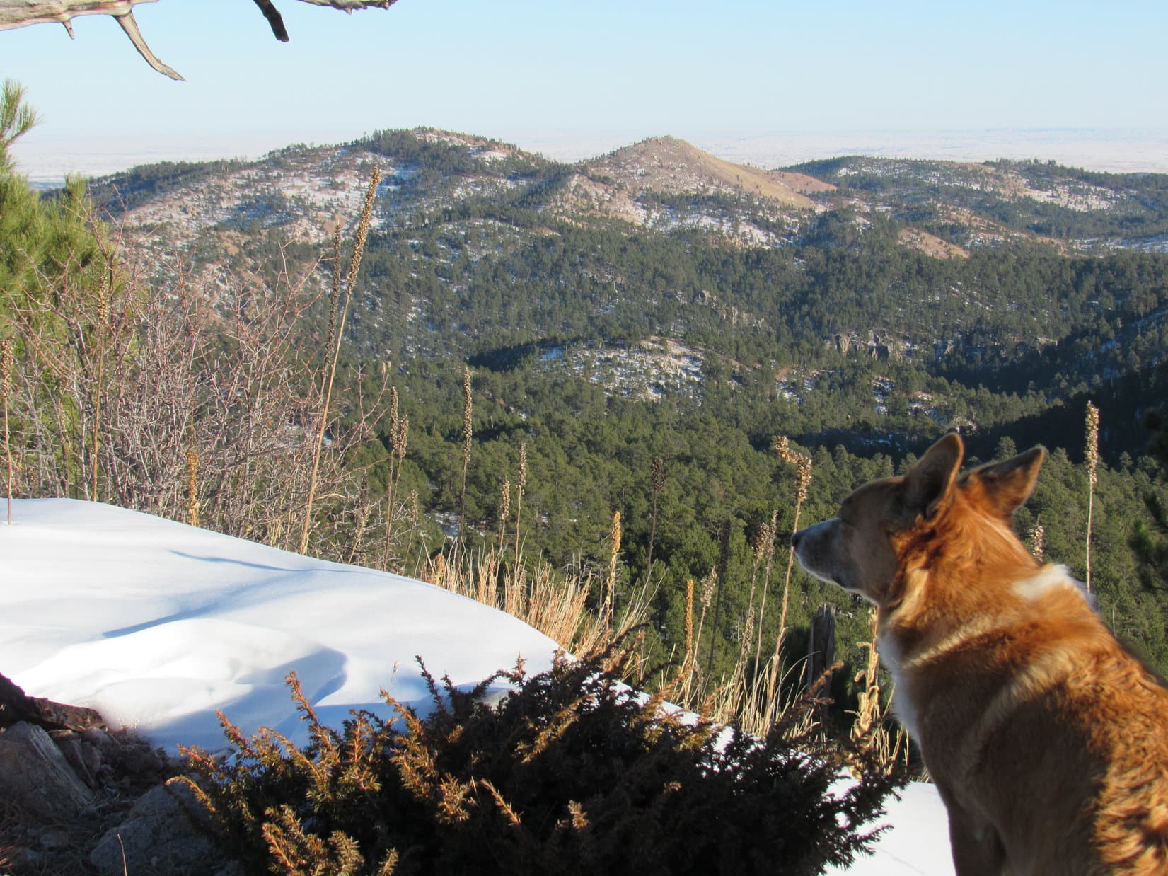
After tagging the summit, Lupe went to take a look at Harney Peak (7,242 ft.), the highest mountain in South Dakota.

Lupe stands at the S end of the summit area on New Year’s Eve Peak. Harney Peak, the highest mountain in South Dakota is visible on the R. Two years ago, the area where Lupe is standing was heavily forested. Back then it was difficult to get even a glimpse of Harney Peak. Sometime in 2015, this part of the mountain was heavily logged. Photo looks S.

After a quick look at Harney Peak, it was time for a break.  Lupe went over to the W edge of the summit area.  Sitting huddled together for a while, Lupe and SPHP contemplated the snowy view to the W.

Lupe perches on a rock at the W edge of the summit area. Lupe and SPHP took a break just below this rock. Photo looks W.
The snowy view Lupe and SPHP contemplated from New Year’s Eve Peak a day before 2016 drew to a close. Photo looks WNW.

The feeling wasn’t quite the same as when Lupe has been to New Year’s Eve Peak before.  After all, there was still one more day to go in 2016.  Somehow that one extra day still to come (due to 2016 being a Leap Year!) did seem to make a little difference.  There wasn’t yet quite that same sense of finality, even though 2016 had less than 34 hours left before drawing to a close.

Even so, it was a time to reflect on 2016, the fast fading year gone by.  Lupe’s 2016 had started right here on New Year’s Day.  She’d gone on 38 great Black Hills expeditions during the year.  She’d met mountaineer Jobe Wymore, and gone with him to the Wildcat Hills of Nebraska at the start of April.  She’d made a trip to the Laramie Mountains in late spring, and climbed Cloud Peak, the highest mountain in the Bighorn Range in Wyoming in July.

Lupe had even spent a day at Kabekona Lake in northern Minnesota in October.  And, of course, there had been her huge 41 day Summer of 2016 Dingo Vacation to the Canadian Rockies, Yukon and Alaska where she’d had so many excellent adventures.

Yes, Lupe had been one lucky Carolina Dog in 2016!  Sadly, now it was all over and done.

A cool N breeze was blowing.  The temperature had dropped considerably since Lupe had left the G6.  Off to the NW, dark clouds were on the far horizon, but were on their way.  Just like 2016, Lupe’s time on New Year’s Eve Peak was almost over.  Lupe went to see the views to the S again.

Harney Peak (R of Center) from New Year’s Eve Peak. Photo looks S.
Boulder Hill (5,331 ft.) is the knob on the L. Silver Mountain (5,405 ft.) is the bare hill at Center straight up from Lupe. Frozen Sheridan Lake is on the R, with Calumet Ridge (5,601 ft.) beyond it. Lupe had seen a mountain lion on Bluelead Mountain (5,170 ft.) near Calumet ridge on Leap Day 2016! Photo looks SE.
Boulder Hill(L) and Silver Mountain(R). Photo looks SE using the telephoto lens.
Harney Peak(R). Photo looks S using the telephoto lens.

Before leaving New Year’s Eve Peak, Lupe returned briefly to the summit.

Back on the summit. Photo looks N.
On New Year’s Eve Peak (6046 ft.).

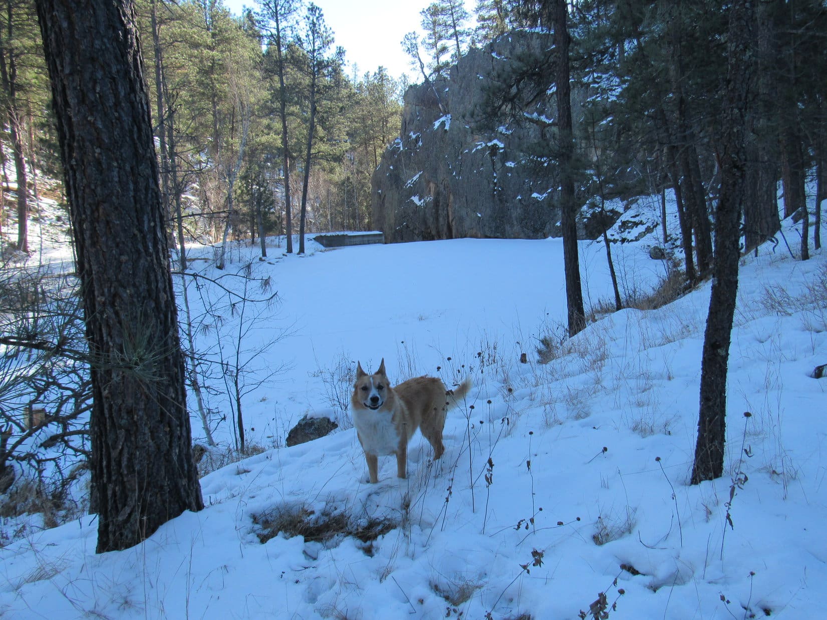
It was time to start back.  Lupe started down the mountain, retracing the route she had taken to New Year’s Eve Peak.

Lupe starts down New Year’s Eve Peak. She has barely left the summit here. Evidently, something was hiding among these rocks. Lupe clambered all over them, sniffing excitedly for 10 minutes before she was willing to give up the hunt. SPHP never saw whatever had caught her attention. Photo looks N.
Going down the S ridge. The ridge becomes much narrower and rockier than this a short distance farther ahead. In some places, Lupe encountered snow drifts 2 feet deep. Photo looks S.
Approaching Pistol Point. Pistol Point is another privately named location. The name comes from the rock near the top that looks like the handle of a pistol jammed into the ground. Photo looks E.
Near the pistol handle rock that gave Pistol Point its name. Photo looks E.
Peak 5800 (Center) from Pistol Point. Photo looks E.

By the time Lupe reached Pistol Point again, the clouds that had been far off to the NW were moving in.  SPHP started to realize that Lupe might be treated to some fairly dramatic skies on the rest of the way back to the G6.  With the sun already quite low in the SW, Lupe’s next to the last sunset of 2016 might be pretty sweet!

The skies were becoming steadily more interesting as Lupe came down from Pistol Point. Harney Peak (Center) is in view beyond the snowy ridge. Photo looks S.
Another look.
Shadow moved over the land as dark clouds sped in from the NW. Off to the E, Peak 5800(L) was still in sunlight. Photo looks ESE.
The sun was getting low as the clouds moved in. Lupe and SPHP hoped for a colorful, dramatic sunset. Five Points is the wavy forested ridge in the distance on the L. Photo looks SW.
Due to a hole in the clouds, Lupe is briefly bathed in sunshine again. Photo looks NW toward High Point 5917.

Lupe reached the minor ridge SE of High Point 5917.  A colorful sunset seemed increasingly likely.  Instead of going straight back across the field to USFS Road No. 710, where it would be hard to see much of the sunset, Lupe and SPHP traveled E along the minor ridge, trying to keep the view to the SW in sight.

Harney Peak (Center) from the minor ridge as the sunlight fades. Photo looks S.

Lupe was near the top of a small hill mid-way between High Point 5917 and Peak 5800 when the next to the last sunset of 2016 reached its peak of perfection.  From this small hill, Lupe sends best wishes to all her fans for a very Happy New Year 2017 full of fun and exciting adventures of your own!  (5:06 PM, 28°F)

Lupe’s next to the last sunset of 2016. Photo looks SW.

Lupe wishes everyone a very Happy New Year 2017!

Links:

Next Black Hills Expedition                    Prior Black Hills Expedition

Expedition No. 150 – New Year’s Eve Peak & Peak 5800 (1-1-16)

Expedition No. 221 – Peak 5800 & New Year’s Eve Peak (1-7-18)

Want more Lupe adventures?  Choose from Lupe’s Black Hills Expeditions Adventure Index or Master Adventure Index.  Or subscribe free to new Lupe Adventures.

Black Hills, SD Expedition No. 186 – Iron Mountain & Peak 5440 (12-23-16)

The cold came first.  Single and low double digit highs.  Subzero nights.  Ten days later, the snow arrived.  Lupe was in for a white Christmas.

Yes, Christmas was coming, and what Lupe wanted most for Christmas was action!  All these days laying around waiting for the weather to improve were excruciatingly dull for the Carolina Dog.  Three weeks into December, a break in the weather came.  Three days with highs in the 40’s.  A little snow melted the first two days.  Only one day remained before things turned cold again.

Lupe’s Christmas wish was going to be granted a little early.  When she saw SPHP starting to get the pack ready, Loop was as excited as if she had caught Santa Claus himself coming down the chimney.  Leaping!  Barking!  Hurry!  Hurry!  Lupe was anxious to go.

SPHP did a poor job of hurrying.  Much of the morning got chewed up by pre-Christmas errands.  Two days after winter solstice, this wasn’t going to be a very long expedition.  Lupe didn’t care.  She was taking what she could get.

Iron Mountain (5,446 ft.) was once again on the way to Lupe’s peakbagging objective.  Since Iron Mountain Road essentially winds all the way up to the top of Iron Mountain, Lupe stopped briefly to check out the view from the summit (11:42 AM, 41°F).  Maybe the Black Hills looked more like Christmas now that there was some snow around?

Lupe arrives up on Iron Mountain on her first Black Hills expedition in 19 dreadfully long days!

Mount Rushmore (5,725 ft.) from Iron Mountain. Lupe saw some snow around, but there wasn’t any up in the trees to make the views look Christmas white.  Photo looks NW.
Harney Peak (7,242 ft.) from Iron Mountain. Photo looks W.

From Iron Mountain, Lupe saw some snow around, but the scene wasn’t exactly a winter wonderland.  There wasn’t any snow up in the trees to make things really look Christmas white.  Lupe and SPHP returned to the G6 and continued on.

Lupe’s peakbagging objective for the day was Peak 5440.  Although the mountain is only 0.25 mile E of the Needles Highway (Hwy 87), Lupe would start for it from Center Lake (12:04 PM, 45°F), 2 miles to the NE.  Her actual route would be longer than that.  After all, Lupe was here to enjoy the day, not to be done with it all as soon as possible!

Lupe started for Peak 5440 here at Center Lake. Center Lake looked plenty white enough, with a good 6″ of snow or more. Photo looks SE.

From Center Lake, Lupe climbed an embankment to reach a road W of the lake.  The map showed this road would lead to some kind of trail following Grace Coolidge Creek to the SSE.  The road climbed a little to the SW, then turned S and dropped down to creek level.

It turned out the trail along Grace Coolidge Creek was actually an abandoned dirt road.  That made it easy to follow, even with half a foot of snow on the ground.  Lupe had a great time looking for squirrels in the forest, while SPHP plodded along.  She found several to bark at that had emerged to enjoy the relatively warm, sunny afternoon.

On the abandoned road that serves as a trail near Grace Coolidge Creek.

Despite the recent long cold snap, Grace Coolidge Creek wasn’t entirely frozen.  In places there was still open flowing water.  Even where there wasn’t, the ice couldn’t be trusted.  The trail crossed the creek a number of times.  It wasn’t a problem, since a single, long sturdy plank provided a footbridge at each crossing.

Lupe pauses on the snowy trail to listen and look for squirrels. She had some success finding squirrels that had emerged to bask in the sunshine on this relatively warm afternoon.

While the mighty squirrel hunter was busily occupied, SPHP was looking for the turn where Lupe needed to leave the creek to start climbing.  The plan was to follow a side trail up a canyon to the W passing N of High Point 4924.  There was no telling what that side trail or canyon might look like.  SPHP rejected a couple of possibilities after comparing actual terrain to the topo map.

The turn couldn’t be much farther.  Lupe came to a place where the trail was about to cross to the E side of the creek again.  Ahead was a small concrete dam next to the base of a natural solid rock wall.  A narrow side canyon full of trees veered off to the NW.

The terrain seemed right, but at first there didn’t appear to be any trail going up the canyon.  That would be bad news.  Lupe and SPHP left the trail by the creek to investigate further.

Yes!  Lupe came across a faint, remnant of a road.  Clearly, it had been a long time since any vehicle had come this way.  The old road was impassable for vehicles now, but looked easy enough to follow on foot and paw.

Lupe looks for the turn to the W. A little concrete dam on Grace Coolidge Creek next to a natural wall of rock is seen beyond Lupe. This was where Lupe needed to leave the creek and start following a narrow side canyon leading NW. Photo looks S.

Lupe left Grace Coolidge Creek behind, following what remained of the ancient road going NW up the narrow side canyon.  The canyon eventually broadened out becoming a wider valley, which wound around toward the W.  SPHP wasn’t entirely certain Lupe had taken the correct route, but things seemed to be matching up pretty well with the topo map.  Lupe passed to the N of a hill which was likely High Point 4924.

This valley was a beautiful and obviously seldom visited place.  Lupe gained elevation steadily, but so did the sides of the valley.  There was lots of snow, but it wasn’t too deep for Lupe to get through.  The big disappointment was that there weren’t nearly as many squirrels here as back along the creek.

For a mile or so, everything seemed fine, but then the valley narrowed sharply, becoming a canyon again.  What was left of the old road had completely vanished.  The canyon floor became increasingly rocky and steep.  This didn’t seem right.  The topo map had shown this route climbing gradually toward Pass 5111.  SPHP halted for another look at the map.

Lupe having a good time in a seldom visited valley W of Grace Coolidge Creek. She is already more than a mile from the creek, near the start of a side valley SPHP took by mistake. Photo looks W.

The map showed Lupe was likely in a minor side canyon SPHP mistook for the main route to Pass 5111.  Lupe was probably N of High Point 5196.  If so, she wasn’t off track by much at all.  Lupe could easily backtrack a short distance back to the main route, or she could climb up the ridge to the N, then follow it W to Pass 5111.

Lupe continued up the narrow canyon.  She left it as soon as an opportunity arose to climb up onto the ridge to the N.  It wasn’t hard to reach a high point along the ridgeline.  From here, Lupe could see a big hill to the N.  SPHP tried to place it on the map.  It seemed to be a hill 0.25 mile NE of Pass 5111.

Lupe reaches the ridgeline N of High Point 5196. She could see this hill off to the N. After consulting the topo map, SPHP concluded this hill was 0.25 mile NE of Pass 5111.

Off to the SW, barely in view due to the forest, was an even higher hill that might well be Peak 5440.  At least everything seemed to make sense again.  Lupe headed W along the ridgeline, climbing steadily.  She soon came to a road that led her right to Pass 5111.  Lupe could see Harney Peak to the NW on the other side of the pass.

At Pass 5111. Harney Peak (Center) is in view. From here, Lupe only needed to follow a ridgeline S to reach Peak 5440. Photo looks NW.

From Pass 5111, Lupe only had to follow one more ridge SSW to Peak 5440.  This ridge has a couple of high spots along the way.  Although the topo map didn’t show any trail leading toward Peak 5440, Lupe found a side road that took her SW partway up onto this next ridge.

Lupe on a snowy side road that went SW from Pass 5111 partway up onto the ridge that would take Lupe to Peak 5440. Photo looks SW.

Lupe reached the ridgeline.  She followed it SSW, still climbing, until she reached the first of the two high points along the way.  This first high point was the highest, and open enough so Lupe had some great views from here.

Cathedral Spires (6,840 ft.)(L) and Harney Peak (7,242 ft.)(R of Center) from the first high point Lupe came to on the ridge leading to Peak 5440. Photo looks NW.
From here, Lupe had her first good look at her peakbagging objective, Peak 5440(L of Center). It was less than 0.5 mile away. Photo looks SSW.
Looking NNW. Cathedral Spires(L), Harney Peak(L of Center) and Peak 5688(far R). Lupe recently visited Peak 5688 for the first time on a windy day in November on Expedition No. 184.
Looking E.

Lupe continued S along the ridge.  She lost some elevation coming off the first high point, crossed over the second lower high spot, and began a fairly steep climb up the forested N face of Peak 5440.  Soon she reached the top of the mountain.  A small rock outcropping only a few feet high toward the NW was the true summit.

Success! Lupe on the true summit of Peak 5440. Harney Peak is in view beyond her. Photo looks NW.

Lupe had her peakbagging success for the day!  Time for a break.  SPHP sat on a rock near the true summit munching an apple.  Lupe wasn’t hungry or thirsty.

At least this expedition had accomplished something!  Lupe was tired enough to want to curl up and lay down next to SPHP for a little bit.  The temperature had been dropping.  It was now close to freezing, yet Lupe insisted upon laying on a patch of snow.

Break time lasted only until the apple was gone.  The sun was getting low.  Lupe and SPHP explored the summit area, which was of modest size.  Most of the summit area was SE of the true summit.  There were good views in most directions, although forest screened everything to the NE.

Looking SE from the true summit.
Cathedral Spires through the telephoto lens. Photo looks NW.
Looking up toward the top of Peak 5440 from the S.
Looking S from the top.
Mount Coolidge (6,023 ft.)(L of Center). Lupe hasn’t been to Mount Coolidge since Black Hills, SD Expedition No. 13, way back on 3-22-12. Photo looks SW.
Looking SE using the telephoto lens.

Time to be heading back, or it would get pitch black out before Lupe would reach the G6.  Lupe and SPHP left Peak 5440 heading down the N slope.  Lupe would retrace her route up back to Pass 5111.  There, a decision would have to be made on which way to go.

Lupe sniffs around in the forest on her way back down the N slope of Peak 5440.
Looking back at Peak 5440 from the N ridge. Sunlight illuminates some of the pine trees for a little while longer. Soon the sun would be down. Photo looks S.

The sun was down by the time Lupe reached Pass 5111 again.  Which way?  Taking the road going NNW would quickly bring Lupe down to the Needles Highway only 0.25 mile away.  It was the safest choice.  Lupe could then take known roads back to the G6.

The other option was the road going SE from the pass.  The topo map showed it going down to the canyon leading to Grace Coolidge Creek.  Once at the creek, Lupe could easily follow the trail back to Center Lake.  This route was more remote, and a little chancy.  Twilight would fade.  However, Lupe should reach the canyon in plenty of time to verify she was on the right track before it got dark.

Lupe took the remote route instead of going to the highway.

Soon there was a problem.  The road didn’t go SE as expected.  Instead, it went NE, staying high on a ridge.  Lupe pressed onward.  As long as the road didn’t play out, NE was actually the shortest route back.

The luck of the Dingo held.  The road didn’t play out.  It remained high on the ridge until finally descending to come out at the Black Hills Playhouse.  Lupe had taken a shortcut on a road not shown on the map.  All was well.  White Dingo magic again!  (5:06 PM, 28°F)

A last look back at Peak 5440 from the high point SW of Pass 5111.

Links:

Next Black Hills Expedition                      Prior Black Hills Expedition

Want more Lupe adventures?  Choose from Lupe’s Black Hills Expeditions Adventure Index or Master Adventure Index.  Or subscribe free to new Lupe Adventures.