Black Hills, SD & WY Expedition No. 168 – Wildcat Peak, Fanny Peak & Summit Ridge (4-21-16)

Every time SPHP woke up, there they were.  Big soft Dingo ears bathed in moonlight stood erect, listening.  Lupe was too excited to sleep, instead she was watching – fascinated by whatever was going on in the darkness outside on Elk Mountain.  Now and then, SPHP let her out of the G6.  The excited American Dingo wandered back and forth between moonlight and shadows, sniffing the night air.

Finally, the nearly full moon hung low in the W.  Dawn was coming soon.  SPHP dozed a while longer.  The sun was up when SPHP came to again.  Lupe, of course, was wide awake, still watching events on Elk Mountain from her pile of gear, blankets and pillows.  She was glad when she realized her long watch was over.  It was time for action!

SPHP repositioned the G6 a mile farther SW, at the junction of USFS Roads No. 118 & No. 123 (6:21 AM, 41°F).  Lupe was 0.25 mile across the border into Wyoming.  She would start her journey to Wildcat Peak (5,500 ft.) from here.  Although Wildcat Peak was less than 2 miles away back in South Dakota, to get there Lupe had to cross an equally high un-named ridge first.  Lupe and SPHP set off following a faint old jeep trail SE.

The morning was cool, clear and bright.  It was great getting off to an early start!  The old jeep trail wound around, but stayed very close to the E edge of the ridgeline, gaining elevation steadily.  Lupe got pretty high up on the ridge.  Elk Mountain was in view just to the N.  Lupe could see the Elk Mountain Lookout Tower (5,662 ft.) at the far NE end of the mountain, but the true summit at the Elk Benchmark (5,669 ft.) remained out of sight to the NW.

Lupe on a big rock outcropping partway up the N end of the un-named ridge. Photo looks N at Elk Mountain. Lupe had just been to the Elk Benchmark (5,669 ft.) at the far NW end of Elk Mountain on Black Hills, SD Expedition No. 167 the day before.
Lupe on a big rock outcropping partway up the N end of the un-named ridge. Photo looks N at Elk Mountain. Lupe had just been to the Elk Benchmark (5,669 ft.) at the far NW end of Elk Mountain on Black Hills, SD Expedition No. 167 the evening before.

The jeep trail didn’t go all the way up to the top of the un-named ridge.  It got quite high, but then took a more level route through a thin forest on the W side of the ridge.  Lupe and SPHP stayed on the jeep trail until it virtually disappeared.  Then Lupe abandoned it to resume a slow, steady climb while continuing S.  She eventually reached the top of the ridge well S of its highest point.

Lupe and SPHP followed the un-named ridge to its S end, where Lupe’s first peakbagging objective, Wildcat Peak (5,500 ft.), was now in view.

Wildcat Peak from the S end of the un-named ridge. Lupe had already lost some elevation by the time she reached this point. Photo looks SE.

Wildcat Peak was less than 0.75 mile away now, but to get to it, Lupe had to go down into a big intervening saddle area.  On the way, she had to lose virtually all of the elevation she had just gained coming up the un-named ridge.  There was no choice, though, but to just go ahead and do it.

Lupe in the saddle area NW of Wildcat Peak. Photo looks SE.

After crossing the saddle area, Lupe and SPHP started the climb up the NW slope of Wildcat Peak.  There weren’t any old roads or jeep trails here, but the climb wasn’t particularly steep or difficult.  Lupe found the true summit of Wildcat Peak up at the very NW end of a rocky summit ridge.  A big boulder, clearly higher than any of the others, was the very top of the mountain.

Lupe reaches the top of Wildcat Peak! The big boulder next to her was the very highest rock on the mountain. Photo looks NNW.
Lupe and the Wildcat Peak summit boulder.
Lupe proclaims this mountain American Dingo Peak! Bring it on wildcats!

From the highest boulder on Wildcat Peak, the rocky summit ridge extended off to the SE for at least several hundred feet.  Most of it wasn’t much lower than the big boulder crowning the NW end of the ridge.  A lot of deadfall timber strewn among the rocks made the terrain considerably more difficult to navigate than it should have been.  Lupe and SPHP went to the SE end of the summit ridge to check out the view.

The view was awesome!  Lupe could see Sullivan Peak (4,967 ft.), Red Point (4,680 ft.), and Twin Buttes (4,949 ft.) where she had been on Black Hills SD, Expedition No. 166 just 11 days before.  It was fun to see them all again from Wildcat Peak!

Looking SSE from Wildcat Peak. Sullivan Peak is the highest of the most distant of the barren ridges located just R of Center. Red Point is the small forested hill at Center seen right below a barren ridge coming down to the L from Sullivan Peak. Twin Buttes are the two most distant barren ridges visible near the R side of the photo. Lupe had visited all 3 of these mountains only 11 days ago on Black Hills, SD Expedition No. 166.

After taking a little break while admiring the views to the S, Lupe and SPHP returned to the big boulder at the NW end of the summit ridge.  Lupe went out on a rock ledge sticking out just below it to the NE for a final look around.

Lupe on a rock ledge near the summit boulder. Photo looks N. The part of Elk Mountain where the lookout towers sits is the barren ridge on the L.

Climbing Wildcat Peak had been fun, but SPHP had several more peakbagging goals in mind for Lupe before the day was over.  Lupe and SPHP left the summit of Wildcat Peak heading back down the NW spine of the mountain.

Lupe starts back down the NW spine of Wildcat Peak. The big summit boulder looms above her. Photo looks SE.
The un-named ridge (L) and part of Elk Mountain (R) from Wildcat Peak. Photo looks NNW.

Lupe’s route back to the G6 was essentially the same one she took to Wildcat Peak.  The only significant variation was that on the way back, she went all the way up to the very top of the un-named ridge NW of Wildcat Peak.

Lupe stands next to the summit boulder on top of the un-named ridge NW of Wildcat Peak. This summit boulder sure didn't measure up to Wildcat Peak standards, but the view of Wildcat Peak was very nice. Photo looks SE.
Lupe stands next to the summit boulder on top of the un-named ridge NW of Wildcat Peak. This summit boulder sure didn’t measure up to Wildcat Peak standards, but the view of Wildcat Peak was very nice. Photo looks SE.

The day had warmed up considerably by the time Lupe reached the G6 again (10:12 AM, 59°F), but it was still very pleasant out.  Before departing, Lupe and SPHP sat in the shade of a big tree and ate brownies, a pure nutritious health food snack Carolina Dogs love.  Re-energized, Lupe and SPHP headed out in the G6 toward Lupe’s next peakbagging goals.

Near the junction of Boles Canyon Road and Roby Canyon Road (USFS Roads No. 117 & No. 264 respectively), SPHP parked the G6 again (10:49 AM, 61°F).  Lupe’s next objective was Fanny Peak (5,884 ft.) more than 2 miles to the NNW.  SPHP’s old USFS map showed USFS No. 264.1A leaving Boles Canyon Road somewhere nearby.  If Lupe and SPHP could find it, No. 264.1A would lead Lupe NNW to a point a short distance E of Fanny Peak.

Lupe and SPHP backtracked a little S along Boles Canyon Road looking for No. 264.1A.  Just N of a short bridge over a ravine, Lupe found a rough track heading N.  It was blocked to vehicles by boulders and unmarked, but this was almost certainly No. 264.1A.  Lupe and SPHP followed the road N beginning a long, gradual climb.

Almost right away, there was trouble.  No. 264.1A went up a long sunny dry hillside.  Scraggly bushes and a few juniper trees dominated the parched landscape.  And cactus.  There was very little cactus right on the rocky road, but all around on both sides cacti grew in great spiny profusion.

Whether Lupe stepped on a small cactus somewhere along the way, or whether she could smell the cacti, SPHP didn’t know.  Her paws looked fine.  What was certain was that Lupe didn’t want to go this way.  She stood on the road and wouldn’t move.  SPHP put her leash on her to encourage her, and help make certain she didn’t get into the cactus.  This time, the leash barely made any difference to Lupe.  Her ears drooped.  She hated this place!

What to do?  Part of the problem was that Lupe had started from less than 4,800 feet of elevation down on Boles Canyon Road.  If Lupe could gain enough elevation, she would probably get above “cactus line” at some point.  SPHP decided to keep encouraging and helping Lupe, believing she could make it to Fanny Peak.

It was a long, slow process.  Lupe stopped again and again on the road.  Sometimes her ears drooped, and she resisted the tug of the leash.  Sometimes she just stood there in the bright sunshine smiling at SPHP, but not budging.  Now and then she was willing to go onward for a little way.  SPHP carried her for short stretches again and again.

Lupe stands smiling in the hot sun on No. 264.1A. Due to all the cactus growing in this parched landscape, she didn’t want to be here at all. Photo looks S at Elk Mountain.

It was sunny.  SPHP felt hot totally exposed to the sun.  Wearing a fur coat, Lupe must have felt that much hotter.  Repeatedly, Lupe and SPHP took temporary shelter in the shade of occasional large juniper trees next to the road.  Lupe drank a lot of water.  This really wasn’t much fun, but it wasn’t terrible either.  Despite the long, slow grind, Lupe was making progress and gaining elevation.

Somewhere around 5,600 feet, it turned out that a “cactus line” really did exist!  SPHP didn’t notice exactly where it happened, but suddenly the cactus was gone.  Ponderosa pines were growing among more prosperous looking juniper trees.  There was more shade.  Lupe started to perk up.  For a little while, SPHP kept Lupe on the leash, but it wasn’t too long before it was apparent the leash was pointless.  There wasn’t any cactus anywhere.  Hallelujah!

Lupe raced happily through the woods.  She was making great progress.  The road started leveling out as it entered a more purely pine forest.  Fanny Peak couldn’t be much farther away now!  SPHP stopped again to carefully study the topo map.  Without the topo map, it would have been very hard to find Fanny Peak.

The topo map showed that the road was supposed to pass along the E side of a 5,840 foot high un-named hill.  Less than 0.5 mile N of High Point 5840, there should be a couple more slightly higher hills to the W of the road.  The high ground formed an arc curving around to the S.  Fanny Peak was the high point at the S end, less than 0.33 mile from the road.

Soon the road did pass along the E side of a forested hill.  SPHP figured this must be the 5,840 foot high un-named hill.  Lupe continued on.  The road again passed along the E side of another hill.  SPHP was thinking Lupe must be getting very close to where she would need to turn W, when suddenly there was a hissing and thrashing noise coming from the hillside right next to the road.  A snake!

Snakes aren’t terribly common in the Black Hills, at least not in the upper elevations Lupe usually frequents.  Despite all her many adventures in the hills, Lupe has only encountered snakes on a very few occasions.  Lupe didn’t quite know what to make of this one.  She stood motionless a few feet away, simply staring at the strange unpleasant creature.

The snake was at least a few feet long, making it the biggest one Lupe had ever seen.  It wasn’t the least bit happy to see Lupe and SPHP.  The snake was hissing, coiling and thrashing around trying to look as scary as possible.

This unhappy bull snake along USFS Road No. 264.1A E of Fanny Peak was the largest snake Lupe had ever seen!

A glance at the snake’s head told SPHP there was nothing to fear.  It wasn’t poisonous.  The only poisonous snakes in the Black Hills region are prairie rattlers, and this wasn’t a rattlesnake.  It was almost certainly some sort of bull snake.  The snake was an exciting find, but it was harmless.

Of course, where there’s one snake, there may be more!  Lupe wasn’t as high up in the Black Hills as she normally is, and snakes are much more common at lower elevations in this territory.  Just the fact that the bull snake was out and about indicated that Spring had progressed far enough along to encourage the reptiles to slither out of their holes.

The bull snake was still having a hissing fit when Lupe and SPHP left it behind.  Somewhere pretty soon, Lupe needed to turn W.  When she came to an intersection not shown on the maps, SPHP decided this was the place.  Three slender pale blue posts stood near the intersection.  There were no other markers, and no road numbers.  One of the roads went W.  Lupe and SPHP followed it.

Lupe hadn’t gone very far on this new road when it started to lose elevation.  Rather than lose elevation, Lupe and SPHP climbed up a forested hill close by to the S.  There were so many trees, it wasn’t possible to see much, but SPHP did see that there was another forested hill about the same height a short distance to the W.  Lupe and SPHP headed over to it.

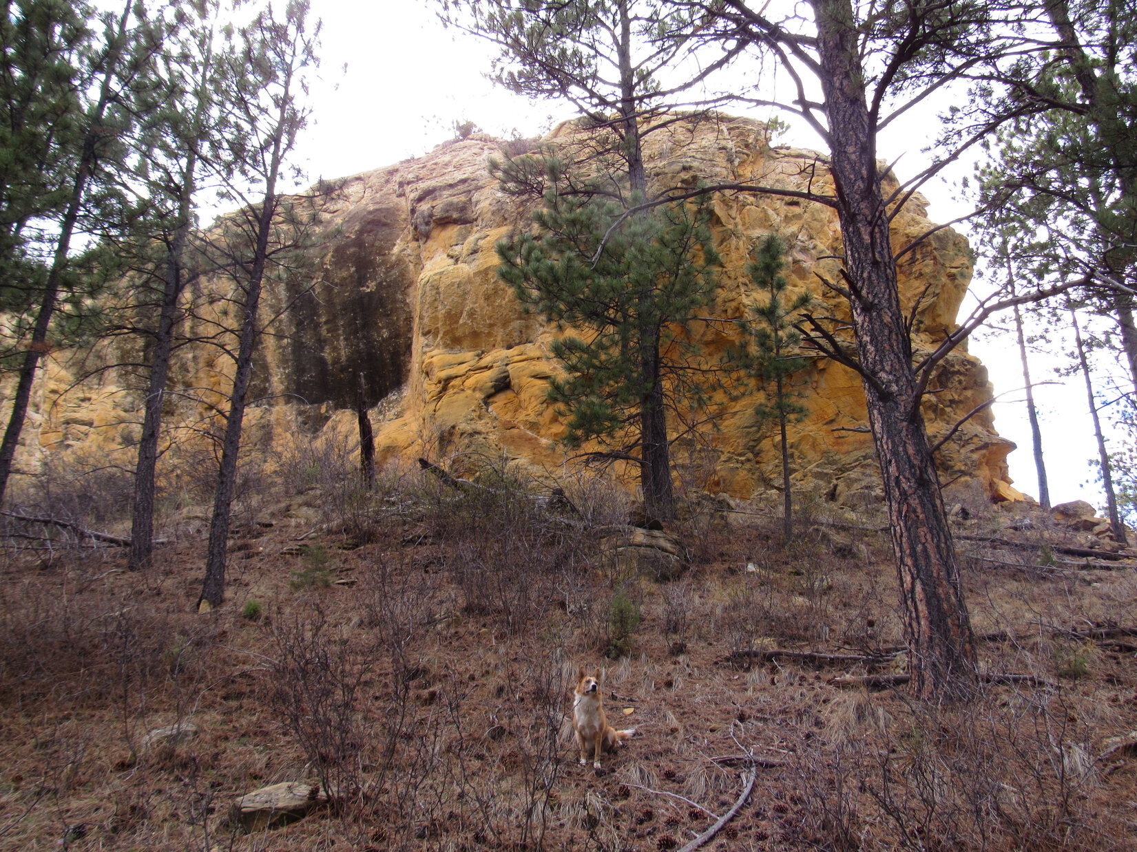
Lupe was soon up at the top of the 2nd hill.  The summit featured a collection of red rocks.  SPHP looked warily around for snakes, but saw none.  Trees again blocked the views, but it was possible to determine that there was an even higher hill somewhat farther off to the SSW.  Looking at the maps one more time, SPHP was almost certain that hill had to be Fanny Peak!

Lupe at the top of the closest little hill NE of Fanny Peak. Photo looks N.

Lupe and SPHP pressed on from the 2nd hill toward Fanny Peak, losing only minor elevation.  As Lupe got closer, she reached a barbed wire fence.  SPHP’s old USFS map showed Fanny Peak right on the South Dakota/Wyoming border, but the Peakbagger.com topo map showed the summit a short distance into Wyoming.  The fence was probably right on the border, which made sense.

Since the Black Hills National Forest ends at the border, Fanny Peak might well be on private property.  In any case, there weren’t any “No Trespassing” signs, and Lupe wasn’t going to harm anything.  Fanny Peak was only a short stroll to the SW from where Lupe went under the fence.  Lupe passed through a little meadow, before climbing a small forested hill to two large rocks at the summit.  The views left no doubt that Lupe really was on Fanny Peak (5,884 ft.)!

Despite all her travails getting here, Lupe attains the summit of Fanny Peak, Wyoming! Photo looks E.
Loopster stands on the money rock on Fanny Peak!

SPHP soon noticed that one of the two big pink rocks at the top of Fanny Peak contained a treasure!  It was a money rock!  In a small depression on top of the rock was a 1999 dime.

The 1999 dime in a depression on top of the money rock at the summit of Fanny Peak.

Lupe didn’t really need a dime.  As treasures go, she would have preferred a rawhide chew, ice cream, T-bone steak or a lot of other things instead.  Lupe and SPHP decided to leave the dime where it was.  No doubt some other bold peakbagger will be willing to brave cacti and snakes to claim it someday!

Forest pretty much hid any views toward the N from Fanny Peak.  The best view was to the S back at Elk Mountain where Lupe had visited the Elk Benchmark (5,669 ft.) yesterday evening and spent a long restless moonlit night.  Lupe could also see the 5,840 foot hill 0.33 mile to the SE where SPHP first realized Lupe was getting close to Fanny Peak.

The best view from Fanny Peak was to the S toward Elk Mountain. Lupe had been at the Elk Benchmark (5,669 ft.) there yesterday evening.
The best view from Fanny Peak was to the S toward Elk Mountain. Lupe had been to the Elk Benchmark (5,669 ft.) there yesterday evening.
Looking SE at the forested 5,840 ft. hill where SPHP first realized Lupe was getting close to Fanny Peak.
This photo shows most of the summit area on Fanny Peak, which wasn't very big. Photo looks W.
This photo shows most of the summit area on Fanny Peak, which wasn’t very big. Photo looks W.

By reaching Fanny Peak, Lupe had accomplished her 2nd peakbagging goal of the day!  Having braved cacti and snakes to get here, naturally she was quite proud of her accomplishment.  However, the view from the top was not at all encouraging as far as her chances of successfully completing her next goal went.

Lupe’s 3rd peakbagging goal was Frannie Peak (5,340 ft.), more than a mile to the W.  Between the trees, SPHP could catch a glimpse of it.  The view was discouraging.  Frannie Peak appeared to be a jagged ridge of red rock.  From this far away it was hard to know for certain, but the rock formations along the jagged spine of Frannie Peak looked too steep for Lupe and SPHP to climb.

SPHP believes this jagged red rock ridge is Frannie Peak, WY. At least from this perspective, it looked too steep for Lupe to climb. Photo looks W from Fanny Peak using the telephoto lens.

Even if the rock formations on Frannie Peak weren’t insurmountable, there were other problems, too.  There was no road SPHP knew of to Frannie Peak, which at 5,340 ft. was well below cactus line.  Although it wasn’t that far away, even a mile over rough ground through cactus country didn’t sound like any fun.  Getting back would double the distance, too.

A lot of time had already been lost due to cactus just getting to Fanny Peak.  A million cacti would seriously slow down any attempt to get to Frannie Peak, too.  Furthermore, there might be rattlesnakes!  SPHP pondered all these negative factors.  It would have been fun to find out if Lupe could climb Frannie Peak, but all SPHP truly expected was failure to reach the top, even if Lupe did manage to get over there.

Fanny Peak would have to suffice.  Frannie Peak was out!  As a consolation 3rd peakbagging goal, Lupe could continue N 2 more miles to the lookout tower on Summit Ridge (6,096 ft.).  Roads would take Lupe all the way there.  She wouldn’t be hindered by cacti or unclimbable rock formations.  Lupe hadn’t been to Summit Ridge for over 3.5 years.  It would be fun to go see it again.

Right or wrong, the decision was made.  Lupe and SPHP left Fanny Peak going back the way they had come.  Lupe returned to the intersection along USFS Road No. 264.1A where the three slender pale blue posts were.  Instead of turning S back to the G6, Lupe went N toward Summit Ridge.

Lupe about to begin her descent from Fanny Peak. Photo looks SSW.
Lupe in the little meadow just NE of Fanny Peak. The summit is in the trees. Photo looks SW from near the fence on the South Dakota/Wyoming border.
The 3 slender blue post intersection 0.33 mile NE of Fanny Peak along USFS Road No. 264.1A. Straight ahead No. 264.1A goes to Summit Ridge. To the right, back S through snake and cactus country to the G6 at Boles Canyon Road. Coming toward the camera is the route W to Fanny Peak. Photo looks NE.
The 3 slender blue post intersection 0.33 mile NE of Fanny Peak along USFS Road No. 264.1A. Straight ahead No. 264.1A goes to Summit Ridge. To the right, back S through snake and cactus country to the G6 at Boles Canyon Road. Coming toward the camera is the route W closer to Fanny Peak. Photo looks NE.

Except for one short off-road shortcut, Lupe followed No. 264.1A all the way N to the intersection with No. 264 in the upper reaches of Roby Canyon.  No. 264 took her the rest of the way up to the Summit Ridge lookout tower.  No snakes, cactus, rock formations or anything else bothered Lupe along the way.

However, as Lupe got close to the old cabin near the Summit Ridge lookout tower, 2 big dogs came running over to bark at her and sniff.  They seemed a bit aggressive, and Lupe didn’t like them.  She growled, and became snappy.  SPHP picked her up.  The owners of the 2 big dogs came over to retrieve them.

SPHP was surprised to see anyone around, but the dog owners said they were renting the old USFS cabin here for a few days.  Relatives were staying in a 5th wheel trailer nearby, too.  After a pleasant brief chat, Lupe and SPHP left the dogs and their owners to go check out the lookout tower.

Lupe arrived at the base of the lookout tower to find the stairway padlocked shut.

Lupe arrives at the Summit Ridge lookout tower. The last time she was here was over 3.5 years ago way back on Black Hills, SD Expedition No. 30 on 10-14-12. Lupe wasn’t even 2 years old yet back then!
It really wasn't too surprising to find the stairway to the tower padlocked shut. It had been locked back on Black Hills, SD Expedition No. 30, too. Back then a sign had said the tower hasn't been manned on a consistent basis since 1972.
It really wasn’t too surprising to find the stairway to the tower padlocked shut. It had been locked back on Black Hills, SD Expedition No. 30, too. Back then a sign had said the tower hasn’t been manned on a consistent basis since 1972.

Although the tower provides a great vantage point, from down below there weren’t any views.  Lupe and SPHP wandered off to the NW a little way, but there were too many trees to see much.  Lupe returned to pose in front of the cool old cabin, but that was about all there was to do.

The USFS cabin at Summit Ridge. There is only one cabin here. A sign said it was available for rent at $35 per night. No running water or electricity! Except for the occasional wandering American Dingo, though, you will enjoy complete solitude in this remote location practically on the Wyoming border.

One of the big dogs (Stevie) kept barking at Lupe, and wanting to come over to confront her.  The owner prevented that from happening, but it was time to go and let the people enjoy the peace and solitude they bargained for.  Lupe and SPHP returned to USFS Road No. 264 and went S.

When Lupe came to the intersection with No. 264.1A again, this time she stayed on No. 264.  She followed it all the way through the entire length of Roby Canyon.  It was easily 4 miles, probably closer to 5, before Lupe reached Boles Canyon Road.  The Roby Canyon trek was secluded, pleasantly scenic, and downhill or level all the way.  Best of all, there weren’t any cactus down in the canyon.

Lupe had a good time running around in Roby Canyon.  She found a few squirrels to bark at.  SPHP collected Lupe treasures.  When Lupe finally got back to the G6, it was 5:54 PM (68°F).  Earlier, before Lupe left to go to Fanny Peak, SPHP had noticed Lupe Treasures down in the ravine under the bridge near the start of USFS Road No. 264.1A.  Now Lupe and SPHP went back there to collect them.

On the way home, Lupe continued having a good time.  She barked at lots of deer, as she sped by in the G6.  She stopped briefly at Ditch Creek campground where she got to lay down in beautiful, clear, cold Ditch Creek to cool off.  She drank deeply.  Ditch Creek was the only stream she had seen in two whole days of Black Hills Expeditions.  She rolled and frolicked in big patches of snow still melting at the campground.

At home, after milk and a big bowl of Alpo, Lupe drifted off to more adventures in Dingo Dreamland.  What she does there, even SPHP can’t relate.  However, it was clear SPHP wouldn’t be seeing those big soft Dingo ears standing at attention in the moonlight all night tonight!Intersection of USFS Roads No. 264 & 264.1A S of Summit Ridge in Roby Canyon.Lupe Treasures collected: 9 glass bottles, 3 plastic bottles, 39 aluminum cans, plus miscellaneous non-recyclables.

Links:

Next Black Hills Expedition                    Prior Black Hills Expedition

Want more Lupe adventures?  Choose from Lupe’s Black Hills Expeditions Adventure Index or Master Adventure Index.  Or subscribe free to new Lupe adventures.

Black Hills, SD Expedition No. 167 – Surveyor’s Hill, Red Butte, Yellow Butte & the Elk Mountain Benchmark (4-20-16)

SPHP wasn’t very well organized.  It took longer than it should have to get going.  Finally, at noon, Lupe and SPHP were on their way in the G6.

Lupe was already expecting great things!  She was riding up high on a small mountain of gear, blankets and pillows, as if she was starting off on one of her Dingo Vacations.  That wasn’t what was happening, but this was going to be a special overnight outing.  Lupe was going to get to do two Black Hills, SD Expeditions in a row!

Lupe’s peakbagging goals were all clustered in the SW Black Hills, not too far from the Wyoming border.  First up was an easy one, Surveyor’s Hill (5,640 ft.).  SPHP parked the G6 at a curve in USFS Road No. 668 down in Hay Draw (1:48 PM, 58°F).  All Lupe had to do to get up to Surveyor’s Hill was follow a side valley NW for 0.375 mile.  Surveyor’s Hill was a minor hill sitting up on a larger ridge that lost elevation as it went SW.

Lupe started off doing just fine, following an animal trail at the bottom of the side valley.  However, when SPHP left the animal trail to start gaining elevation faster on the NE side of the valley, Lupe hesitated.  She remembered all the cactus around on her recent trip to the Wildcat Hills of Nebraska with mountaineer Jobe Wymore.  There had also been cactus around on her last couple of Black Hills, SD Expeditions, too.

Lupe didn’t want to leave the safety of the animal trail.  Even though SPHP didn’t see any cactus, it took some persuading to convince Lupe to keep going.  Lupe repeatedly sat down and lagged behind.  She only came when SPHP got too far away, or stopped to sit down and “check the maps”.  A few times, SPHP had to carry her.

Fortunately, it wasn’t far to Surveyor’s Hill, and there really didn’t seem to be any cactus around.  Lupe gradually regained her confidence.  Once she was up on the ridge at the base of Surveyor’s Hill, she started feeling secure enough to lead SPHP the rest of the way up.

Lupe nears Surveyor's Hill. Photo looks WNW.
Lupe nears Surveyor’s Hill. Photo looks WNW.

For such a small hill, the scenic rewards when Lupe reached the top were very nice.  The forest on Surveyor’s Hill completely burned away in the Jasper Fire in August, 2000.  As a result, Surveyor’s Hill has a commanding 360° view.  Some of the best views were off to the SW.

Lupe reaches the summit of Surveyor's Hill. Her next 2 peakbagging goals are in sight. Red Butte (5,500 ft.) is the partly forested hill L of Center. Yellow Butte (5,460 ft.) is the little knob seen straight above Lupe's tail. Wyoming is on the far horizon. Photo looks W.
Lupe reaches the summit of Surveyor’s Hill. Her next 2 peakbagging goals are in sight. Red Butte (5,500 ft.) is the partly forested hill L of Center. Yellow Butte (5,460 ft.) is the little knob seen straight above Lupe’s tail. Wyoming is on the far horizon. Photo looks W.
Two more of Lupe's peakbagging goals are seen here. Wildcat Peak (5,500 ft.) is on the L. Elk Benchmark (5,669 ft.) is the high point on the R closest to Lupe's ear. Photo looks SW.
Two more of Lupe’s peakbagging goals are seen here. Wildcat Peak (5,500 ft.) is on the L. Elk Benchmark (5,669 ft.) is the high point R of Center. Photo looks SW.
Red Butte from Surveyor's Hill using the telephoto lens. Photo looks W.
Red Butte from Surveyor’s Hill using the telephoto lens. Photo looks W.
Yellow Butte from Surveyor's Hill using the telephoto lens. Photo looks WNW.
Yellow Butte from Surveyor’s Hill using the telephoto lens. Photo looks WNW.

Lupe liked it up on Surveyor’s Hill.  She really didn’t want to follow SPHP down the S slope when it was time to go.  She still suspected she was being lured back down into dangerous cactus country.  SPHP went a long way down before Lupe finally decided she didn’t want to risk being left behind.

Lupe felt better remaining high up on her Surveyor's Hill vantage point. When SPHP got too far away, she reluctantly decided to come down. Photo taken looking NNW using the telephoto lens.
Lupe felt better remaining high up on her Surveyor’s Hill vantage point. When SPHP got too far away, she reluctantly decided to come down. Photo taken looking NNW using the telephoto lens.

On the short trek back to the G6, Lupe’s confidence continued to build.  Instead of encountering cactus, she saw a squirrel!  All the painful thoughts of cactus disappeared, wiped out in an instant by the exciting squirrel.  With the squirrel’s help, by 2:34 PM (58°F) Lupe was back at the G6, and on her way to Red Butte (5,500 ft.).

SPHP parked the G6 again down in Gillette Canyon, at the junction of USFS Roads No. 281 & No. 281.1V.  Red Butte was only a little over 0.5 mile WNW as the crow flies.  On the first part of the journey, Lupe and SPHP followed No. 281.1V.  Red Butte was soon in sight across a big field.

Red Butte from near USFS Road No. 281.1V. Photo looks WNW.

Lupe and SPHP stayed on No. 281.1V as it crossed a big field heading for Red Butte.  When the road reached the trees, it started gaining elevation.  Lupe and SPHP stayed on the road only until it started curving NE, then Lupe left it climbing NW directly up the forested ridge.

Once again, Lupe was reluctant to follow SPHP off the road.  Her fear of cactus returned.  Again and again, she stopped and watched while SPHP plodded away.  When SPHP got too far ahead, she waited for SPHP to stop and look back at her.  Then she ran to catch up.  In this manner, Lupe and SPHP progressed steadily, though more slowly than normal.

When Lupe reached the top of the ridgeline, she turned WSW following the ridge toward the summit of Red Butte.  SPHP still saw no cactus around.  Lupe’s confidence grew.

The steepest part of the climb came at the end.  The summit of Red Butte was up on top of a hill thickly covered with 3 foot high bushes.  Lupe liked the bushes, and the many pathways between them.  She forgot all about cactus, sniffing her way through the bush maze.  For SPHP, the bushes were more of a pain to navigate, but soon both Lupe and SPHP stood on the summit of Red Butte.

Lupe at the summit of Red Butte. Wildcat Peak (5,500 ft.) (L) and the Elk Benchmark (5,669 ft.) (seen above Lupe) are in view to the SW.
The highest parts of Red Butte were covered with a thick maze of bushes. Lupe liked them! Photo looks NE.
Lupe stands at the top of a small limestone outcropping on the E side of Red Butte. Photo looks N.

The true summit of Red Butte was near the ENE end of the short summit ridge close to where Lupe initially reached the top.  However, there was another high point off to the WSW.  After visiting the true summit, Lupe and SPHP headed over to this second high point to take a look at things from there.  On the way, SPHP suddenly spied a large patch of cactus ahead.

Right away, SPHP stopped Lupe and put her leash on.  Lupe had been so engrossed with exploring the maze of bushes, she didn’t yet realize there was any cactus around.  To make certain Lupe didn’t have a bad experience, SPHP carried her over the cactus patch to reach the second high point.

Lupe on the slightly lower WSW high point of Red Butte. Photo looks ENE back toward the true summit. The only cactus Lupe and SPHP came to all day was a big patch located between these two high points.

With cactus around, Lupe and SPHP didn’t stay long on the WSW high point.  It was quite close to the true summit, so the views weren’t much different anyway.  SPHP carried Lupe back over the cactus patch to the true summit again.  A break between the trees provided a look at nearby Yellow Butte (5,460 ft.), where Lupe would be headed next.

Yellow Butte from Red Butte using the telephoto lens. Photo looks N.

Lupe and SPHP left Red Butte heading back down the way Lupe had originally come up.  Lupe followed the ridgeline NE back to USFS Road No. 281.1V.  Lupe came to no more cactus, and although SPHP kept a careful lookout, SPHP saw no more cactus the rest of the day.

Crocuses were blooming on the ridge ENE of Red Butte.

When Lupe reached USFS Road No. 281.1V again, she followed it N for about 0.33 mile.  She then came to an intersection where she turned W.  She soon passed by No. 281.1A coming up Hop Draw.  From this point, No. 281.2Y led Lupe W the rest of the way to Yellow Butte.  In this manner, Lupe effectively went around the E end of Hop Draw coming from Red Butte.

Although Yellow Butte is a little lower than either Surveyor’s Hill or Red Butte, it is a much craggier, and therefore more interesting peak.  In fact, SPHP wasn’t at all certain that Lupe would find a way up to the summit.  As Lupe approached Yellow Butte, there appeared to be a reasonably safe way up near the S end of the E face, but SPHP didn’t really like the looks of it all that much.

Approaching the E face of Yellow Butte on USFS Road No. 281.2Y. It looked like it might be possible to climb up the big cracks on the L, but SPHP preferred to look around for an easier route up.

Instead of heading toward the big cracks in the rocks toward the S end of the E face, Lupe and SPHP went to check out the N end first.  The N end of the E face wasn’t encouraging at all.

The N end of the E face of Yellow Butte gave Lupe no encouragement at all. She could only get up this part of the mountain with Dingo Wings, which she didn't happen to have on her at the time. Photo looks WSW.
The N end of the E face of Yellow Butte gave Lupe no encouragement at all. She could only get up this part of the mountain with Dingo Wings, which she didn’t happen to have on her at the time. Photo looks WSW.

Yellow Butte was certainly well named!  The entire mountaintop appeared to consist of a massive very yellow rock outcropping with near vertical, and in some places overhanging, walls.  The narrow N end of the mountain featured beautiful yellow, overhanging cliffs.

Lupe perches on rocks beneath the yellow overhanging cliffs at the narrow N end of Yellow Butte. Photo looks S.

The northern portion of the W face of Yellow Butte was a towering, vertical yellow rock wall.

The northern part of the W face of Yellow Butte was a continuous yellow cliff. Photo looks N.

It was starting to look like Lupe and SPHP might have no choice.  The large steep cracks in the rocks on the E face might be the only possible way up.  However, as Lupe drew near the S end of the W face, suddenly there was a break in the sheer cliff wall.  A ramp of relatively easy terrain led all the way up to the top of the massive rock formation.

Surprisingly, the first rocks Lupe encountered on top were not yellow at all.  The true summit, which is closer to the S end of the mountain, consisted of a very different, but interesting gray-pink rock full of holes, lines and pockets.

Lupe on a dead tree very close to the summit of Yellow Butte. Red Butte (Center) is seen beyond Lupe. Photo looks SSE.
Lupe at the very top of Yellow Butte. Surprisingly, the rocks at the summit were not yellow at all. Instead, they were an interesting pink/gray stone full of holes, lines, and pockets. Photo looks NW.
Lupe at the very top of Yellow Butte. Surprisingly, the rocks at the summit were not yellow at all. Instead, they were an interesting pink-gray stone full of holes, lines, and pockets. Photo looks NW.
Lupe at the top of Yellow Butte. This photo clearly shows the unusual pink gray stone at the summit, and part of the broad flat top of the yellow rock toward the N end of the mountain. Photo looks N.

After visiting the summit, Lupe went to explore the flat top of the yellow rocks toward the N end of the mountain.  Exposed rock covered most of a fairly large area, but scattered trees and bushes grew here and there, too.  Cliffs were to the W, N and E.

Lupe out on the relatively flat top of the yellow rocks at the N end of Yellow Butte. Photo looks S toward the summit.

Yellow Butte was quite an interesting place.  SPHP was glad Lupe had found an easy way up.  Before departing, Lupe briefly returned to the summit one more time.  Then she headed back down the relatively easy ramp near the S end of the W face.

A closer look at the interesting pink-gray rocks forming the summit. Photo looks ESE.
A final look at the yellow cliffs on the W face of Yellow Butte on Lupe's way down. Photo looks N (and up!).
A final look at the yellow cliffs on the W face of Yellow Butte on Lupe’s way down. Photo looks N (and up!).

Lupe returned to USFS Road No. 281.2Y.  She followed it E to No. 281.1V again, which she stayed on all the rest of the way back to the G6 (5:49 PM, 55°F).

SPHP’s original plan had been for Lupe to head on over to Wildcat Peak (5,500 ft.) next, but the very late start earlier in the day meant it was already too late now for that adventure.  Lupe would get a chance to climb Wildcat Peak tomorrow.  In the meantime, Lupe had another fun alternative close to Wildcat Peak.  She could go to the Elk Benchmark (5,669 ft.).

Lupe had been to the Elk Benchmark once before, a little over a year ago on Black Hills SD Expedition No. 125.   Both Lupe and SPHP had a great time there then.  The Elk Benchmark is located at the NW corner of Elk Mountain, a high ridge on the border with Wyoming.   The ridge runs N/S for several miles.  The S end of the ridge is heavily forested, but years ago a forest fire burned virtually all the trees off the N end.

USFS Road No. 118 passes very close to the true summit at Elk Benchmark on its way to the Elk Mountain Lookout Tower (5,662 ft.), so it’s possible to drive almost right to it.  However, a year ago Lupe and SPHP had found it much more fun to travel the broad treeless portion of the ridge on paw and foot.  Lupe enjoyed chasing the numerous rabbits, and SPHP loved the big sweeping views.

Since USFS Road No. 118 traverses the entire length of Elk Mountain, Lupe and SPHP could stay out long after dark without worrying about getting lost.  Repeating Lupe’s prior journey to the Elk Benchmark would be a perfect way to end the day!  So when Lupe reached the G6 again after her visit to Red and Yellow Buttes, it was time to press on to Elk Mountain.

By 6:30 PM (54°F), SPHP was parking the G6 at the junction of USFS Roads No. 118 and No. 118.1C.  This junction was up on top of the Elk Mountain ridge at the S end of the burned area.  Elk Benchmark was still at least 2 miles N.  Before heading N, Lupe and SPHP made a short trek over to the E side of the ridge for a look at Wildcat Peak to the S.

Wildcat Peak is seen in the sunlight straight above Lupe. She would get a chance to climb it the next day. Photo looks S from Elk Mountain.

After a good look at Wildcat Peak, Lupe and SPHP went back to No. 118 to start following it N.  Lupe quickly rediscovered the existence of rabbits up on Elk Mountain.  The enthusiastic Carolina Dog bounded away.  She was off and running!  Fortunately, there didn’t seem to be any cactus to worry about.  Even though the rabbits had all the advantages on their home ground, Lupe had an exhilarating time sniffing excitedly for them and giving chase.

Meanwhile, SPHP was enjoying the tremendous views.  To the W, a broad swath of eastern Wyoming could be seen.  To the E, the southern Black Hills of South Dakota.  Far away, almost indiscernibly faintly on the SSW horizon, SPHP could even see Laramie Peak (10,272 ft.).

Lupe at the E edge of the Elk Mountain ridge. The Elk Mountain Lookout Tower is faintly visible in the distance just to the R of Lupe's head. The Lookout Tower is just 7 feet lower than the Elk Mountain's true summit at the Elk Benchmark (5,669 ft.). Photo looks N.
Lupe along the E edge of Elk Mountain. The Elk Mountain Lookout Tower is faintly visible in the distance just to the R of Lupe’s head. The Lookout Tower is just 7 feet lower than Elk Mountain’s true summit at the Elk Benchmark (5,669 ft.). Photo looks N.
Lupe now on the W side of Elk Mountain. Photo looks N toward the true summit at the Elk Benchmark (L of Center). USFS Road No. 118 is seen on the R.
Looking N at Elk Benchmark. There are two USGS markers on the rocks at the top. The one toward the S has an arrow pointing NNW toward the one with the elevation stamp, which is just a few steps away.

Lupe and SPHP barely made it to the Elk Benchmark summit before sunset.  The world was all aglow with a soft yellow-orange light.  Off to the SE, the Elk Mountain Lookout Tower stood on another high point almost as high as where Lupe was.

Lupe reaches the Elk Benchmark just before sunset. One of two USGS markers is right below her near her front paws. (This is the S one with the arrow on it.) Slightly lower Elk Mountain Lookout Tower is seen in the distance. Photo looks SE.
The S USGS marker with the arrow on it pointing toward the N marker a few paces away.
The N USGS benchmark with the 5,669 foot elevation stamp.
Lupe on Elk Benchmark at sunset. The N USGS benchmark with the elevation stamp is seen near her. A metal post sticks up out of the ground to its R. Photo looks S along the W side of the Elk Mountain ridge.

Lupe and SPHP took a break at the Elk Benchmark while the sun sank below the horizon.  On Lupe’s trip here more than a year earlier on 4-4-15, Lupe and SPHP had gone on to see the Elk Mountain Lookout Tower, and another nearby high point featuring the Most Colorful Rock.  This time, it would have gotten dark before Lupe could get over there, so there wasn’t any point in going.

Lupe and SPHP just relaxed enjoying the glorious view until the light started fading from the clouds.

Sunset from Elk Benchmark.

Lupe and SPHP didn’t start back toward the G6 until 10 or 15 minutes after the sun disappeared.  Then Lupe led the way, resuming her futile, but enormously entertaining rabbit hunts.  Darkness grew in the E.  The orange glow in the W faded.  Gradually it became harder and harder for SPHP to see the happily roaming Carolina Dog.  She became a phantom of the night, disappearing and reappearing at will.

A huge, white moon obliterated most stars and cast ghostly shadows.  Tomorrow the moon would be full.  The long trek back was marvelous.  At 9:08 PM, it was over.  Lupe and SPHP were back at the G6, but to Lupe’s delight, she wasn’t going home.  Together, Lupe and SPHP would spend this night on Elk Mountain!Lupe on Elk Benchmark at sunset, 4-20-16Links:

Next Black Hills Expedition                       Prior Black Hills Expedition

Want more Lupe adventures?  Choose from Lupe’s Black Hills Expeditions Adventure Index, Dingo Vacations Index, or Master Adventure Index.  Or subscribe free to new Lupe adventures.